Isolated showers and thunderstorms possible in the interior and west this afternoon for South Florida. Temperatures will warm up into the 90s out west and mid 80s along the east coast metro areas. Chance of rain increases by the end of the week. #FLwx
Tuesday, May 8, 2018
EAST PACIFIC STORM INVESTIGATION 90E
ZCZC MIATWOEP ALL TTAA00 KNHC DDHHMM Special Tropical Weather Outlook NWS National Hurricane Center Miami FL 1045 AM PDT Mon May 7 2018 For the eastern North Pacific...east of 140 degrees west longitude: 
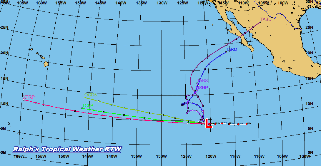
1. A large area of disturbed weather has formed a little more than one thousand miles south-southwest of the southern tip of the Baja California peninsula. Environmental conditions are forecast to be marginally favorable for some development during the next day or two while the disturbance moves generally toward the west-northwest and northwest. After that time, upper-level winds are expected to become less conducive for tropical cyclone formation. The next Special Tropical Weather Outlook on this system will be issued by 11 AM PDT Tuesday, or earlier, if necessary. * Formation chance through 48 hours...low...30 percent. * Formation chance through 5 days...medium...40 percent. Forecaster Avila
Sunday, May 6, 2018
Saturday, May 5, 2018
LATEST SATELLITE ANIMATIONS
Satellite you see here is infrared and water vapor. Most of the heavy moisture is east and southeast of the weak center.
RTW http://ralphstropicalweather.myfreesites.net
RAINFALL OUTLOOK DAY-1 THRU 3
So far at my house over night 0.64 inches of rain not that bad. This system center is mostly over Cuba and has lost most of the moisture ahead of it. Should not be a washout in anyway. However, do expect every so often a fast moving showers. So far on latest radar shows the heaviest concentration of showers is over the Florida Straits and Keys. Lightning has remain concentrated south of Haiti and North of Jamaica. So as for the chance of thunderstorms with these cells its Low chance on the west side of the upper low. There still is a chance for a thunderstorm to pop up during the heating of the day but once again this system seems to be pretty benign at this time.
RTW http://ralphstropicalweather.myfreesites.net
Day-1 thunderstorm outlook
Day-2 Thunderstorm outlook
Day-3 Thunderstorm outlook
RAIN BANDS FROM THIS MID TO UPPER LEVEL LOW MOVING INLAND
Outer bands from this mid to upper level low are moving onshore this evening. You can expect brief heavy downpours with gusty winds and lightning with stronger cells. The low is partially over Cuba and the Atlantic waters. Development is not likely at this time.
RTW http://ralphstropicalweather.myfreesites.net
Friday, May 4, 2018
THUNDERSTORM OUTLOOK FOR DAY-1,2 AND 3
THERE IS A CHANCE FOR THUNDERSTORMS AS THIS SYSTEM APPROACHES THE PENINSULA. HOWEVER, IT DOES NOT LOOK LIKE A SEVERE WEATHER EVENT AT THIS TIME.
RAINFALL OUTLOOK FOR FLORIDA
So far it does not look like a significant rainfall event at this time. Here is Day-1, 2 and 3 rainfall outlook.
Subscribe to:
Posts (Atom)