Thursday, May 24, 2018

STORM INVEST 90L AND TRACKING THE TROPICS MAY 24, 2018...1001 AM EDT

 
STORM INVEST 90L 
ZCZC MIATWOAT ALL
TTAA00 KNHC DDHHMM

Special Tropical Weather Outlook
NWS National Hurricane Center Miami FL
740 AM EDT Thu May 24 2018

For the North Atlantic...Caribbean Sea and the Gulf of Mexico:

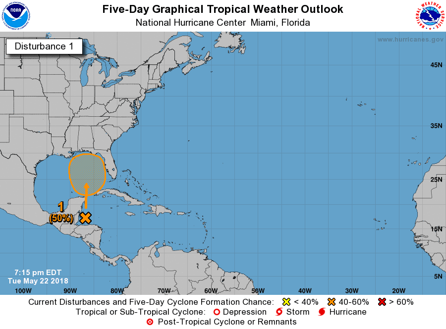
1. A broad, stationary surface low pressure system centered over the
southeastern Yucatan Peninsula is gradually becoming better defined.
Although showers and thunderstorms, along with strong gusty winds,
are confined primarily to the adjacent waters of the northwestern
Caribbean Sea, gradual development of this system is expected during
the next couple of days as it drifts northward near the Yucatan
Peninsula.  Environmental conditions are forecast to become more
conducive for development through early next week, and a subtropical
or tropical depression is likely to form by late Saturday over the
southeastern Gulf of Mexico.  Regardless of development, locally
heavy rainfall is forecast across western Cuba and over much of
Florida and the northern Gulf Coast into early next week. In
addition, the threat of rip currents will steadily increase along
the Gulf coast from Florida westward to Louisiana over Memorial Day
weekend. For more information on these threats, please see products
issued by your local weather office. The next Special Tropical
Weather Outlook on this system will be issued by 200 PM EDT this
afternoon.
* Formation chance through 48 hours...medium...40 percent.
* Formation chance through 5 days...high...80 percent.

Forecaster Stewart


ralphstropicalweather.com 
12Z MODEL RUN 
LATE MODEL RUN
GFS ENSEMBLE
 DAY 1-5 RAINFALL OUTLOOK
12Z INTENSITY MODEL RUN


STORM INVEST 90L AND TROPICAL UPDATE MAY 23, 2018 1155 PM EDT

STORM INVEST 90L
000
ABNT20 KNHC 232308
TWOAT 

Special Tropical Weather Outlook
NWS National Hurricane Center Miami FL
710 PM EDT Wed May 23 2018

For the North Atlantic...Caribbean Sea and the Gulf of Mexico:

A broad surface low centered over the southeastern Yucatan
Peninsula has become better defined since yesterday, and it
continues to produce a large area of cloudiness and showers
extending from the northwestern Caribbean Sea across Cuba into the
Florida Straits.  Continued slow development of this system is
possible during the next couple of days as it drifts northward near
the Yucatan Peninsula.  Thereafter, environmental conditions are
forecast to become more conducive for development, and a subtropical
or tropical depression is likely to form this weekend over the
eastern or central Gulf of Mexico.  Regardless of development,
locally heavy rainfall is possible across western Cuba and the
Cayman Islands during the next few days, and over much of Florida
and the northern Gulf Coast during the weekend. For more information
on the heavy rain threat, please see products issued by your local
weather office. The next Special Tropical Weather Outlook on this
system will be issued by 800 AM EDT on Thursday.
* Formation chance through 48 hours...low...10 percent.
* Formation chance through 5 days...high...70 percent.

$$
Forecaster Beven


 00Z MODEL RUN
 LATE MODEL RUN
GFS ENSEMBLE


Wednesday, May 23, 2018

New URL Address for Ralph's Tropical Weather


Just wanted to let you all know that now the website is official and the new address is http://ralphstropicalweather.com/. since this is now a monthly payment your help will be greatly appreciated. Any spare change will do so we can keep the site up and running. No more banner at bottom!

Thanks for the help throughout the years to those that have supported RTW since 1999.
Ralph

18Z MODEL RUN, INTENSITY MODEL RUN AND RAINFALL OUTLOOK AND MODEL

So far we are looking at a rain maker as this system tracks north into the Gulf of Mexico.  You can't rule out a sub-tropical or weak tropical cyclone as it moves north across the Gulf.  Looks like a wet holiday weekend for a portion of the Southeast. 
PRESENT LOCATION
 18Z MODEL RUN
LATE MODEL RUN
GFS ENSEMBLE
INTENSITY MODEL RUN
DAY 1-5 RAINFALL OUTLOOK 
CLICK ON THIS IMAGE FOR MORE GRAPHICS
http://www.wpc.ncep.noaa.gov/qpf/day4-7.shtml
GFS PRECIPITABLE WATER VIDEO


STORM INVEST 90L MAY 23, 2018

STORM INVEST 90L
ZCZC MIATWOAT ALL
TTAA00 KNHC DDHHMM CCA

Special Tropical Weather Outlook...Corrected
NWS National Hurricane Center Miami FL
800 AM EDT Wed May 23 2018

Corrected header

For the North Atlantic...Caribbean Sea and the Gulf of Mexico:

1. A broad surface low centered near the coast of northeastern Belize
continues to produce a large area of cloudiness and showers
extending from the northwestern Caribbean Sea across Cuba and into
the Florida Straits.  Little development is expected during the
next couple of days due to strong upper-level winds and proximity to
the Yucatan Peninsula.  However, environmental conditions are then
forecast to become more conducive for development, and a subtropical
or tropical depression could form this weekend over the eastern or
central Gulf of Mexico.  Regardless of development, locally heavy
rainfall is possible across western Cuba and the Cayman Islands
during the next few days, and over much of Florida and the
northern Gulf Coast during the weekend. For more information on the
heavy rain threat, please see products issued by your local weather
office. The next Special Tropical Weather Outlook on this system
will be issued by 800 PM EDT.
* Formation chance through 48 hours...low...near 0 percent.
* Formation chance through 5 days...medium...60 percent.

Forecaster Blake

 12Z MODEL RUN
 LATE MODEL RUN
 ENSEMBLE MODEL RUN


Tuesday, May 22, 2018

STORM INVEST 90L MAY 22, 2018

STORM INVEST 90L
000
ABNT20 KNHC 222314
TWOAT 

Special Tropical Weather Outlook
NWS National Hurricane Center Miami FL
715 PM EDT Tue May 22 2018

For the North Atlantic...Caribbean Sea and the Gulf of Mexico:

A broad surface low centered just east of Belize is producing a
large area of cloudiness and showers extending from the northwestern
Caribbean Sea across Cuba and into the Florida peninsula.  Little
development is expected during the next couple of days due to strong
upper-level winds and proximity to the Yucatan Peninsula of Mexico.
However, gradual subtropical or tropical development is possible
late this week while the system moves slowly into the central or
eastern Gulf of Mexico.  Regardless of development, locally heavy
rainfall is possible across western Cuba, the Cayman Islands, and
much of Florida during the next several days.  For more information
on the heavy rain threat, please see products issued by your local
weather office. The next Special Tropical Weather Outlook on this
system will be issued by 800 AM EDT on Wednesday. 
 
* Formation chance through 48 hours...low...near 0 percent.
* Formation chance through 5 days...medium...50 percent.

$$
Forecaster Beven


 00Z MODEL RUN
 00Z MODEL RUN
 LATE MODEL RUN
 ENSEMBLE MODEL RUN
 

18z MODEL RUN FOR INVEST 90L MAY 22, 2018... 0427 PM EDT

Here are the latest 18z model run for INVEST 90L, and they are all over the Place.  Looking at a disorganized system so what can you expect out of the models, nothing much.  Anyhow this system should slowly track northward in the coming days.  Looks like this system will basically be another rain producer so those area from Louisiana to Florida should be ready for torrential rains and possible flooding into the Memorial Day weekend...RTW