FLC086-060030-
/O.NEW.KMFL.FA.Y.0007.190505T2226Z-190506T0030Z/
/00000.N.ER.000000T0000Z.000000T0000Z.000000T0000Z.OO/
Miami-Dade FL-
626 PM EDT Sun May 5 2019
The National Weather Service in Miami has issued a
* Urban and Small Stream Flood Advisory for...
Eastern Miami-Dade County in southeastern Florida...
* Until 830 PM EDT.
* At 626 PM EDT, Doppler radar indicated heavy rain due to
thunderstorms. This will cause urban and small stream flooding in
the advisory area. Over one inch of rain has already fallen in
less than an hour.
* Some locations that will experience flooding include...
Miami, Hialeah, Miami Beach, Surfside and North Miami.
PRECAUTIONARY/PREPAREDNESS ACTIONS...
Excessive runoff from heavy rainfall will cause flooding of canals
and streams, urban areas, highways, streets and underpasses as well
as other drainage areas and low lying spots.
Sunday, May 5, 2019
Friday, May 3, 2019
WEATHER EVENT ISSUED BY NWS MIAMI
FLZ073-074-173-032200-
Metropolitan Miami Dade FL-Inland Miami-Dade County FL-
Coastal Miami Dade County FL-
522 PM EDT Fri May 3 2019
...SIGNIFICANT WEATHER ADVISORY FOR NORTHERN MIAMI-DADE COUNTY UNTIL
600 PM EDT...
* At 521 PM EDT, National Weather Service meteorologists were
tracking a strong thunderstorm over Tamiami, or near Kendall,
moving east at 5 mph.
* Winds in excess of 45 mph and funnel clouds possible with this
storm.
* Locations impacted include...
Miami, Hialeah, Coral Gables, South Miami, Kendall, Doral, Hialeah
Gardens, Pinecrest, Miami Springs, Sweetwater, Miami Shores, West
Miami, El Portal, Medley, Westchester, Gladeview, Glenvar Heights,
Fountainbleau, Kendale Lakes and University Of Miami.
PRECAUTIONARY/PREPAREDNESS ACTIONS...
Funnel clouds occasionally touch down and produce tornadoes or
waterspouts. Move indoors and stay away from windows.
To report severe weather, contact your nearest law enforcement
agency. You can also share your report with NWS Miami on Facebook and
Twitter.
TROUGH OF LOW PRESSURE OVER NORTHERN FLORIDA...
000
ABNT20 KNHC 031340
TWOAT

Special Tropical Weather Outlook
NWS National Hurricane Center Miami FL
940 AM EDT Fri May 3 2019

For the North Atlantic...Caribbean Sea and the Gulf of Mexico:

A surface trough and broad area of low pressure over northeastern
Florida is producing a large area disorganized showers and
thunderstorms over the far western Atlantic waters.  Environmental
conditions are not expected to be conducive for significant
development of this system while it moves northeastward along the
southeast coast of the United States through Saturday.  Later this
weekend, the system is expected to merge with a frontal system off
the east coast of the United States.  Regardless of development,
locally heavy rainfall is possible over eastern portions of the
Florida peninsula and along the southeast United States coast during
the next day or so.  The next Special Tropical Weather Outlook will
be issued by 10 AM EDT Saturday, or sooner if conditions warrant.
Additional information on this system can be found in High Seas
Forecasts issued by the National Weather Service.
* Formation chance through 48 hours...low...10 percent.
* Formation chance through 5 days...low...10 percent.

&&

High Seas Forecasts issued by the National Weather Service can be
found under AWIPS header NFDHSFAT1, WMO header FZNT01 KWBC, and
online at https://ocean.weather.gov/shtml/NFDHSFAT1.php

$$
Forecaster Brown
This trough is producing a southwesterly flow over the state of Florida which
is enhancing the rain and late afternoon storm development once again today.
RTW
Thursday, May 2, 2019
TROUGH OF LOW PRESSURE LOW CHANCE FOR DEVELOPMENT
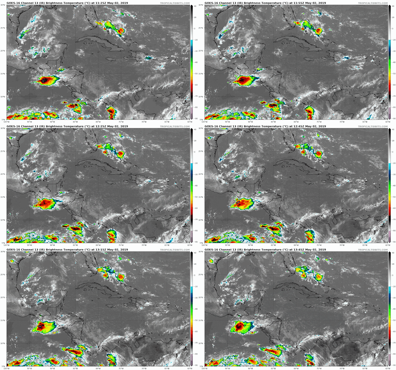
A trough of low pressure in the middle levels of the atmosphere is producing fasting moving showers over the Florida. Atmospheric conditions and proximity to land is hindering development at this time. This system has a low chance 10% for sub-tropical or tropical development. After reviewing models they are also suggesting a low chance for development. Main concern is heavy rains and storms at time.
RTW
RTW
Wednesday, May 1, 2019
TROUH OF LOW PRESSURE IN THE BAHAMAS IS BEING MONITORED
ZCZC MIATWOAT ALL
TTAA00 KNHC DDHHMM

Special Tropical Weather Outlook
NWS National Hurricane Center Miami FL
925 AM EDT Wed May 1 2019

For the North Atlantic...Caribbean Sea and the Gulf of Mexico:

1. A trough of low pressure located over the northwestern Bahamas is
producing disorganized shower and thunderstorm activity.  Little
development is expected during the next couple of days as the
system moves generally northwestward toward the Florida Peninsula.
Subsequently, some slow development is possible as the disturbance
turns northeastward and moves over the western Atlantic.
Regardless of development, locally heavy rains are possible over
portions of the Bahamas and the Florida Peninsula during the next
couple of days.  The next Special Tropical Weather Outlook will be
issued by 10 AM EDT Thursday, or sooner if conditions warrant.
* Formation chance through 48 hours...low...near 0 percent.
* Formation chance through 5 days...low...20 percent.

Forecaster Beven
Strong easterly winds is beginning to draw in moisture on shore the east coast of Florida as this trough tracks west-northwest to a northwest. These showers will be fast moving and at times could be heavy. Development is not out of the question, but if it were to occur, it would be as this system re-curves back to the northeast and over the west Atlantic waters. RTW
A NON TROPICAL DISTURBANCE IN THE BAHAMAS
A non tropical disturbance near the Eastern Bahamas associated with a mid to upper level low could enhance rain and storm chance for the Bahamas and Florida in the coming days.
Could this system become a sub- tropical storm or tropical depression? That can't be ruled out, however, models are not hinting at strong development at this time. I will monitor it closely as it tracks west-northwestward.
Notice to my viewers...
Ralph's Tropical Weather RTW
Will begin regular tropical updates starting May 15, 2019. So check back daily after the May 15 for your full tropical updates.
CLOUD TEMPERATURE SATELLITE
EURO MODEL
AMERICAN GFS MODEL
Ligtning map
Friday, April 19, 2019
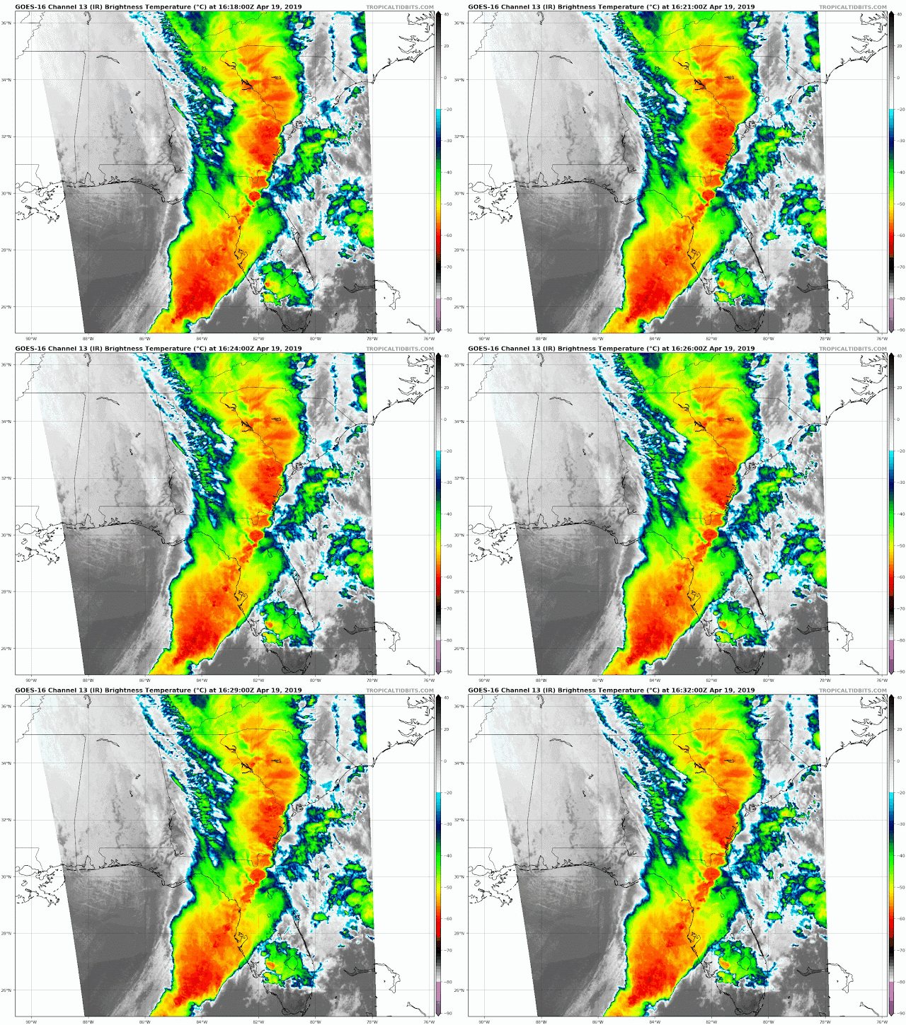
POTENT LINE OF STORMS MOVING THROUGH FLORIDA
Potent line of storms moving over northern and central Florida. There are tornado watch boxes for a portion of Florida and the east coast so make sure you check Storm Prediction Center for updates and listen to local media for updated.
This line is producing plenty of lightning within the squall line, Gusty winds and isolated and an tornado is not out of the question.
If you have a NOAA weather radio in make sure to keep it in alert mode.
Day-1 Severe weather outlook
Still Wide view radar
Lightning map
Color satellite shows the squall line extended I further south into Eastern Gulf.
Thursday, April 18, 2019
UPDATED SEVERE WEATHER OUTLOOK
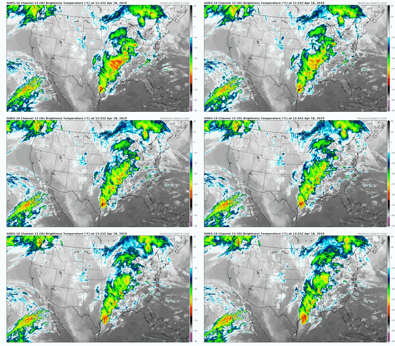
Severe weather will continued to spread east as this upper level trough tracks eastward. see the latest SPC maps below. Stay tuned to your local media and NWS office.
DAY-1 OUTLOOK
THUNDERSTORM OUTLOOK
DAY-2 OUTLOOK
GFS FORECAST MODEL
COLOR INFRARED SATELLITE
RADAR STILL SHOT
DAY-1 OUTLOOK
THUNDERSTORM OUTLOOK
DAY-2 OUTLOOK
GFS FORECAST MODEL
COLOR INFRARED SATELLITE
RADAR STILL SHOT
Wednesday, April 17, 2019
DAY 1-3 SEVERE WEATHER OUTLOOK
A cut-off upper level trough of low pressure tracking east will bring enhanced chance for severe weather for a portion of Oklahoma, Kansas and Texas today.
DAY-2 OUTLOOK
Tomorrow the severe weather threat will spread east over Louisiana, Mississippi, Alabama and a portion of the western tip of the Florida Panhandle.
DAY-3 OUTLOOK
On Friday the severe weather threat will spread over a portion of Georgia and Florida north to the Carolinas and Virginia. Stay up to date on weather conditions and advisories in the days to come... RTW
Subscribe to:
Posts (Atom)


