
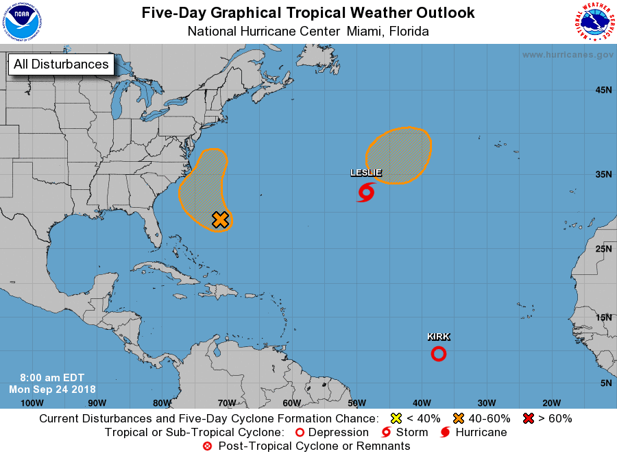
Kirk doengraded to a depression is forecast to regain it's tropical storm status as it tracks further west.
So far Kirk has a avoided dry air because it's been tracking at low latitudes and along the inter-tropical convergence zone where condition are more favorable.
You might ask then why did it weaken to a depression?
Well this storm system is tracking westward too fast, at a forward speed of 24 mph. Storms traveling at these speeds produce their own wind shear separating the colder cloud tops from the center of circulation.
So until this system slows down the likelihood of strengthening is low. Kirk is forecast to weaken and disspipate in the Caribbean...RTW
As for Leslie that storm is stuck in a poor steering environment and will be stuck in a loop over the north Atlantic. Another low is forecast to develop north of Leslie they will more than likely interact weakening Leslie and then that system will be stuck in that loop as well...RTW
Invest 98L the left overs of Florence seems a bit better organized this morning with cold cloud tops blowing up around the low.
This system will come close to the Outer Banks and produce rain and storm with sqaully conditions upon approach to this area.
The only good news is that it will be moving along quickly and not hang around...RTW


No comments:
Post a Comment
Note: Only a member of this blog may post a comment.