
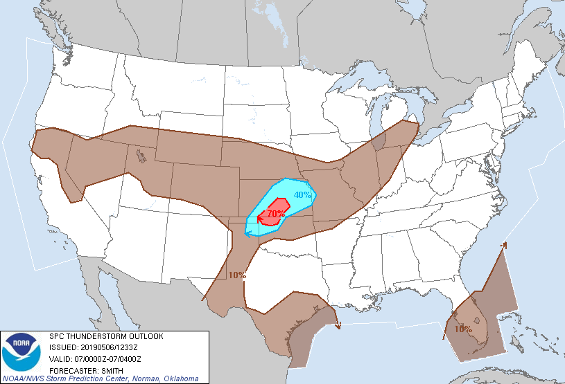
You can expect heavy downpours with localized flooding in those areas prone to street flooding.
There is chance for strong damaging Gusty winds up 60 mph, hail and frequent lightning strikes this afternoon.
Slower moving cells could produce urban street flooding in those areas already saturated by last night's heavy downpours.
Stay tuned to NOAA weather radio and local media for updates this afternoon and early evening.
RTW
Maps courtesy of Storm Prediction Center


Radar courtesy of
WDT Radar Scope

No comments:
Post a Comment
Note: Only a member of this blog may post a comment.