
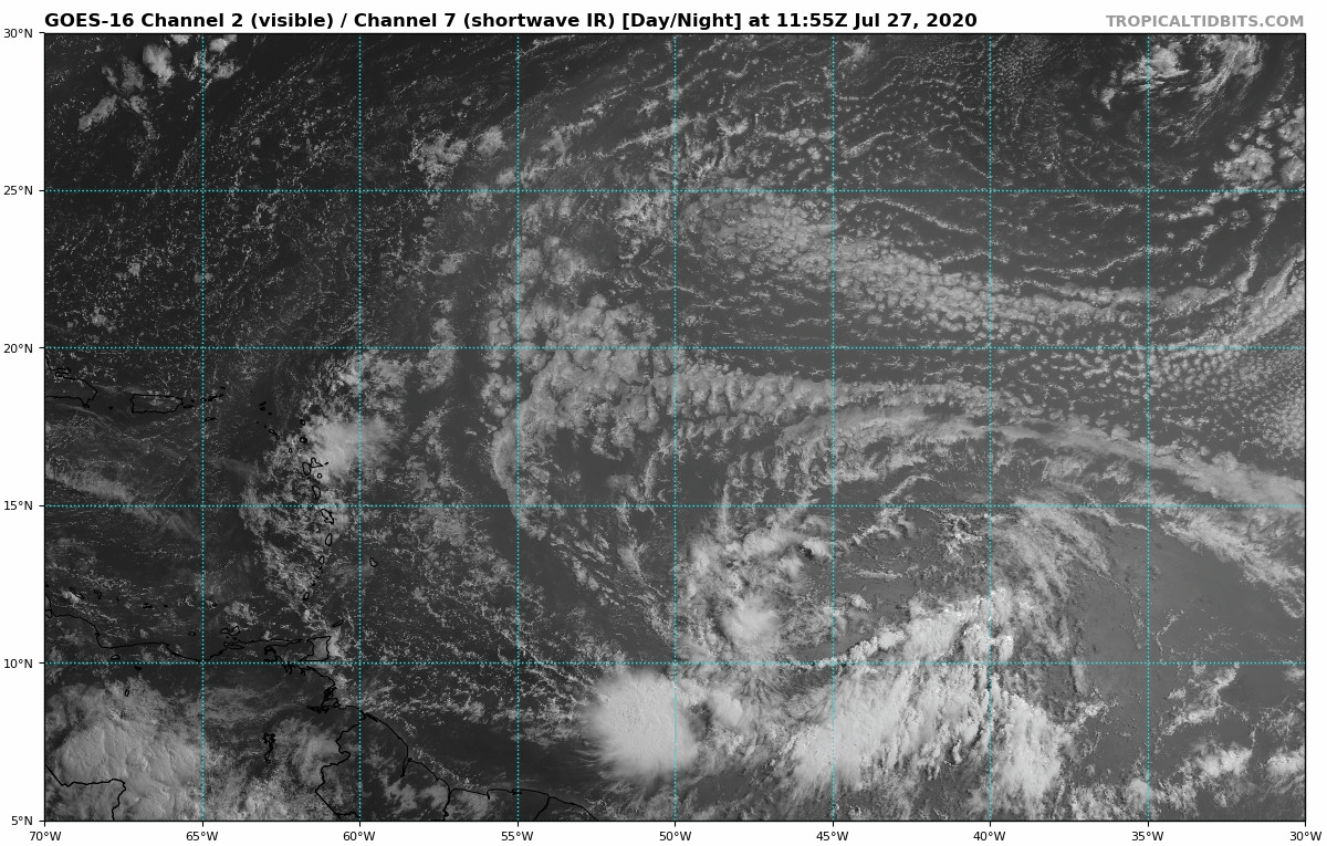
334
ABNT20 KNHC 271124
TWOAT

Tropical Weather Outlook
NWS National Hurricane Center Miami FL
800 AM EDT Mon Jul 27 2020

For the North Atlantic...Caribbean Sea and the Gulf of Mexico:

The Weather Prediction Center has issued the last advisory on the
remnants of Hanna, located inland over northern Mexico.

Shower activity associated with a broad area of low pressure located
a little more than 1000 miles east of the Windward Islands has
become a little less organized since last night. However,
environmental conditions are still expected to become more favorable
for development in a day or two and a tropical depression or
tropical storm will likely form within the next couple of days. The
system is forecast to move westward to west-northwestward at 15 to
20 mph and could begin to affect portions of the Lesser Antilles on
Wednesday or Wednesday night. Interests on those islands should
continue to monitor the progress of this system.
* Formation chance through 48 hours...high...80 percent.
* Formation chance through 5 days...high...90 percent.

$$
Forecaster Zelinsky


THESE MODEL EXAMPLES BELOW ARE PREVIOUS MODEL RUN TO SEE WHICH ONE
IS MORE CONSISTENT WITH THE TRACKS. NOT FOR OFFICIAL USE BY RTW


CLUSTER OF STORMS NOT INVEST 92 LOOKS HEALTHIER THAT 92L. HEADED FOR SOUTH AMERICAN COAST. IF IT HOLDS UP STRONG GUSTY WINDS AND HEAVY RAINS
WILL MOVE ON SHORE WITHIN A DAY OR SO.

No comments:
Post a Comment
Note: Only a member of this blog may post a comment.