Ensemble models are hinting a the possibility of tropical system could reach the Bahamas this during this month. However, once again these are model forecasting in the near future and they are always subject to change. I will continue to monitor closely.
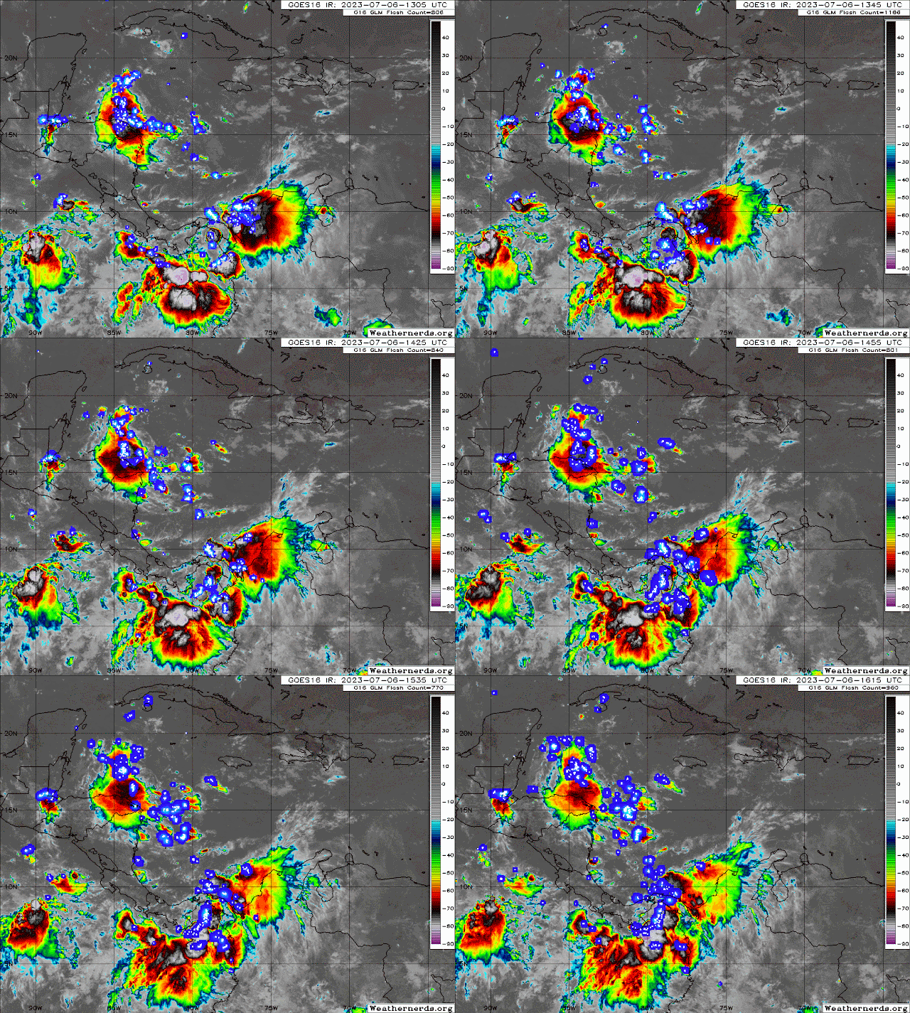
There are 3 tropical waves in the Atlantic and 1 in the Caribbean that the southern axis of the wave is interacting with the monsoon trough in this area. This interaction is producing strong to severe storms off the Columbia west coast and over southern Caribbean waters and over the east Pacific waters. Latest satellite now showing storms spreading west over northeast Nicaragua and Honduras as well.
The other three waves have some showers and storms produced by the interaction with the ITCZ (inter-tropical convergence). The one off the African coast has stronger storms being enhanced by the African monsoon trough in that area.
RTW
014
AXNT20 KNHC 060953
TWDAT

Tropical Weather Discussion
NWS National Hurricane Center Miami FL
1205 UTC Thu Jul 6 2023

Tropical Weather Discussion for North America, Central America
Gulf of Mexico, Caribbean Sea, northern sections of South
America, and Atlantic Ocean to the African coast from the
Equator to 31N. The following information is based on satellite
imagery, weather observations, radar and meteorological analysis.

Based on 0600 UTC surface analysis and satellite imagery through
0900 UTC.

...TROPICAL WAVES...

A tropical wave has moved offshore Africa early this morning and
now resides in the far eastern Atlantic along 19N. Scattered
moderate convection is noted from 07N to 11N E of 20W.

An eastern Atlantic tropical wave extends along 36W from 04N to
15N moving west at 10 to 15 kt. No significant convection is
observed at this time.

A central Atlantic tropical wave extends along 52W from 04N to 16N
moving west at 15 kt. Scattered moderate to isolated strong convection
is observed east of the wave from 05N to 11N between 44W and 52W.

A Caribbean tropical wave extends along 78W from Colombia to
Jamaica moving west at 15 kt. Scattered moderate convection is
noted well ahead of this wave, in the NW Caribbean.

...MONSOON TROUGH/ITCZ...

The monsoon trough extends from the coast of Africa near 19N16W
to 12N30W. The ITCZ extends from 08N38W to 07N46W. Scattered
moderate convection has developed along the monsoon trough from
06N to 10N between 25W and 30W. Scattered moderate convection is
observed near the ITCZ from 03N to 08N between 41W and 44W.

...GULF OF MEXICO...

A 1018 mb high pressure centered near the Louisiana coast is the
dominate feature, with a pair of surface troughs along the Florida
and Yucatan west coasts, respectively. Scattered, disorganized
convection has developed offshore Mississippi, Alabama, and Texas.
Away from these areas of convection, winds are light to gentle in
the eastern Gulf and mainly moderate SE in the western Gulf. Seas
in the eastern Gulf are 3 ft or less, with 3 to 6 ft in the west.

For the forecast, moderate to locally fresh winds will pulse
north and west of the Yucatan peninsula tonight as a diurnal
trough develops and moves offshore. Elsewhere, weak high pressure
will support gentle to moderate breezes and slight seas.

...CARIBBEAN SEA...

Convection in the NW Caribbean is primarily associated with a
tropical wave described in the Tropical Waves section above.
 A relatively tight gradient between subtropical high pressure
and lower pressure in the SW Caribbean, enhanced by a passing
tropical wave, is supporting fresh to strong easterly trade winds
in the majority of the basin. Seas of 9-11 ft are noted in the
south- central Caribbean, with 6-9 ft seas in the remainder of the
central Caribbean. Winds are moderate in the far eastern and far
NW Caribbean, and gentle throughout the Clark basin and Gulf of
Darien in the SW Caribbean. Seas are in the 3-6 ft range in these
areas of lighter wind.

For the forecast, the tropical wave over the central Caribbean
will move west across the western Caribbean into Fri night. Fresh
to strong winds and rough seas will follow the tropical wave
mainly across the central Caribbean. Another tropical wave will
enter the eastern Caribbean Fri night.

...ATLANTIC OCEAN...

A 1019 mb low pressure near 28N59W disrupts overall high pressure
dominant over much of the basin, but the feature is no longer
producing any convection. Convection to the south in the tropical
Atlantic is associated with features described in the Tropical
Waves and ITCZ/Monsoon Trough sections above. For waters N of 22N
and W of 35W, winds are mainly light to gentle, with seas of 3 to
5 ft. Moderate to fresh trades prevail to the S with seas of 4 to
6 ft. Similar conditions are observed E of 35W, except for areas
between the Canary and Cabo Verde islands, where fresh to locally
strong NE winds and seas of 6 to 8 ft are occurring.

For the forecast west of 55W, weak Bermuda High will maintain a
weak pressure gradient and lead to gentle winds across most of the
area into tonight. S of 22N, moderate to fresh winds will prevail
into Sat, behind a tropical wave moving through the Caribbean.
Looking ahead, the high pressure ridge will shift south Sat night,
ahead of a series of weak troughs moving between northeast
Florida and Bermuda through Sun. One of these troughs will produce
fresh SW winds across the northern waters for the start of next
week.

$$
KONARIK


.gif)

.gif)
No comments:
Post a Comment
Note: Only a member of this blog may post a comment.