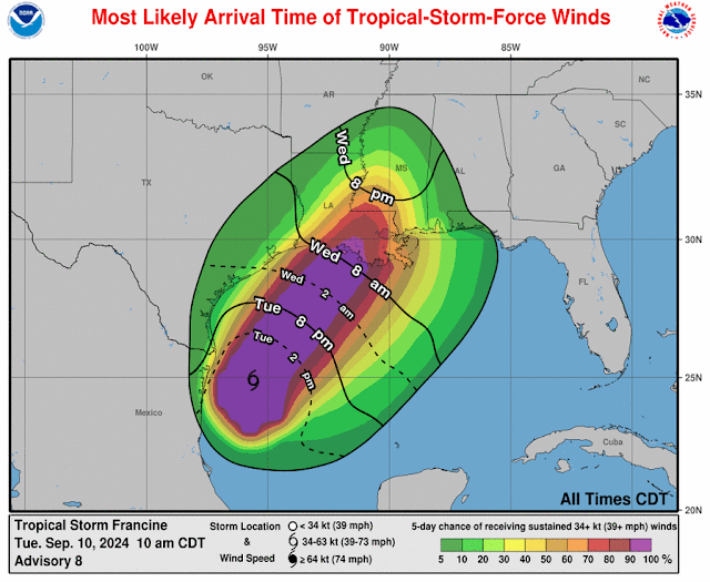
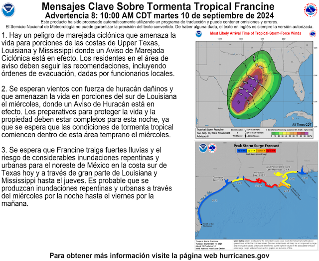
Francine is not yet a hurricane, but it is forecast to become one today or tomorrow. Francine is now tracking northeast and is expected to bring storm surge to the southern coastal areas of Louisiana as it makes landfall around 2 a.m. Wednesday.
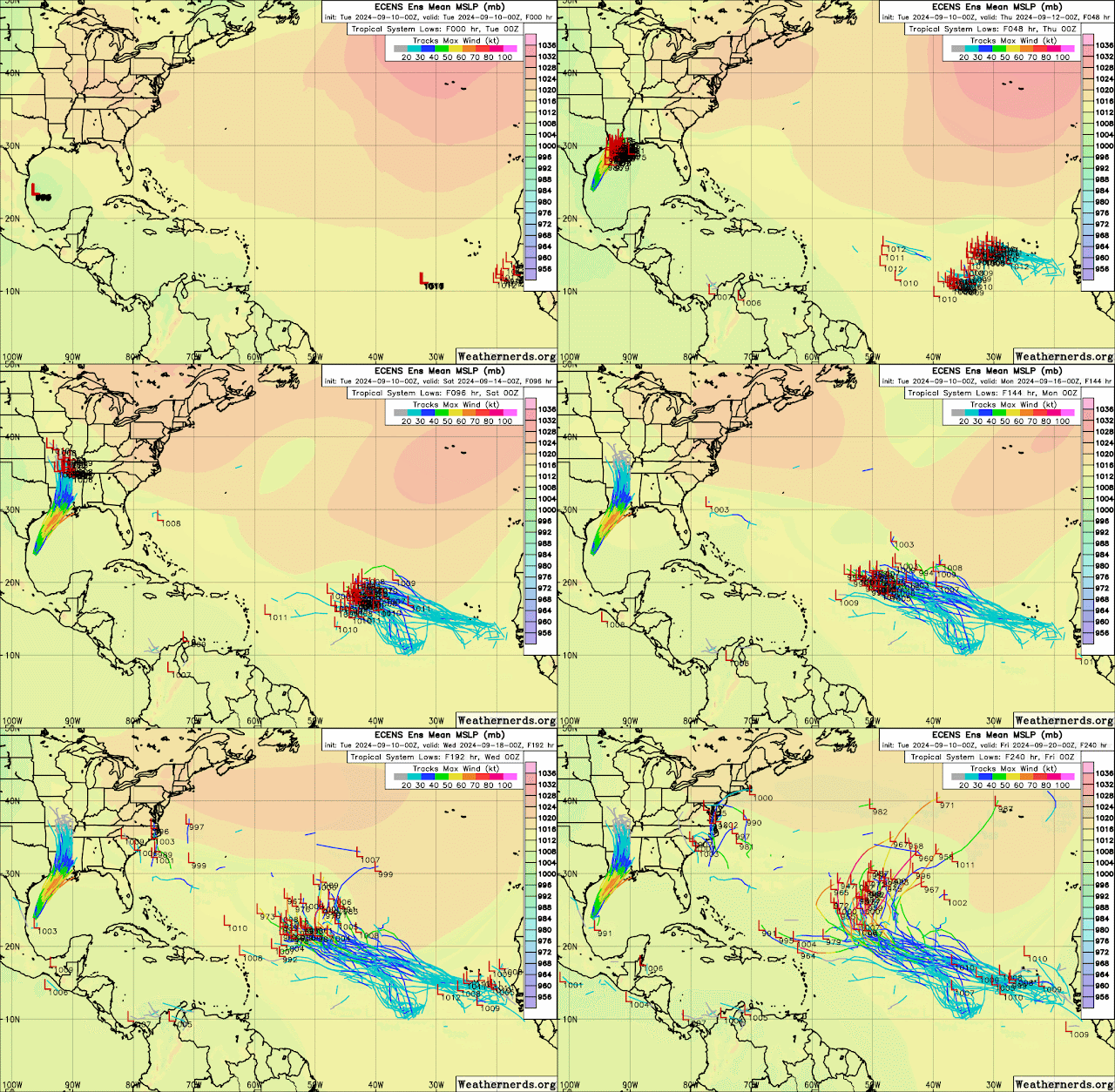
Forecast shows increasing vertical wind shear across Louisiana before landfall, and this could help prevent further strengthening and maybe even weaken Francine at landfall, and some of the Ensemble models are hinting that this may happen. That would be good news if that forecast holds. However, for now we are looking at a possible Cat 1 or maybe a Cat 2 making landfall according to the intensity models.
Continue monitoring updates from local media, the government, and the National Hurricane Center!
RTW
| ...FRANCINE NOW MOVING NORTHEASTWARD ACROSS THE WESTERN GULF OF MEXICO... ...EXPECTED TO BECOME A HURRICANE THIS AFTERNOON OR TONIGHT... | |||||||
| 1:00 PM CDT Tue Sep 10 Location: 25.3°N 95.2°W Moving: NE at 9 mph Min pressure: 988 mb Max sustained: 65 mph | |||||||


.png)
.gif)


.png)
.gif)

No comments:
Post a Comment
Note: Only a member of this blog may post a comment.