Good morning to all, and happy Friday, November 15, 2024!
Let's talk a bit about Sara and the future track of Sara. Sara is located near 16.1°N and 86.0°W, moving 5mph and slowing down. It is sitting along the coast between the Bay Islands and mainland Honduras.
- Heavy rains from Sara have been producing catastrophic flooding, and on-going water rescues have been occurring over night.
- Sara's proximity to the coastline is preventing rapid intensification, but regardless of that, the heavy rainfall is bad enough for this region.
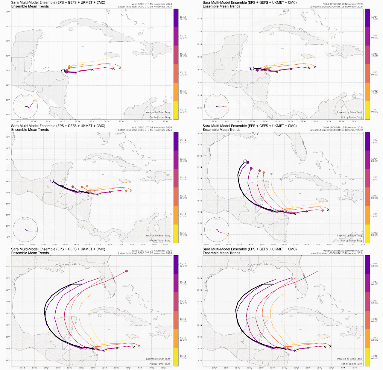
- Sara is forecast to continue on a west-northwest track, and as it moves over the waters east of Belize, it could strengthen a bit before making landfall along the southeast coast of the Yucatan Peninsula.
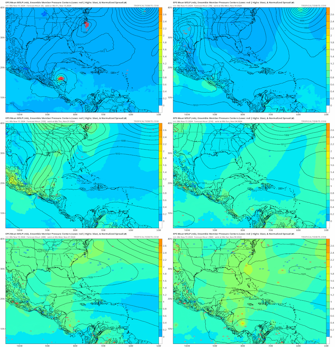
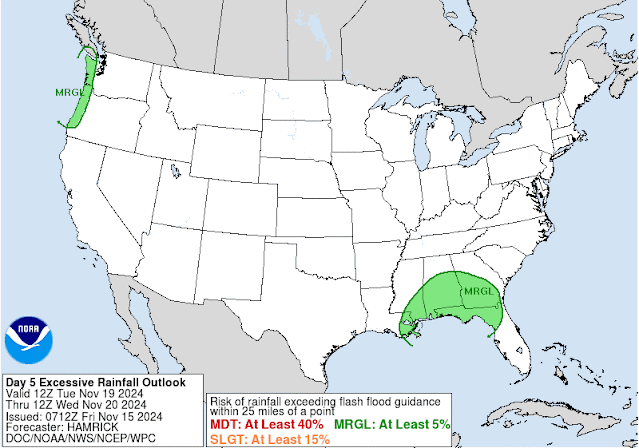
- As Sara moves inland, most of the models show that Sara will dissipate over land, and if there are any remnants of the low as it enters the Southern Gulf, then that low will be pulled north and merge with the frontal boundary and could redevelop some. Models are also showing development of another low along the boundary, and some thunderstorms with gusty winds will develop along the boundary as it tracks toward the Panhandle. Models are also showing that these storms will be short-lived as the front traverses Florida. The GFS ensemble model is the only one hinting at a tropical storm passing over or south of the Florida straits. While the Navy model, which I did not bother posting here, suggests a hurricane moving over Central Florida.
I will continue to monitor it for you all, but as it looks now we will not have to worry about Sara into next week.
RTW
SPANISH VERSION:
Buenos días a todos y feliz viernes 15 de noviembre de 2024.
Hablemos un poco sobre Sara y su trayectoria futura. Sara se encuentra cerca de 16.1°N y 86.0°W, avanza a 5mph y disminuye su velocidad. Se encuentra a lo largo de la costa entre las Islas de la Bahía y el continente de Honduras.
Las fuertes lluvias de Sara han estado produciendo inundaciones catastróficas y se han estado realizando rescates acuáticos durante la noche.
La proximidad de Sara a la costa está impidiendo una intensificación rápida, pero independientemente de eso, las fuertes lluvias son lo suficientemente malas para esta región.
Se pronostica que Sara continuará en una trayectoria oeste-noroeste y, a medida que avanza sobre las aguas al este de Belice, podría fortalecerse un poco antes de tocar tierra a lo largo de la costa sureste de la península de Yucatán. A medida que Sara se entra en el interior de Yucatan, la mayoría de los modelos muestran que Sara se disipará sobre la tierra y, si quedan restos de la baja presión a medida que ingresa al Golfo Sur, entonces esa baja presión será arrastrada hacia el norte y se fusionará con el límite frontal y podría volver a desarrollarse. Los modelos también muestran el desarrollo de otra baja presión a lo largo del límite y algunas tormentas eléctricas con ráfagas de viento se desarrollarán a lo largo del límite a medida que avanza hacia el Panhandle. Los modelos también muestran que estas tormentas serán de corta duración a medida que el frente atraviesa Florida. El modelo de conjunto GFS es el único que sugiere una tormenta tropical que pasa sobre o al sur de los estrechos de Florida. Mientras que el modelo de la Marina, que no me molesté en publicar aquí, sugiere un huracán que se mueve sobre Florida Central.
Continuaré monitoreándolo para todos ustedes, pero como parece ahora, no tendremos que preocuparnos por Sara hasta la próxima semana.
RTW
| ...SARA SLOWING DOWN BETWEEN THE BAY ISLANDS AND NORTHERN MAINLAND OF HONDURAS... ...CATASTROPHIC FLOODING AND MUDSLIDES ONGOING FOR PORTIONS OF CENTRAL AMERICA... | |||||||
| 9:00 AM CST Fri Nov 15 Location: 16.1°N 86.0°W Moving: W at 5 mph Min pressure: 997 mb Max sustained: 50 mph | |||||||


.png)


No comments:
Post a Comment
Note: Only a member of this blog may post a comment.