Thursday, August 10, 2023

..UPDATE ON MID TO UPPER LEVEL LOW NORTH OF DOMINICAN AND OVER EAST BAHAMAS..


Afternoon update on the disorganized middle- to upper-level low north of the Dominican Republic and over the east Bahamas This system remains disorganized, but a center of circulation is noted on satellite.

At this time, the center is void of convection (thunderstorms), but if it begins to rap storms near the center, we could see some slow development as conditions in the upper level are favorable for development.

However, there is some dry land west of the center of circulation, and this could hinder development.

Storms with heavy rain, gusty winds, and lighting continue to affect Haiti, the Dominican Republic, over the Mona Passage, and northwest Puerto Rico.

At this time, there is no concern for development; just remain vigilant as this system tracks west and could bring stormy conditions to the Bahamas and Florida by Friday and the weekend.

RTW


..TROPICAL WEATHER OUTLOOK AUG 10, 2023 AND STORM READINESS TIPS AT BOTTOM OF PAGE..


A mid to upper level disturbance north of Dominican Republic has be producing showers and storms over the area including a portion of Puerto Rico.  This sow moving system will gradually track westward and enhance showers and storms over the Bahamas and possibly Florida by this weekend.

Elsewhere showers and storms noted in the Atlantic are associated with the African Monsson trough and the Inter-tropical convergence zone.  

RTW


ZCZC MIATWOAT ALL
TTAA00 KNHC DDHHMM

Tropical Weather Outlook
NWS National Hurricane Center Miami FL
200 AM EDT Thu Aug 10 2023

For the North Atlantic...Caribbean Sea and the Gulf of Mexico:

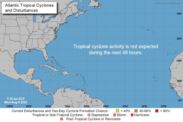
Tropical cyclone formation is not expected during the next 7 days.

$$
Forecaster D. Zelinsky
NNNN


616 
AXNT20 KNHC 100444
TWDAT 

Tropical Weather Discussion
NWS National Hurricane Center Miami FL
0605 UTC Thu Aug 10 2023

Tropical Weather Discussion for North America, Central America
Gulf of Mexico, Caribbean Sea, northern sections of South
America, and Atlantic Ocean to the African coast from the
Equator to 31N. The following information is based on satellite
imagery, weather observations, radar and meteorological analysis.

Based on 0000 UTC surface analysis and satellite imagery through 
0435 UTC.

...SPECIAL FEATURES...

NE Atlantic Gale Warning: A strong pressure gradient between the 
1024 mb subtropical ridge located north of the Madeira Islands and
lower pressures in NW Africa support strong to gale-force 
northerly winds off the coast of Morocco and Western Sahara, 
including the Canary Islands. Meteo-France has a gale warning in 
effect until 11/0000 UTC for the Canarias region with the 
strongest winds occurring in the water passages between the Canary
Islands. For more details, refer to the Meteo-France High Seas 
Forecast listed on their website https://wwmiws.wmo.int

...TROPICAL WAVES...

An eastern Atlantic tropical wave has its axis along 22W, south 
of 17N, and is moving slowly westward at 5-10 kt. Scattered 
moderate convection is observed from 06N to 11N and east of 26W.

Another eastern Atlantic tropical wave has its axis along 36W, 
south of 17N, and is moving slowly westward at 5 kt. Scattered 
moderate convection is noted from 05N to 09N and between 30W and 
42W.

An eastern Caribbean tropical wave has its axis along 63W, south 
of 20N, moving W at 15 kt. Scattered moderate convection is
evident from 12N to 22N and between 61W and 70W.

A central Caribbean tropical wave has its axis along 76W, south 
of 21N, moving W at 10 kt. No significant convection is noted 
over water.

...MONSOON TROUGH/ITCZ...

The monsoon trough enters the Atlantic through the coast of
Senegal near 12.5N16W and continues westward to 09N38W. The ITCZ
extends from 09N38W to 09N50W to 11N61W. Convection is described 
in the tropical waves section.

GULF OF MEXICO...

The subtropical ridge centered over the central Atlantic extends
westward into the Gulf of Mexico, maintaining fairly tranquil
weather conditions. The pressure gradient between the ridge and
lower pressures over Texas and Mexico support moderate to fresh
southerly winds west of 87W. Seas in these waters are 3-6 ft. The
strongest winds and highest seas are occurring off southern Texas
and NE Tamaulipas. Locally moderate or weaker winds and slight
seas prevail elsewhere in the Gulf.

For the forecast, surface ridging across the Gulf will support
gentle to moderate winds over most of the basin during the next 
several days. Moderate to fresh winds will prevail across the 
western Gulf through tonight then pulse through the weekend. A 
thermal trough will move off the Yucatan Peninsula each night, 
producing moderate to fresh winds to the northwest of the Yucatan 
Peninsula through the weekend. 

CARIBBEAN SEA...

Aside from the convection already described in the Tropical Waves
section, a few showers and isolated thunderstorms are seen in the
nearshore waters of southern Cuba and NW Colombia. A dry airmass 
is found in the rest of the Caribbean Sea, suppressing the 
development of convection. Moderate to locally fresh easterly 
trade winds and seas of 3-5 ft are present in the central and 
eastern Caribbean. Moderate or weaker winds and slight seas 
prevail elsewhere.

For the forecast, gentle to moderate trade winds will prevail over
the Caribbean through tonight, with fresh winds in the south-
central basin. A tropical wave will move into the eastern and 
central Caribbean Thu through Fri, bringing fresh to locally 
strong winds and moderate seas. On Sat and through the forecast 
period, fresh to strong winds and moderate seas will pulse across 
the south central Caribbean in the evening hours, while moderate 
to fresh winds and moderate seas prevail elsewhere.

ATLANTIC OCEAN...

Please read the SPECIAL FEATURES section for details on the GALE
WARNING in the NE Atlantic.

A surface trough located north of Hispaniola and divergence aloft
sustain a large area of showers and isolated thunderstorms,
especially south of 28N and between 66W and 73W. Farther east,
scattered moderate convection is noted north of 25N and between
41W and 53W. The rest of the tropical Atlantic is dominated by a
broad subtropical ridge maintaining fairly tranquil weather
conditions.

Moderate to locally fresh easterly winds are evident south of 25N
and west of 55W, along with seas of 4-6 ft. Elsewhere, moderate or
weaker winds and slight to moderate seas prevail.

For the forecast W of 55W, the subtropical ridge axis will
continue to be situated near 27N through much of the week. 
Moderate to fresh winds can be expected through tonight S of 25N 
and E of 78W. Later in the week, the northern portion of a 
tropical wave is expected to move across the southeastern waters. 
This will increase winds fresh to locally strong with moderate 
seas across the region Thu through Sat, including the Bahamas. 
Moderate to fresh winds will resume on Sun. 

$$
DELGADO


Courtesy of Ralph's Tropical Weather RTW and South Dade GMRS Club

Also proud partners with the American Red Cross of greater Miami


Remember to always be storm ready!
(Note: I am not a sponsor for any of the businesses I linked below)

See more on readiness at below link.  


Wednesday, August 9, 2023

..TROPICAL WEATHER OUTLOOK AUG 9, 2023..


Strong showers and storms moving through the Windward Islands ahead of a tropical wave.  Gusty winds and heavy rains moving through this area today.

Strong showers and storms accompany a tropical wave passing over Dominican Republic and Haiti.  If these storms hold together they could bring showers and storms to Southern Bahamas, portions of eastern Cuba and Florida in the coming days.

RTW


000
AXNT20 KNHC 091035
TWDAT 

Tropical Weather Discussion
NWS National Hurricane Center Miami FL
1205 UTC Wed Aug 9 2023

Tropical Weather Discussion for North America, Central America
Gulf of Mexico, Caribbean Sea, northern sections of South
America, and Atlantic Ocean to the African coast from the
Equator to 31N. The following information is based on satellite
imagery, weather observations, radar and meteorological analysis.

Based on 0600 UTC surface analysis and satellite imagery through 
1000 UTC.

...TROPICAL WAVES...

An eastern Atlantic tropical wave has its axis along 20W, south 
of 17N, moving westward at 5 kt. Scattered moderate convection is
noted from 09N to 14N and east of 23W.

Another eastern Atlantic tropical wave has its axis along 35W, 
south of 17N, moving westward at 15-20 kt. Scattered moderate
convection is noted from 05N to 08N between 35W and 37W.

A central Atlantic tropical wave has its axis along 58W, south of
19N, moving westward at 15-20 kt. Scattered moderate to isolated 
strong convection is evident from 10N to 15N and between 57W and 
61W. These storms are likely producing gusty winds. Seas in the 
area range 4-6 ft.

A central Caribbean tropical wave has its axis along 72W, south 
of 20N, moving westward at 15-20 kt. Scattered thunderstorms are
noted in the northern portion of the trough axis, N of Hispaniola
from 19N to 22N between 69W and 74W.

A western Caribbean tropical wave has its axis along 86W, south 
of 19N, moving westward at 15-20 kt. Most of the convection 
associated with this wave is occurring in the eastern Pacific.

...MONSOON TROUGH/ITCZ...

The monsoon trough reaches the Atlantic through the coast of
Guinea-Bissau near 12N16W and continues westward to 10N40W. The
ITCZ extends from 10N40W to 13N57W. Scattered moderate convection
is noted from 06N to 14N and E of 27W and from 05N to 11N between
29W and 34W. 

GULF OF MEXICO...

A trough extends in the eastern Bay of Campeche with showers near
it. Otherwise, weak riding extends across the Gulf of Mexico.
The pressure gradient between the aforementioned ridge and lower 
pressures over Mexico support moderate to locally fresh E-SE in 
the western Gulf and Bay of Campeche. The wave heights in the 
region described are 2-4 ft. Moderate or weaker winds and slight 
seas prevail in the rest of the basin.

For the forecast, weak high pressure centered over the NE Gulf will
support gentle to moderate winds over most of the basin during
the next several days. Winds across the western Gulf will increase
to moderate to fresh tonight, continuing through most of the 
week. A thermal trough will move off the Yucatan Peninsula each 
night, producing moderate to fresh winds to the northwest of the 
Yucatan Peninsula through the weekend. 

CARIBBEAN SEA...

A few showers and isolated thunderstorms persist in the lee of
Cuba and near the Cayman Islands, from 17N to 22N between 78W and
84W. Similar convection is evident in the SW Caribbean Sea, 
mainly within 100 nm of northern Panama and Costa Rica. The 
remainder of the basin is under fairly tranquil weather 
conditions.

A weak pressure gradient between the subtropical ridge in the 
central Atlantic and lower pressures in northern South America 
support moderate to locally fresh easterly trade winds in the 
central Caribbean, along with seas of 4-6 ft. Locally moderate or 
weaker winds and slight to moderate seas prevail elsewhere.

For the forecast, gentle to moderate trade winds will prevail 
over the Caribbean through tonight, with fresh winds in the south-
central basin. A tropical wave will move into the eastern and 
central Caribbean Thu through Sat, bringing fresh to strong winds 
and moderate seas. By Sun, fresh winds and moderate seas will 
prevail through most of the basin.

ATLANTIC OCEAN...

Scattered moderate to isolated strong convection persist off NE 
Florida due to divergence aloft. The rest of the tropical Atlantic
is dominated by an expansive 1020 mb subtropical ridge positioned
near 26N67W and 26N27W. This is allowing for fairly tranquil 
weather conditions. The pressure gradient between the ridge and 
lower pressures in the Caribbean region sustain moderate to 
locally fresh easterly trade winds south of 25N and west of 50W. 
The seas in these waters are 4-7 ft. Moderate to locally fresh 
southerly winds are noted north of 27N and west of 35W, along with
seas of 4-8 ft. The highest seas are present near 31N44W. 
Moderate or weaker winds and slight to moderate seas prevail 
elsewhere.

For the forecast W of 55W, the subtropical ridge axis will 
continue to be situated along 28N through much of the week. 
Moderate to locally fresh winds can be expected through tonight S 
of 25N and E of 78W. Later in the week, the northern portion of a 
tropical wave is expected to move across the southeastern waters. 
This will increase winds fresh to strong with moderate seas across
the region Thu through Sat, including the Bahamas. Moderate to 
locally fresh winds will resume on Sun. 

$$
AReinhart
000
ABNT20 KNHC 091134
TWOAT 

Tropical Weather Outlook
NWS National Hurricane Center Miami FL
800 AM EDT Wed Aug 9 2023

For the North Atlantic...Caribbean Sea and the Gulf of Mexico:

Tropical cyclone formation is not expected during the next 7 days.

$$
Forecaster Berg


South Dade GMRS Club (General Mobile Radio Service)

Partners with the American Red Cross


Tuesday, August 8, 2023

..TROPICAL WEATHER OUTLOOK AUG 8, 2023..


There are several tropical waves across the Atlantic and in the Caribbean. So far other than showers and storms enhanced by the monsoon troughs, and the inter-tropical convergence zone (ITCZ) there are no signs of development.  Some of these storms will make their wave will bring gusty winds and storms to the Lesser Antilles.  I will continue to monitor them as they track west across the Atlantic.

RTW


000
AXNT20 KNHC 081037
TWDAT

Tropical Weather Discussion
NWS National Hurricane Center Miami FL
1205 UTC Tue Aug 8 2023

Tropical Weather Discussion for North America, Central America
Gulf of Mexico, Caribbean Sea, northern sections of South
America, and Atlantic Ocean to the African coast from the
Equator to 31N. The following information is based on satellite
imagery, weather observations, radar and meteorological analysis.

Based on 0600 UTC surface analysis and satellite imagery through 
1020 UTC.

...TROPICAL WAVES...

An eastern Atlantic tropical wave has its axis along 28W, south 
of 16N, moving westward at 10 kt. No deep convection is noted 
near the wave axis.

A central Atlantic tropical wave has its axis along 47W, south of
17N, moving westward at 10 kt. Scattered moderate convection is 
observed from 05N to 09N and between 47W and 51W.

A tropical wave is near the Lesser Antilles, with its axis along 
61W, south of 21N, moving westward at 10-15 kt. Scattered 
moderate to isolated strong convection is noted from 16N to 22N 
between 58W and 63W. 

A central Caribbean tropical wave has its axis along 78W, south 
of 20N, moving westward at 15 kt. Numerous moderate to scattered
strong convection is noted near the monsoon trough and the wave
axis, S of 11N between 76W and 80W. 

...MONSOON TROUGH/ITCZ...

The monsoon trough enters the Atlantic Ocean through the coast of
The Gambia near 11N16W to 10N39W. The ITCZ continues from 10N39W
to 11N57W. Scattered moderate to isolated strong convection is
noted mostly along the ITCZ from 07N to 14N between 36W and 57W.
Scattered moderate convection is moving off the coast of Africa
from 06N to 13N and E of 21W. 

GULF OF MEXICO...

The subtropical ridge extends westward into the Gulf of Mexico,
anchored by a 1019 mb high pressure system located near 27N86W. A
trough extends in the eastern Bay of Campeche with some scattered
showers noted around it. The weak pressure gradient promotes 
primarily moderate or weaker anticyclonic winds. Seas of 3-4 ft 
are noted west of 90W and 1-2 ft elsewhere.

For the forecast, relatively weak high pressure over the area 
will support gentle to moderate winds over most of the basin 
during the next several days. Moderate return flow across the 
western Gulf will become moderate to fresh by Wed, continuing 
through most of the week. A thermal trough will move off the 
Yucatan Peninsula each night, producing moderate to fresh winds to
the northwest of the Yucatan Peninsula through most of the week. 

CARIBBEAN SEA...

Scattered showers and isolated thunderstorms continue across the 
nearshore waters of southern Cuba and Hispaniola. Scattered
thunderstorms are also noted in the NW Caribbean. Elsewhere, a 
generally dry airmass suppresses the development of deep 
convection. The pressure gradient between the ridge north of the 
islands and lower pressures in northern South America support 
fresh to locally strong easterly trade winds in the central 
Caribbean, along with seas of 5-8 ft. The strongest winds are 
seen on earlier scatterometer satellite data in the Gulf of 
Venezuela. Moderate or weaker winds and slight to moderate seas 
prevail in the rest of the basin.

For the forecast, fresh to locally strong trade winds will 
prevail over the central Caribbean. Meanwhile, moderate to fresh 
trades are expected over the eastern basin, with gentle to 
moderate trades are expected in the western basin. Winds across 
the Caribbean will diminish slightly tonight into Wed night. A 
tropical wave will move into the eastern and central Caribbean Thu
into Fri, bringing fresh to locally strong winds and moderate 
seas. 

ATLANTIC OCEAN...

A 1024 mb subtropical ridge positioned near 28N50W dominates the
tropical Atlantic, maintaining fairly tranquil weather conditions
outside of the deep tropics. There are a few exceptions, including
divergence aloft producing a few showers north of 29N and between
63W and 69W. Similar activity is noted in the Straits of Florida.
Scattered moderate convection is also seen south of 22N between
63W and 70W in association with the tropical wave in the area as 
mentioned in the Tropical Waves section. These storms are
impacting north of Hispaniola.

Moderate to locally fresh easterly trade winds due to the pressure
gradient between the ridge and lower pressures in the tropics are
found south of 26N and west of 37W. Seas in these waters are 5-7
ft. Moderate or weaker winds and moderate seas prevail elsewhere.

For the forecast W of 55W, the subtropical ridge axis will 
continue to be situated along 28N through much of the week. Fresh 
E trade winds S of 25N and E of 75W will diminish to mostly 
moderate speeds tonight through Wed. Seas generated by these winds
will gradually subside this morning. Winds off the N coast of 
Hispaniola will pulse moderate to locally fresh today through Thu.
Later in the week, the northern portion of a tropical wave is 
expected to move across the southeastern waters. This will 
increase winds fresh to locally strong across the region Thu 
through Sat, including the Bahamas.

$$
AReinhart


Monday, August 7, 2023

..TROPICAL WEATHER OUTLOOK AUG 7, 2023..


Hefty wave near the Cabo Verde islands has a bit of rotation, but the strong storms are west of the waves axis. Upper level conditions seem to be favorable ahead of this wave at this time. I will monitor this wave closely during the next few days.

RTW


643 

AXNT20 KNHC 071805
TWDAT 

Tropical Weather Discussion
NWS National Hurricane Center Miami FL
1805 UTC Mon Aug 07 2023

Tropical Weather Discussion for North America, Central America
Gulf of Mexico, Caribbean Sea, northern sections of South
America, and Atlantic Ocean to the African coast from the
Equator to 31N. The following information is based on satellite
imagery, weather observations, radar and meteorological analysis.

Based on 1200 UTC surface analysis and satellite imagery through
1740 UTC.

...TROPICAL WAVES...

An Atlantic Ocean is along 23W/24W, from 16N southward,
moving westward from 10 knots to 15 knots. Precipitation:
isolated moderate is from 16N southward from 27W eastward.
This precipitation also is close to the monsoon trough.

An Atlantic Ocean is along 41W/42WW from 17N southward,
moving westward about 20 knots. Precipitation: any nearby
precipitation also is close to the ITCZ.

An Atlantic Ocean tropical wave is along 55W/56W, from
21N southward, moving westward from 15 knots to
20 knots. Precipitation: scattered strong is from 13N to
14N between 60W and 61W. Isolated moderate to locally
strong is elsewhere from 22N southward between 52W and 61W.

A Caribbean Sea tropical wave is along 71W/72W, from
20N southward, moving westward about 15 knots. This
wave is moving through an area of upper level cyclonic
wind flow, that is between 70W and 80W. The GFS model
also shows broad 700 mb cyclonic wind flow in much of
the Caribbean Sea. Precipitation: isolated moderate to
locally strong is from 20N southward between 60W and 80W.

A Caribbean Sea tropical wave is along 84W, from
20N southward, moving westward about 15 knots.
Precipitation: isolated moderate to locally strong is
from central Nicaragua northward from 80W westward. The
comparatively stronger precipitation that is from east
central Nicaragua is related to the monsoon trough.

...MONSOON TROUGH/ITCZ...

The monsoon trough passes through the coastal plains of
Senegal near 15N17W, to 14N20W, 13N30W and 11N37W. The
ITCZ continues from 11N37W, to 10N43W and 10N55W.
Precipitation: scattered strong is within 90 nm on either
side of the monsoon trough between 28W and 31W. Widely
scattered moderate to isolated strong is from 05N to
15N between 42W and 51W. Isolated moderate to locally
strong is elsewhere from 15N southward from 55W eastward.

GULF OF MEXICO...

The upper level inverted trough that was in the Yucatan
Peninsula has moved toward the west and the northwest.
An upper level ridge now runs from the SW corner of
the Gulf of Mexico beyond the Florida Panhandle.
Precipitation: isolated moderate to locally strong is
in the area, mostly on the southeastern side of the
trough.

A surface trough is along 93W/94W, from 17N in the
Isthmus of Tehuantepec of southern Mexico to 22N.
Precipitation: isolated moderate to locally strong
is from 24N southward from 90W westward.

A surface ridge passes through 27N72W in the
Atlantic Ocean, through Lake Okeechobee in
south Florida, toward the middle Texas Gulf coast.

The sea heights are reaching 1 foot in the eastern half
of the Gulf. The sea heights are reaching 2 feet from
from the coastal waters of Louisiana into the west 
central sections of the Gulf, and in the coastal waters
of Mexico along 20N. The sea heights are 3 feet elsewhere.
Moderate or slower anticyclonic wind flow covers the area.

Weak high pressure centered over the NE Gulf will support
gentle to moderate winds over most of the basin during . 
Moderate return flow across the far western Gulf will
become moderate to fresh by mid-week. A thermal trough
will move off the Yucatan Peninsula each night,
producing moderate to fresh winds to the northwest
of the Yucatan Peninsula through most of the week. 

CARIBBEAN SEA...

Please, read the TROPICAL WAVES section, for information
about the 71W/72W tropical wave, and the 84W tropical wave.

The sea heights are ranging from 6 feet to 9 feet from
Hispaniola and Jamaica southward between 69 and 81W.
The 9 foot sea heights are in the coastal waters of
Colombia between 75W and 76W. The sea heights are
ranging from 2 feet to 3 feet in the Atlantic Ocean
just to the east of the eastern Caribbean Sea islands.
The sea heights are ranging from 3 feet to 4 feet
in the Venezuela coastal waters, and off the SE coast
of Nicaragua. The sea heights are 5 feet elsewhere
from 70W eastward. The sea heights are ranging 
from 2 feet to 3 feet from 15N northward from 80W
westward. Strong NE winds are within 250 nm of the
coast of Colombia between 72W and 77W. Fresh
NE-to-E winds are elsewhere the Greater Antilles
southward from 66W westward. Moderate easterly winds
are elsewhere from 70W eastward. Moderate or slower
wind speeds are in the rest of the area.

The monsoon trough is along 07N/10N from northern
Colombia beyond the central sections of Panama, and
into the eastern Pacific Ocean. Precipitation:
scattered strong is from 06N to 12N between the
border of Colombia and Panama, and 87W.

The 24-hour rainfall totals in inches, according to the
Pan American Temperature and Precipitation Tables,
MIATPTPAN, for the period that ended at 07/1200 UTC,
are: 0.24 in Bermuda, and 0.18 in St. Thomas in the 
Virgin Islands.

Fresh to strong trade winds will prevail in the south
central Caribbean through Tue, with fresh trade winds
over the central Caribbean. Meanwhile, moderate to fresh
trades are expected over the eastern basin, with gentle
to moderate trades are expected in the western basin.
Winds across the Caribbean will diminish slightly by
mid-week with gentle to moderate winds expected to prevail. 

ATLANTIC OCEAN...

Precipitation: isolated moderate to locally strong is from
28N northward from 60W westward. A stationary front is 
along 35N/36N from 60W westward. 

Broad surface anticyclonic wind flow is from 23N
northward from 24W westward. A surface ridge is along
34N32W, to a 1025 mb high pressure center that is near
30N49W, to 27N72W, beyond Lake Okeechobee in south
Florida. 

Strong NE-to-E winds are from 19N to 21N between 63W and
66W. Fresh NE-to-E winds are: from the monsoon trough/ITCZ
to 20N between 35W and 47W; from 14N to 25N between 47W 
and 70W. Fresh southerly winds are from 06N southward
between 29W and 40W. Fresh SW winds are from 28N northward
between 70W and 78W. Moderate or slower winds are elsewhere.
The sea heights are ranging from 7 feet to 9 feet from 15N
to 25N between 40W and 60W. The sea heights range from
4 feet to 6 feet, with some isolated 7 foot heights,
elsewhere from 70W eastward. The sea heights are 4 feet
or less from 70W westward.

The subtropical ridge axis will continue to be situated
along 28N through much of the week. Expect fresh ESE 
trade winds to continue through this evening S of 25N
and E of 75W. Increased swell due to these winds is
expected to subside by tonight. Winds off the N coast
of Hispaniola will pulse to locally strong speeds this
afternoon and evening. Starting Tue, these winds will
be mostly at gentle to moderate speeds through early
Thu, then increase slightly to fresh speeds through
Fri night.

$$
mt/ja