Tuesday, June 4, 2024

..TROPICAL OUTLOOK JUNE 4, 2024..


There is a strong monsoon storm southwest of the African coast, behind a tropical wave near 26 West. Although these waves are moving through the moist inter-tropical convergence zone (ITCZ), there are no signs of low pressure developing along the axis of these waves or anywhere near the waves.
 
A persistent, stationary upper-level trough that extends northeast from the Caribbean into the Atlantic continues to produce strong gusty winds, lightning, and heavy rains that are causing flash floods and deadly mudslides. Jamaica, Haiti, and the Dominican Republic have been drenched by these heavy rains and storms over the weekend and the past few days.
 
Monsoon storms are also present south of Panama and Costa Rica. 
 
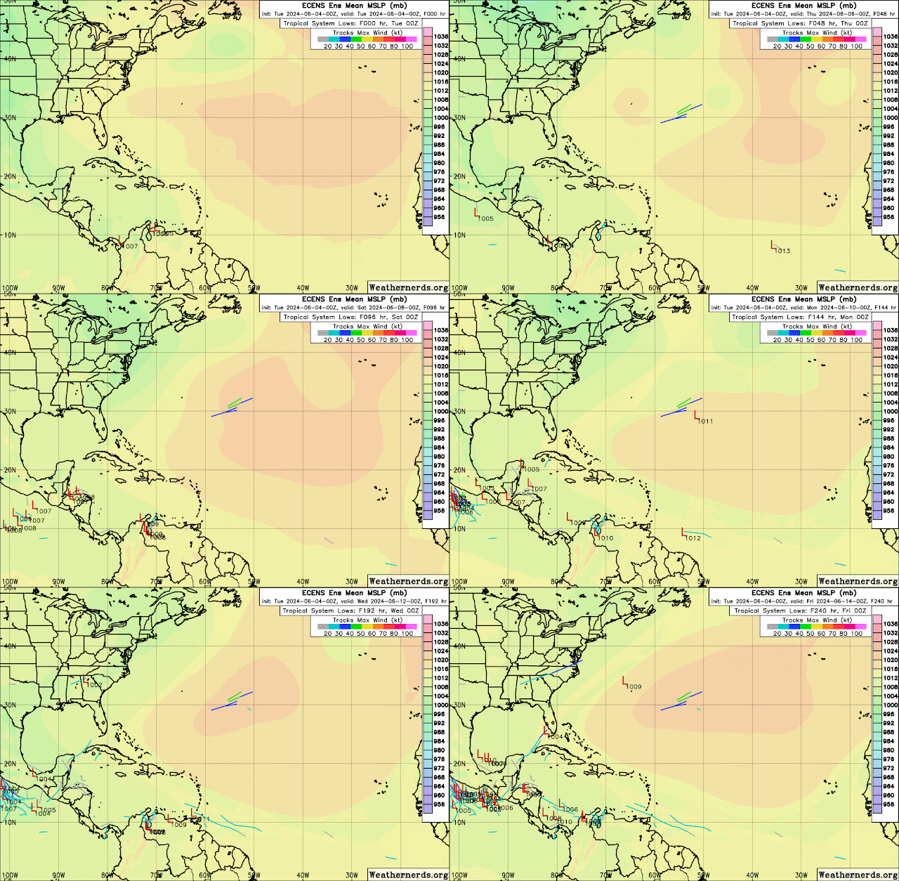
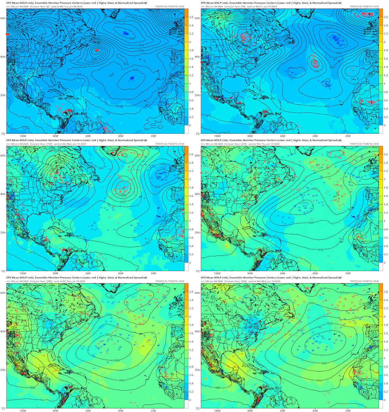
I am still monitoring the northwest Caribbean for moisture rising up from there by early next week that could bring gusty winds, heavy rains for western Cuba, and possibly Florida. This is not for sure, so for now I am just monitoring since ensemble models are still hinting that something will rise out of the northwest Caribbean.

The latest Global Tropic Hazards Outlook map now show a greater than 20% chance for the Bay of Campeche and the Northwest Caribbean for 2nd week June 12-18 and 3rd week June 19-25.  So we have to continue watching these areas this month.

RTW


000
ABNT20 KNHC 041747
TWOAT 

Tropical Weather Outlook
NWS National Hurricane Center Miami FL
Issued by the NWS Weather Prediction Center College Park MD
200 PM EDT Tue Jun 4 2024

For the North Atlantic...Caribbean Sea and the Gulf of Mexico:

Tropical cyclone formation is not expected during the next 7 days.

$$
Forecaster Otto/Taylor
-----------------------------------------------------------------
160 
ACCA62 KNHC 041748
TWOSAT

Perspectiva sobre las Condiciones del Tiempo en el Trópico
Centro Nacional de Huracanes del SNM Miami FL
Emitido por el Centro de Predicción del Tiempo del SNM College Park
MD
200 PM EDT martes 4 de junio de 2024

Para el Atlántico Norte...Mar del Caribe y el Golfo de México:

No se espera la formación de ciclones tropicales durante los
próximos 7 días.

$$
Pronosticador Otto/Taylor

*** Este producto ha sido procesado automáticamente utilizando un
programa de traducción y puede contener omisiones y errores. El
Servicio Nacional de Meteorología no puede garantizar la precisión
del texto convertido. De haber alguna duda, el texto en inglés es
siempre la versión autorizada. ***
-----------------------------------------------------------------
927 
AXNT20 KNHC 041805
TWDAT

Tropical Weather Discussion
NWS National Hurricane Center Miami FL
1805 UTC Tue Jun 4 2024

Tropical Weather Discussion for North America, Central America
Gulf of Mexico, Caribbean Sea, northern sections of South
America, and Atlantic Ocean to the African coast from the
Equator to 31N. The following information is based on satellite
imagery, weather observations, radar and meteorological analysis.

Based on 1200 UTC surface analysis and satellite imagery through 
1740 UTC.

...SPECIAL FEATURES...

HEAVY RAINFALL IN HISPANIOLA, IN JAMAICA, AND IN EASTERN CUBA:

A persistent western Caribbean Sea upper level trough will
continue to support the significant rainshowers through Friday.
The threats to land are: dangerous lightning, heavy rain, and 
gusty winds, through Friday. It is possible that heavy rain may
lead to flash flooding and mudslides, especially in areas of 
Hispaniola where the ground remains saturated from earlier recent
heavy rain events. Global models show that this afternoon and
Thursday afternoon will be the days with the most significant 
precipitation, in the north central Dominican Republic and in the  
northeastern part of Haiti. It is possible also that significant 
rainfall may reach eastern Cuba, and the Cayman Islands, where 
abundant moisture will be present. Please, refer to bulletins and
forecasts that are from your local weather bureau office for more
detailed information.

...TROPICAL WAVES...

An Atlantic Ocean tropical wave is along 26W, from 11N southward,
moving westward about 10 knots. Any close precipitation is related
to the monsoon trough or to the ITCZ.

An Atlantic Ocean tropical wave is along 39W, from 11N southward,
moving westward about 10 knots. Any close precipitation is related
to the ITCZ.

An Atlantic Ocean tropical wave is along 54W, from 13N southward, 
moving westward about 10 knots. Any close precipitation is related
to the ITCZ.

The earlier central Caribbean Sea tropical wave that was close to 
72W, at 04/0600 UTC, was eliminated from the map analysis. Most of
the moisture that was accompanying this feature is outside the
Caribbean Sea at this time.

The earlier western Caribbean Sea tropical wave that was close to
85W/86W, at 04/0600 UTC, was eliminated from the map analysis.
This wave has become caught up in the nearby NE-to-SW oriented 
upper level trough.

...MONSOON TROUGH/ITCZ...

The monsoon trough passes through the coastal plains of Guinea-
Bissau close to 11N15W, to 08N19W, to 06N25W. The ITCZ is along
04N/05N between 27W and 36W. Precipitation: scattered strong is
from 05N to 08N between 17W and 21W. Scattered moderate to
isolated strong is elsewhere within 90 nm on either side of the
rest of the line 08N14W 05N23W 05N30W 05N36W 06N43W 06N49W 08N54W
14N62W.

...GULF OF MEXICO...

A broad surface ridge extends from an Atlantic Ocean 1017 mb
32N74W high pressure center, to the coastal waters of the U.S.A.
Gulf coast states. Moderate seas are in the western half of the 
area. The sea heights range from 6 feet to 7 feet in the Texas 
coastal waters. Slight seas are in the rest of the Gulf of Mexico.
Mostly fresh to some strong SE winds are from 90W westward. 
Moderate or slower winds are in the remainder of the Gulf of 
Mexico. 

A weak Atlantic ridge extends SW into the NE Gulf, and will 
dominate the basin through the next several days. This pattern 
will support generally moderate to fresh SE to S winds in the 
western Gulf, fresh to occasionally strong near the Yucatan 
Peninsula and in the NW Gulf, and gentle to moderate winds in the 
eastern Gulf through late Wed. By Thu, the ridge will weaken, 
allowing for winds to diminish somewhat. Hazy conditions due to 
agricultural fires over Central America and Mexico will continue 
for the next couple of days, reducing visibility to around 3 nm at
times, mainly over the western half of the Gulf. 

...CARIBBEAN SEA...

Please, read the SPECIAL FEATURES section, for information about
the heavy rainfall event in Hispaniola, in Jamaica, and in the
eastern sections of Cuba.  

Cyclonic wind flow is covering much of the northern half of the
area, with a persistent and deep layer trough. A surface trough
currently is in the Windward Passage. Precipitation: scattered to
numerous strong is in the Windward Passage. Scattered moderate to
isolated strong is from 14N to Jamaica between 75W and 79W, and in
the eastern half of the Dominican Republic.

Mostly fresh to some strong SE winds are from the Windward Passage
eastward. Moderate or slower winds are in the remainder of the
Caribbean Sea. Mostly moderate to slightly rough seas are between
64W and 73W. Mostly moderate to some slight seas are in the
remainder of the Caribbean Sea.

The 24-hour rainfall totals in inches, for the period that ended 
at 04/1200 UTC, are: 1.47 in Guadeloupe; 0.31 in San Juan in 
Puerto Rico; 0.29 in Trinidad; 0.15 in Montego Bay in Jamaica; and
0.04 in Tegucigalpa in Honduras. This information is from the Pan
American Temperature and Precipitation Tables/MIATPTPAN.

The monsoon trough is along 12N/13N, from 75W off the coast of
Colombia, beyond Nicaragua, and into the Pacific Ocean.
Precipitation: scattered to numerous strong is within 150 nm to 
the south of the monsoon trough between 75W and 79W; and from 06N
to 09N between 78W and 80W to the south of Panama. Other isolated
moderate to locally strong is elsewhere from 14N southward from 
70W westward.

Weak high pressure extends across the western Atlantic along 
31N-32N. The associated pressure gradient across the region will 
support fresh winds across the east-central Caribbean this 
morning, with seas to near 8 ft. Winds and seas will then diminish
modestly through Wed night. A deep layered upper- level trough 
from the W Atlantic to the W Caribbean will continue to support 
active thunderstorms across north-central portions through today. 
As this feature moves E-NE across the Atlantic, associated weather
will shift across the NE Caribbean this evening through Thu. 
Fresh trade winds will return to southeast portions of the basin 
Thu evening through early Sat. 

...ATLANTIC OCEAN...

A cold front passes through 31N39W, to 26N48W. A surface trough
continues, from 26N48W, to a 1013 mb low pressure center that is
near 28N63W. The surface trough continues from the 1013 mb low
pressure center, to the Windward Passage. Precipitation: scattered
strong is within 480 nm to the southwest of the 1013 mb low 
pressure center. Widely scattered moderate to isolated strong is
elsewhere from 10N to 21N between 60W and 63W, and from 20N
northward between 50W and 70W.

Mostly moderate seas cover the entire area in general. The 
comparatively highest sea heights, range from 4 feet to 6 feet.
Some smaller areas of sea heights of 4 feet or less are mixed
into the areas of predominantly moderate seas. Fresh NE winds are
to the southeast of 31N16W 23N19W 21N30W 20N40W 19N60W. Fresh to
strong southerly winds are between 60W and 70W, to the south of
the 28N60W 25N70W-Windward Passage surface trough. Moderate or
slower winds are in the remainder of the Atlantic Ocean.

A frontal trough extends from 27N55W to 1013 mb low pressure near 
28.5N62.5W to the SE Bahamas. A deep-layered upper trough across 
the W Atlantic and into the W Caribbean will shift E-NE across the
region through Thu, and maintain active thunderstorms between 55W
and 70W, that will shift E and NE through Thu. The upper trough 
is expected to aid in strengthening of the low pressure, which 
will move NE and exit the area waters Wed morning. Strong to near 
gale-force SW winds are expected ahead of this low pressure this 
afternoon and evening as it moves across the NE waters. Weak high 
pressure will begin to build across the basin Wed then shift 
slowly E-NE Thu through Fri night. A weak front may drop into the 
NW waters Sat. 

mt/ss


That's a lot of moisture rising up from the Caribbean from June 5-12.  
If that were to happen then this would be a flooding potential for Cuba, Florida and the Bahamas.


Monday, June 3, 2024

..TROPICAL OUTLOOK JUNE 3, 2024..


There are five tropical waves in total, and none are showing signs of organization at this time. The wave approaching the northeast coast of South America is interacting with moisture from the inter-tropical conversion zone, which is trailing behind this wave. This moisture will eventually move over South America and the lower Windward Islands, producing squally conditions and heavy rains.
 
There is another wave located near the east coast of the Dominican Republic that will more than likely begin interacting with a and upper level trough near the eastern coast of Cuba. This trough has been producing heavy rains and storms over the Central Caribbean Islands, including Jamaica, eastern Cuba, Haiti, and the Dominican Republic. The interaction with this wave is more likely to enhance rain and storms with gusty winds and lightning in the coming days in this region. Flash flooding and deadly mud slides also a concern.

I am still monitoring the northwest Caribbean in the coming days and weeks as some of the ensemble models are still hinting that something will come out of the Northwest Caribbean.

Upper level conditions are not quite favorable at this time.  

RTW

804 
AXNT20 KNHC 031709
TWDAT

Tropical Weather Discussion
NWS National Hurricane Center Miami FL
1805 UTC Mon Jun 3 2024

Tropical Weather Discussion for North America, Central America
Gulf of Mexico, Caribbean Sea, northern sections of South
America, and Atlantic Ocean to the African coast from the
Equator to 31N. The following information is based on satellite
imagery, weather observations, radar and meteorological analysis.

Based on 1200 UTC surface analysis and satellite imagery through 
1700 UTC.

...SPECIAL FEATURES...

Heavy Rainfall in Hispaniola, Jamaica, and Eastern Cuba: 
A persistent upper-level trough over the western Caribbean will
sustain a diffluent pattern aloft across the area through Friday.
This will support the generation of strong showers and
thunderstorms capable of producing dangerous lightning, heavy
rain, and gusty winds through Friday. The heavy rain may lead to
flash flooding and mudslides. Flooding is also possible in areas
of Hispaniola where the ground remains saturated from recent heavy
rain events. According to the most recent models, Tue afternoon
and Thu afternoon will be the days with the most significant
precipitation over north-central Dominican Republic and NE Haiti.
There are also indications that significant rainfall could occur 
over eastern Cuba and the Cayman Islands where abundant moisture 
will remain in place. Please refer to products from your local 
weather service for more information.

...TROPICAL WAVES...

A far eastern Atlantic tropical wave is near 21W from 11N 
southward, and moving west at 15 to 20 kt. Convection is limited
near the wave axis. 

A central Atlantic tropical wave is near 35W from 11N southward, 
and moving west at 10 to 15 kt. Convection remains minimal. 

Another Atlantic tropical wave is near 52W from 12N southward, 
and moving west at 15 kt. Scattered moderate convection is noted
mainly behind the wave axis covering the waters from 05N to 10N
between 40W and 50W, and from 06N to 12N between 50W and 54W.

An eastern Caribbean tropical wave is near 69W from 19N southward,
and moving west at 10 to 15 kt. the wave appears to enhance
convection over eastern Dominican Republic and western Venezuela.


A western Caribbean tropical wave is near 82W from 21N southward,
and is quasi-stationary due to interaction with an upper-level
trough. A cluster of moderate to strong convection is near the
southern end of the wave axis over the SW Caribbean, and this
convective activity is affecting the coasts of southern Nicaragua,
Costa Rica and western Panama. Scattered moderate convection is
also noted on the east side of the wave axis from 16N to 18N
between 78W and 82W.

...MONSOON TROUGH/ITCZ...

A monsoon trough enters the Atlantic near the border of Sierra
Leone and Guinea, then continues westward to 07N20W. An ITCZ 
extends from 07N20W to 06N32W, then from 06N35W to 07N48W. Aside
from the convection associated with the tropical waves, scattered
moderate convection is present from 03N to 08N between 08W and 
33W.

The eastern end of the East Pacific monsoon trough is producing
scattered showers and thunderstorms in the Caribbean waters off
the Panama coast to northern Colombia.

...GULF OF MEXICO...

A surface ridge continues to dominate the Gulf waters anchored by
a 1018 mb high pressure located over the Carolinas. This system 
is supporting moderate to fresh SE winds with 4 to 6 ft seas in 
the western Gulf, and gentle to moderate E to SE winds with 2 to 
4 ft seas in the eastern Gulf. Haze due to agricultural fires over
Central America and Mexico continues across the western Gulf, 
including the Bay of Campeche, reducing visibility to around 3 nm 
at times. Recent smoke graphic from NESDI indicates medium 
concentration of smoke over SE Mexico, the Yucatan Peninsula and 
the western Gulf of Mexico S of 27N.

For the forecast, the west Atlantic ridge extends W-SW into the 
eastern Gulf, and will dominate the basin through the next several
days. This pattern will support generally moderate to fresh E to 
SE winds in the western Gulf, and near the Yucatan Peninsula to 
occasionally strong, and gentle to moderate winds in the eastern 
Gulf. By the end of the week, the ridge will weaken, allowing for 
winds to diminish somewhat. Hazy conditions due to agricultural 
fires over Central America and Mexico will continue for the next 
couple of days, reducing visibility to around 3 nm at times, 
mainly over the western half of the Gulf. 

...CARIBBEAN SEA...

Please read the Special Features section above for information on
a heavy rainfall event. A couple of tropical waves are moving
westward across the Caribbean Sea. Please, see the Tropical Wave
section above. 

A 1023 mb high is centered just SE of Bermuda. The pressure gradient
between this system and the Colombian low supports moderate to
fresh E to SE winds across the east and central Caribbean with
seas of 4 to 6 ft, and gentle to moderate E winds and seas of 2 to
4 ft elsewhere, except light winds in the NW part of the basin,
particularly N of 18N and W of 82W. Convection continues to 
flare-up over parts of Hispaniola, between Haiti and Jamaica, within
about 90 nm SW of Jamaica, and over eastern Cuba. Showers carried
by SE winds are noted over the eastern Caribbean. 

For the forecast, the pressure gradient across the region will 
support fresh to strong trade winds across the east-central 
Caribbean through early Tue, with seas to near 8 ft. An upper- 
level trough from the W Atlantic to the NW Caribbean will continue
to support active thunderstorms across north-central portions, 
and gradually shift across the NE Caribbean Tue through Thu. Fresh
trade winds will return to southeast portions of the basin Thu 
night through Fri. 

...ATLANTIC OCEAN...

A cold front enters the forecast waters near 31N45W and continues
SW to near 26N55W where it becomes stationary extending westward 
along 25N/26N to near 26N72W. Recent scatterometer data indicate 
the wind shift associated with the cold front as well as moderate 
to locally fresh winds on either side of it. Similar wind speeds 
with 5 to 7 ft are seen N of the stationary front to about 29N. A
surface trough is also present in this area and extends over the 
Turks and Caicos Islands into the Windward Passage. A large area 
of scattered moderate convection is observed from 19N to 28N 
between 60W and 72W. A diffluent pattern aloft is helping to 
induce this convective activity. Scattered showers with embedded 
thunderstorms are noted near SE Florida, and between the central 
Bahamas and Cuba. High pressure dominates the remainder of the 
Atlantic forecast region, with a 1023 mb high center just SE of 
Bermuda, and another 1022 mb center near 27N33W. Under the 
influence of the latter high pressure, light to gentle anticyclonic
flow prevail with seas of 3 to 5 ft. Moderate to locally fresh 
trades and seas of 5 to 7 ft are across the tropical Atlantic. 
Gentle to locally moderate winds and 3 to 5 ft seas prevail across
the remainder of the open tropical Atlantic waters.

For the forecast W of 55W, the above mentioned stationary front 
will meander and weaken into a surface trough by tonight. A deep- 
layered upper trough across the W Atlantic and into the NW 
Caribbean will shift eastward across the area through Thu, and 
maintain active thunderstorms E of 72W today that will shift E and
NE through Thu. The interaction of the upper trough and the 
stationary front is expected to create elongated low pressure 
across NE portions on Tue, and shift NE and out of the area on 
Wed. Fresh to strong SW winds are forecast ahead of this 
trough/low as it moves across these waters. Weak high pressure 
will build across the basin Thu through Fri night. 

$$
GR


Saturday, June 1, 2024

..TROPICAL OUTLOOK JUNE 1, 2024..


000
AXNT20 KNHC 012101
TWDAT

Tropical Weather Discussion
NWS National Hurricane Center Miami FL
0005 UTC Sun Jun 2 2024

Tropical Weather Discussion for North America, Central America
Gulf of Mexico, Caribbean Sea, northern sections of South
America, and Atlantic Ocean to the African coast from the
Equator to 31N. The following information is based on satellite
imagery, weather observations, radar and meteorological analysis.

Based on 1800 UTC surface analysis and satellite imagery through 
2100 UTC.

...SPECIAL FEATURES...

Heavy Rainfall in Hispaniola, Jamaica, and Eastern Cuba: Active
tropical waves and a persistent upper level trough continue to 
enhance atmospheric moisture content across the northern, 
central, and western Caribbean. Heavy rains are possible through 
next week, with the greatest risk for large accumulations from 
Tuesday through Friday. Localized flooding is possible, especially
in areas of Hispaniola where the ground remains saturated from 
recent heavy rain events. Please refer to products from your local
hydro-meteorological service for more information.

...TROPICAL WAVES...

The axis of a tropical wave is near 40W from 12N southward, 
moving west at 10-15 kt. Scattered moderate convection is noted 
from 04N to 11N between 36W and 41W.

The axis of a tropical wave is near 56W from 13N southward, 
moving west at 15 kt. Scattered moderate convection is from 07N 
to 11N between 52W and 55W. 

The axis of a tropical wave is near 80W from 18N southward, 
moving west at around 15 kt. Scattered moderate isolated strong 
convection is from 11N to 18N between 77W and 81W. 

...MONSOON TROUGH/ITCZ...

The monsoon trough extends from the coastal border of Guinea- 
Bissau and Senegal near 12N16W to 06N20W. The ITCZ continues from
06N20W to 06N27W and from 05N42W to 07N51W. Scattered moderate 
convection is noted from 03N to 11N between 30W and 50W.

GULF OF MEXICO...

Scattered moderate convection is north of 27N between 84W and 94W
in the NE Gulf. Gentle to moderate winds are across most of the 
basin with 3-5 ft seas.  

For the forecast, a ridge will dominate the Gulf waters through 
at least Sun, supporting generally moderate to fresh SE winds, 
except for locally strong winds pulsing near the northern and 
western portions of the Yucatan peninsula during the late 
afternoons and at night. Hazy conditions due to agricultural fires
over Central America and Mexico will continue for at least the 
next couple of days reducing visibility at times. Winds E of 90W 
will diminish to mainly light to gentle speeds on Mon morning and 
prevail through Thu night.

CARIBBEAN SEA...

Please see the SPECIAL FEATURES section above for information on a
HEAVY RAIN EVENT. 

Fresh to strong trades,and 6-8 ft seas, prevail in the south
central Caribbean. Moderate to fresh trades, and seas of 5-7 ft, 
are noted elsewhere.

For the forecast, the pressure gradient will increase today as 
high pressure N of the area strengthens some. This will lead to 
fresh to strong trade winds across the central Caribbean through 
early Mon, with seas building to around 9 ft. Fresh to strong 
winds are also expected over portions of the western basin just 
over southern Jamaica adjacent waters as a tropical wave moves 
across the region through Sun afternoon. The wave is also 
supporting scattered showers and tstms between the Windward 
Passage and the coast of Nicaragua, which are forecast to continue
and amplify the next couple of days.

ATLANTIC OCEAN...

A cold front extends from 31N67W SW to the central Bahamas.  
Scattered moderate and isolated strong convection is within 240 nm
se of the front. Moderate to fresh winds, and seas of 4-7 ft are
found W of the front. High pressure prevails elsewhere N of 20N,
anchored by a 1022 mb high centered near 32N43W. Gentle to
moderate winds prevail elsewhere, with seas in the 3-6 ft range. 

For the forecast W of 55W, the front is forecast to become nearly
stationary along 25N by early Sun and weaken into a surface 
trough by Mon evening. Energy associated with a convectively 
active tropical wave, currently over the W Caribbean will lift NNE
and merge with this trough by Tue. Afterwards, the trough will 
drift eastward and move to the central subtropical Atlantic waters
Thu into Fri. Fresh SW winds are forecast ahead of this trough as
it crosses the northern offshore waters. 

$$
AL


Friday, May 31, 2024

..TROPICAL OUTLOOK MAY 31, 2024..


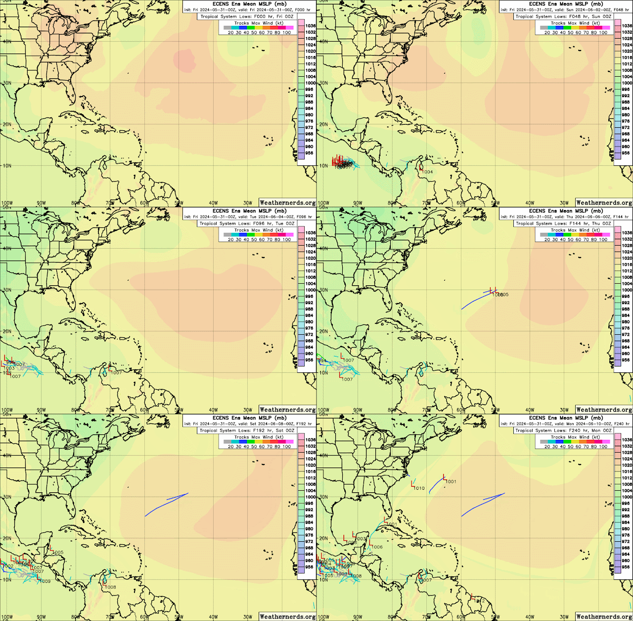
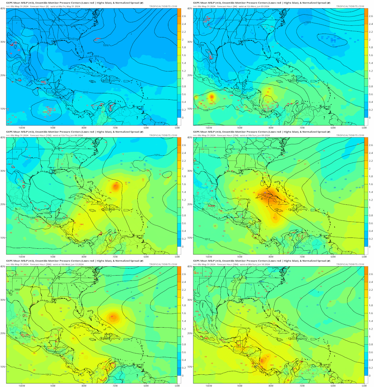
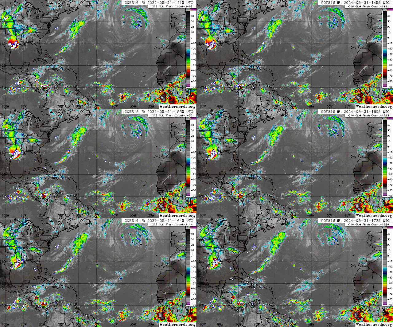
There is plenty of monsoon moisture southwest of the African coast but so far the tropics remain quiet.  Areas to monitor in the coming weeks is the southern and northwest Caribbean.  So far the GEFS and the GEPS ensemble models suggest some development.  So for now enjoy your weekend.

RTW

000
ABNT20 KNHC 311710
TWOAT 

Tropical Weather Outlook
NWS National Hurricane Center Miami FL
200 PM EDT Fri May 31 2024

For the North Atlantic...Caribbean Sea and the Gulf of Mexico:

Tropical cyclone formation is not expected during the next 7 days.

$$
Forecaster Berg
-----------------------------------------------------------------
SPANISH VERSION:
679 
ACCA62 KNHC 311711
TWOSAT

Perspectiva de Tiempo Tropical
Centro Nacional de Huracanes del SNM Miami FL
200 PM EDT viernes 31 de mayo de 2024

Para el Atlántico Norte...Mar del Caribe y el Golfo de México:

No se espera la formación de ciclones tropicales durante los
próximos 7 días.

$$
Pronosticador Berg

*** Este producto ha sido procesado automáticamente utilizando un
programa de traducción y puede contener omisiones y errores. El
Servicio Nacional de Meteorología no puede garantizar la precisión
del texto convertido. De haber alguna duda, el texto en inglés es
siempre la versión autorizada. ***
-----------------------------------------------------------------
000
AXNT20 KNHC 311640
TWDAT

Tropical Weather Discussion
NWS National Hurricane Center Miami FL
1805 UTC Fri May 31 2024

Tropical Weather Discussion for North America, Central America
Gulf of Mexico, Caribbean Sea, northern sections of South
America, and Atlantic Ocean to the African coast from the
Equator to 31N. The following information is based on satellite
imagery, weather observations, radar and meteorological analysis.

Based on 1200 UTC surface analysis and satellite imagery through 
1630 UTC.

...TROPICAL WAVES...

An eastern Atlantic tropical wave is near 28W from 11N southward,
and moving west at 10-15 kt. Convection is described in the 
Monsoon Trough/ITCZ section.

A central Atlantic tropical wave is near 49W from 12N southward, 
and moving west at 10-15 kt. Scattered moderate convection is from
10N to 13N between 45W and 50W.

A Caribbean tropical wave is along 72W from 18N near Cabo Rojo, 
República Dominicana southward across Lago de Maracaibo, and 
moving westward at 10-15 kt. Scattered showers are in the vicinity
of the wave axis.

...MONSOON TROUGH/ITCZ...

The monsoon trough extends from the coast of Africa near 10N13W to
06N25W. Scattered moderate isolated strong convection is from 03N
to 10N east of 23W. The ITCZ extends from 05N31W to 08N45W.
Scattered moderate convection is from 03N to 08N between 32W and
38W.

GULF OF MEXICO...

A squall line with embedded strong thunderstorms moved off the
Texas coast and into the NW Gulf earlier this morning. As of 1500
UTC, the squall line extends from 30N93W near the Texas/Louisiana
border to 27N97W near Corpus Christi, Texas. Buoy 42019 reported
wind gusts to gale force as the squall line moved through.

Elsewhere, the large scale (synoptic) conditions across the Gulf
of Mexico are characterized by weak high pressure ridging. Gentle
to moderate E to SE winds prevail, with locally fresh SE winds in
the Bay of Campeche. Seas are 3-6 ft west of 90W, and 1-3 ft east
of 90W. 

For the forecast, high pressure ridging will prevail across the 
Gulf waters through at least Sun, supporting moderate to fresh 
winds mainly over the western Gulf due to the pressure gradient 
between the ridge and lower pressures over Mexico. Fresh to strong
NE to E winds will pulse near the northern and western portions 
of the Yucatan peninsula during the late afternoons and at night 
through Sun. Haze due to agricultural fires over Central America 
and Mexico will continue for at least the next couple of days and
may reduce visibility at times.

CARIBBEAN SEA...

Please see the tropical waves section above.

Scattered moderate isolated strong convection is evident on
satellite imagery in the SW Caribbean from 09N to 12N between 76W
and 82W, likely enhanced by the extension of the East Pacific 
Monsoon Trough. Moderate to fresh trades prevail across most of the
Caribbean, with 4-7 ft seas. In the NW Caribbean, trades are 
light gentle with 2-4 ft seas.

For the forecast, the moderate pressure gradient between high 
pressure N of the area and low pressure near Colombia will
continue support fresh to locally strong trade winds over the 
south- central Caribbean today. The pressure gradient will 
increase tonight into Sat as high pressure north of the area 
strengthens some. This will lead to fresh to strong trade winds 
across the central basin Sat through early Mon, with seas building
to around 9 ft. Winds will slightly diminish by early next week.
Looking ahead, the potential for heavy rains returns next week across
Hispaniola, eastern Cuba, Jamaica, the Turks and Caicos, and the 
southeast and central Bahamas. Localized flooding is possible,
especially where the ground remains very moist from recent heavy 
rain events.

ATLANTIC OCEAN...

Please see the tropical waves section above.

In the W Atlantic, a decaying cold front is from 31N69W to 27N74W.
Ahead of the boundary, scattered moderate convection is from 25N
to 28N between 66W and 70W. In the east and central Atlantic, a
weak cold front extends from 31N23W to 24N38W where a surface
trough then continues to 31N51W. 1020 mb high pressures are
centered near 23N31W and 26N51W. These high pressures provide for
gentle to moderate trades across the tropical Atlantic, with 4-6
ft seas.

For the forecast, a frontal trough will move eastward across the 
forecast waters through Sun. High pressure building in behind the 
frontal trough will tighten the pressure gradient across the 
region, bringing moderate to fresh winds and across waters north 
of 24N, along with building seas E of the Bahamas. Marine 
conditions will slightly improve across the waters by early next 
week. 

$$
Mahoney


Upper level conditions are unfavorable for 
tropical cyclone formation at this time.


Thursday, May 30, 2024

..TROPICAL OUTLOOK MAY 30, 2024..


Not much to talk about it remains quiet for now.  NHC discussion below for more detailed info.

RTW

000
ABNT20 KNHC 301133
TWOAT 

Tropical Weather Outlook
NWS National Hurricane Center Miami FL
800 AM EDT Thu May 30 2024

For the North Atlantic...Caribbean Sea and the Gulf of Mexico:

Tropical cyclone formation is not expected during the next 7 days.

$$
Forecaster Bucci
----------------------------------------------------------
Spanish Version
459 
ACCA62 KNHC 301134
TWOSAT

Perspectiva de Tiempo Tropical
Centro Nacional de Huracanes del SNM Miami FL
800 AM EDT jueves 30 de mayo de 2024

Para el Atlántico Norte...Mar del Caribe y el Golfo de México:

No se espera la formación de ciclones tropicales durante los
próximos 7 días.

$$
Pronosticador Bucci

*** Este producto ha sido procesado automáticamente utilizando un
programa de traducción y puede contener omisiones y errores. El
Servicio Nacional de Meteorología no puede garantizar la precisión
del texto convertido. De haber alguna duda, el texto en inglés es
siempre la versión autorizada. ***

000
AXNT20 KNHC 301107
TWDAT 

Tropical Weather Discussion
NWS National Hurricane Center Miami FL
1205 UTC Thu May 30 2024

Tropical Weather Discussion for North America, Central America
Gulf of Mexico, Caribbean Sea, northern sections of South
America, and Atlantic Ocean to the African coast from the
Equator to 31N. The following information is based on satellite
imagery, weather observations, radar and meteorological analysis.

Based on 0600 UTC surface analysis and satellite imagery through 
1045 UTC.

...TROPICAL WAVES...

A far eastern Atlantic tropical wave has its axis along 20W/21W 
from 03N to 14N. It is moving westward around 15 kt. Scattered 
moderate to isolated strong convection is within 120 nm east and 
180 nm west of the wave from 07N to 08N.

A central Atlantic tropical wave has its axis along 37W/38W from 
02N to 10N, moving westward 15-20 kt. Broken to overcast 
multilayer clouds along with clusters of moderate convection are 
from 03N to 08N between 32W and the wave, and from 03N to 10N 
between the wave and 40W.

A tropical wave has recently entered the far southeastern 
Caribbean Sea, with its axis along 62W and south of 14N. It is 
moving westward at 15 kt. Broken to overcast multilayer clouds 
with embedded scattered showers and a few thunderstorms are within
120 nm west of the wave from 10N to 12N.

A western Caribbean tropical wave is along 86W/87W south of 21N
to inland Honduras and northwest Nicaragua. It is moving westward
at 10-15 kt. Scattered showers and a few thunderstorms are 
west of the wave over western Nicaragua and southeastern
Guatemala. 

...MONSOON TROUGH/ITCZ...

The monsoon trough passes through the coastal plains of Guinea-
Bissau near 12N16W and extends to 10N20W. The ITCZ extends from 
06N22W to 03N35W. Scattered moderate convection is within 60 nm 
north of the ITCZ between 24W-26W.

GULF OF MEXICO...

A north-to-south oriented surface trough is analyzed from 
northeast Florida southwestward to just north of western Cuba. 
No significant weather is occurring with this feature. 
Otherwise, weak high pressure is over the region as a warm front 
is analyzed from extreme southwestern Louisiana to inland 
central Texas. Scattered moderate to isolated strong convection 
is seen from 28N to 31N between 89W-92W.

Slight to moderate seas are over the western half of the area. 
Slight seas are over the eastern half of the area. Fresh northeast
to east winds are over the eastern Bay of Campeche. Gentle to 
moderate southeast winds are elsewhere west of 88W, while light to
gentle winds are east of 88W.

Hazy conditions, that are due to agricultural fires in Mexico and
in Central America, are persisting in most of the western half of
the Gulf of Mexico. 

For the forecast, relatively weak surface ridging will continue 
across the area into early next week. As a result, winds will 
pulse moderate to fresh during the evenings through the weekend. 
Fresh to strong NE to E winds will pulse near the northern and 
western portions of the Yucatan peninsula during the late 
afternoons and at night through Sun. Haze west of 90W due to 
agricultural fires over Central America and Mexico will continue 
for at least the next couple of days reducing visibility at times.

CARIBBEAN SEA...

The southern part of broad upper-level troughing reaches 
southward to the northwestern Caribbean Sea. A series of upper- 
level impulses are passing through the base of the upper trough. 
Southwesterly flow aloft across the base of the upper trough 
continues to transport abundant tropical moisture from the 
southwestern Caribbean to sections of the northwestern and north-
central Caribbean Sea, and to across the southern Atlantic 
waters between 45W and 76W. The atmospheric environment will 
remain very unstable and conducive for additional heavy rainfall 
to affect some areas of the Greater Antilles. Numerous moderate 
to strong convection is noted from 11N to 15N west of 80W to 
inland the eastern section of Nicaragua and inland northern 
Costa Rica. This activity is likely to produce locally heavy 
rainfall, gusty winds and at the same time be accompanied by 
frequent lightning. Please refer to bulletins and forecasts from 
your local weather office for the latest information on this 
activity.

An area of increasing numerous moderate to strong convection is 
confined to south of 13N between the coast of NW Colombia and 
79W. This activity is exhibiting frequent lightning, and is along 
and north of the eastern portion of the E Pacific monsoon trough 
that extends from northern Panama to inland Colombia near 10N73W.

Overnight scatterometer data shows fresh to strong trade winds 
from about 12N to 15N between 70W and 80W. Moderate to fresh
trade winds are elsewhere across the basin, except for light 
to gentle winds over the northwestern and north-central sections.
Latest altimeter data passes indicate slight seas north of 15N 
and west of 80W. Moderate seas are over the rest of the basin.

Hazy conditions continue to affect the Gulf of Honduras due
to persistent agricultural fires in Central America. The haze
may be reducing the visibility to around 3 nm at times, 
especially along the northern coast of Honduras and the Bay 
Islands. 

For the forecast, a moderate pressure gradient between high 
pressure north of the area and low pressure near Colombia will 
maintain fresh to strong trade winds over the south-central 
Caribbean and Gulf of Honduras through Fri night. Winds will 
become moderate to fresh Thu through Fri as the pressure gradient 
slackens some. The pressure gradient will increase Fri night 
behind a tropical wave that is currently in the far southeastern 
part of the Caribbean leading to fresh to strong trade winds 
across the central basin through early Mon. The tropical wave 
along 86W/87W will move inland the Yucatan Peninsula and northern
Central America today. Smoke from agricultural fires over Central
America is causing reduced visibilities over portions of the Gulf
of Honduras. 

ATLANTIC OCEAN...

A surface trough is analyzed from 31N32W to 29N52W and 
southwestward to near Puerto Rico and to the eastern Caribbean 
near 15N67W. Scattered showers and thunderstorms are within 60 to 
120 nm south of the trough between 30W-49W. Broken to overcast 
multilayer cloud, with embedded scattered showers and isolated 
thunderstorms are noted from 17N to 25N between 50W and 58W, also 
from 18N to 22N between 58W and 68W and from 19N to 25N between 
42W and 50W. Weak high pressure is present generally elsewhere 
across the basin. 

Overnight scatterometer data depicts fresh trade winds from 07N 
to 19N between 30W and 61W. Moderate to fresh northerly winds are
from 14N to 21N east of 26W. Moderate or weaker winds are 
elsewhere over the basin. Pockets of moderate seas are from 08N 
to 20N between 35W and 61W and from 14N to 21N between 17W and 
26W.

For the forecast, relatively weak surface ridging over the region
is allowing for moderate or lighter winds to exist over the 
forecast waters. A cold front will move off the southeastern U.S. 
coast today, move across the western half of the area through Fri 
night, and across the remainder of the forecast waters through 
late Mon. High pressure building in behind the front will tighten 
the pressure gradient across the region, bringing moderate to 
fresh winds across waters north of 20N. Moderate seas can also be 
expected with these winds. Conditions will slightly improve by 
early next week north of 27N. 

$$
Aguirre