Tuesday, July 28, 2020

POTENTIAL TROP CYCLONE NINE 0800 PM EDT UPDATE


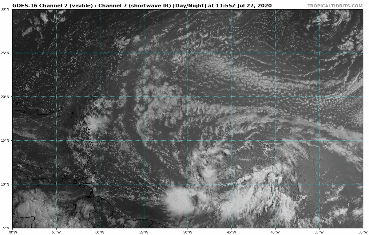
PTC NINE IS GRADUALLY BECOMING BETTER ORGANIZED.  I BEEN LOOKING AT SOME OF THE MODELS AND SOME SUGGEST A HURRICANE DEVELOPING.   THE EURO DOES NOT SUGGEST A HURRICANE BUT IT DOES SUGGEST A TROPICAL STORM.  

ITS STILL TO EARLY TO TELL THE INTENSITY OF THIS SYSTEM, BUT A HURRICANE CANNOT BE RULED OUT AT SOMETIME DURING THE LIFE OF THIS STORM SYSTEM

NOW IS A GOOD TIME TO CHECK WHAT YOU MAY NEED IN YOUR KIT.  REMEMBER PLEASE THINK OF OTHERS WHO MAY NEED TO BUY SUPPLIES IN CASE STORES GET BUSY SO DON'T HOARD LIKE SOME DID BEFORE THE QUARANTINE.   BY THIS TIME WE SHOULD OF STOCKED UP FOR HURRICANE SEASON WHICH RUNS JUNE 1 THROUGH NOVEMBER 30.  REMEMBER HAND SANITIZERS, MASK, GLOVES.  LETS HOPE THIS SYSTEM DOES NOT GET STRONGER FOR ANYONE IN ITS PATH.

566 
WTNT34 KNHC 282352
TCPAT4

BULLETIN
Potential Tropical Cyclone Nine Intermediate Advisory Number 2A
NWS National Hurricane Center Miami FL       AL092020
800 PM AST Tue Jul 28 2020

...DISTURBANCE STILL EXPECTED TO BECOME A TROPICAL STORM LATER
TONIGHT OR ON WEDNESDAY...
...HEAVY RAINFALL AND TROPICAL-STORM CONDITIONS WILL SPREAD ACROSS
TO THE LEEWARD ISLANDS...THE U.S. AND BRITISH VIRGIN ISLANDS...AND
PUERTO RICO...


SUMMARY OF 800 PM AST...0000 UTC...INFORMATION
----------------------------------------------
LOCATION...14.2N 58.7W
ABOUT 340 MI...545 KM SE OF THE LEEWARD ISLANDS
MAXIMUM SUSTAINED WINDS...40 MPH...65 KM/H
PRESENT MOVEMENT...WNW OR 285 DEGREES AT 25 MPH...40 KM/H
MINIMUM CENTRAL PRESSURE...1007 MB...29.74 INCHES


WATCHES AND WARNINGS
--------------------
CHANGES WITH THIS ADVISORY:

None.

SUMMARY OF WATCHES AND WARNINGS IN EFFECT:

A Tropical Storm Warning is in effect for...
* Puerto Rico, Vieques, Culebra
* U.S. Virgin Islands
* British Virgin Islands
* Antigua, Barbuda, Montserrat, St. Kitts, Nevis, and Anguilla
* Guadeloupe, Martinique, St. Martin, and St. Barthelemy
* Saba and St. Eustatius
* St. Maarten
* Dominica
* Dominican Republic from Cabo Caucedo northward along the northern
coast to the Dominican Republic/Haiti border

Interests elsewhere in Hispaniola, the Turks and Caicos, and the
southeast and central Bahamas should monitor the progress of this
system.

A Tropical Storm Warning means that tropical storm conditions are
expected somewhere within the warning area within 36 hours.

For storm information specific to your area in the United
States, including possible inland watches and warnings, please
monitor products issued by your local National Weather Service
forecast office. For storm information specific to your area
outside of the United States, please monitor products issued by
your national meteorological service.


DISCUSSION AND OUTLOOK
----------------------
At 800 PM AST (0000 UTC), the disturbance center has re-formed near
latitude 14.2 North, longitude 58.7 West. The system is moving
toward the west-northwest near 25 mph (40 km/h), and this general
motion with some slight reduction in forward speed is expected over
the next few days. On the forecast track, the system is forecast to
move through the Leeward Islands on Wednesday, near or over the
Virgin Islands and Puerto Rico Wednesday night, and near or over
Hispaniola on Thursday.

Maximum sustained winds are near 40 mph (65 km/h) with higher
gusts. Some strengthening is expected during the next 48 hours, and
the system is forecast to become a tropical storm tonight or on
Wednesday.

Environmental conditions are expected to be conducive for
additional development, and a tropical storm is forecast to form
tonight or Wednesday.
* Formation chance through 48 hours...high... 90 percent
* Formation chance through 5 days...high...90 percent  
Tropical-storm-force winds extend outward up to 230 miles (370 km)
primarily to the northeast of the center.

The estimated minimum central pressure is 1007 mb (29.74 inches).


HAZARDS AFFECTING LAND
----------------------
Key messages for Potential Tropical Cyclone Nine can be found in
the Tropical Cyclone Discussion under AWIPS header MIATCDAT4, WMO
header WTNT44 KNHC, and on the web at
www.hurricanes.gov/text/MIATCDAT4.shtml.

WIND:  Tropical storm conditions are expected to reach the Leeward
Islands late tonight or Wednesday morning, and spread across the
U.S. and British Virgin Islands and Puerto Rico Wednesday afternoon
through Thursday morning. These conditions are forecast to reach
portions of the Dominican Republic within the warning area early
Thursday.

RAINFALL:  The potential tropical cyclone is expected to produce the
following rain accumulations:

Across the northern Leeward Islands, British and U.S. Virgin
Islands: 3 to 6 inches.

Across Puerto Rico: 3 to 6 inches, with isolated maximum totals of
10 inches.

Across the Dominican Republic: 3 to 6 inches, with isolated maximum
totals of 8 inches.

These rainfall amounts could lead to life threatening flash flooding
and mudslides, as well as potential riverine flooding.

Rainfall is also expected in the following locations:

Across the Windward Islands: 1 to 3 inches.


NEXT ADVISORY
-------------
Next complete advisory at 1100 PM AST.

$$
Forecaster Stewar


POTENTIAL TROPICAL CYCLONE NINE 0500 PM EDT ADVISORY

000
WTNT34 KNHC 282039
TCPAT4

BULLETIN
Potential Tropical Cyclone Nine Advisory Number   2
NWS National Hurricane Center Miami FL       AL092020
500 PM AST Tue Jul 28 2020

...DISTURBANCE FORECAST TO BECOME A TROPICAL STORM TONIGHT OR
WEDNESDAY...
...EXPECTED TO BRING HEAVY RAINFALL AND TROPICAL-STORM-CONDITIONS
TO THE LEEWARD ISLANDS...THE U.S. AND BRITISH VIRGIN ISLANDS...AND
PUERTO RICO...


SUMMARY OF 500 PM AST...2100 UTC...INFORMATION
----------------------------------------------
LOCATION...14.4N 55.9W
ABOUT 435 MI...700 KM ESE OF THE LEEWARD ISLANDS
MAXIMUM SUSTAINED WINDS...40 MPH...65 KM/H
PRESENT MOVEMENT...WNW OR 285 DEGREES AT 23 MPH...37 KM/H
MINIMUM CENTRAL PRESSURE...1007 MB...29.74 INCHES


WATCHES AND WARNINGS
--------------------
CHANGES WITH THIS ADVISORY:

The government of the Dominican Republic has issued a Tropical
Storm Warning from Cabo Caucedo northward along the northern coast
of the Dominican Republic to the northern border with Haiti

SUMMARY OF WATCHES AND WARNINGS IN EFFECT:

A Tropical Storm Warning is in effect for...
* Puerto Rico, Vieques, Culebra
* U.S. Virgin Islands
* British Virgin Islands
* Antigua, Barbuda, Montserrat, St. Kitts, Nevis, and Anguilla
* Guadeloupe, Martinique, St. Martin, and St. Barthelemy
* Saba and St. Eustatius
* St. Maarten
* Dominica
* Dominican Republic from Cabo Caucedo northward along the northern
coast to the Dominican Republic/Haiti border

Interests elsewhere in Hispaniola, the Turks and Caicos, and the
southeast and central Bahamas should monitor the progress of this
system.

A Tropical Storm Warning means that tropical storm conditions are
expected somewhere within the warning area within 36 hours.


For storm information specific to your area in the United
States, including possible inland watches and warnings, please
monitor products issued by your local National Weather Service
forecast office. For storm information specific to your area
outside of the United States, please monitor products issued by
your national meteorological service.


DISCUSSION AND OUTLOOK
----------------------
At 500 PM AST (2100 UTC), the disturbance was centered near latitude
14.4 North, longitude 55.9 West. The system is moving toward the
west-northwest near 23 mph (37 km/h), and this general motion with 
some slight reduction in forward speed is expected over the next 
few days. On the forecast track, the system is forecast to move 
through the Leeward Islands on Wednesday, near or over the Virgin 
Islands and Puerto Rico Wednesday night, and near or over 
Hispaniola on Thursday.

Maximum sustained winds are near 40 mph (65 km/h) with higher gusts. 
Some strengthening is expected during the next 48 hours, and the 
system is forecast to become a tropical storm tonight or Wednesday.

Environmental conditions are expected to be conducive for
additional development and a tropical storm is forecast to form
tonight or Wednesday. 
* Formation chance through 48 hours...high...90 percent
* Formation chance through 5 days...high...90 percent

Tropical-storm-force winds extend outward up to 230 miles (370 km) 
primarily to the northeast of the center.

The estimated minimum central pressure is 1007 mb (29.74 inches).


HAZARDS AFFECTING LAND
----------------------
Key messages for Potential Tropical Cyclone Nine can be found in
the Tropical Cyclone Discussion under AWIPS header MIATCDAT4, WMO
header WTNT44 KNHC, and on the web at
www.hurricanes.gov/text/MIATCDAT4.shtml.

WIND:  Tropical storm conditions are expected to reach the Leeward
Islands late tonight or Wednesday morning and spread across the U.S.
and British Virgin Islands and Puerto Rico Wednesday afternoon
through Thursday morning. These conditions are expected to reach
portions of the Dominican Republic within the warning area early
Thursday.

RAINFALL:  The potential tropical cyclone is expected to 
produce the following rain accumulations:

Across the northern Leeward Islands, British and U.S. Virgin 
Islands: 3 to 6 inches.

Across Puerto Rico: 3 to 6 inches, with isolated maximum totals of 
10 inches.

Across the Dominican Republic: 3 to 6 inches, with isolated maximum 
totals of 8 inches.

These rainfall amounts may lead to life threatening flash flooding 
and mudslides, as well as potential riverine flooding.  

Rainfall is also expected in the following locations:

Across the Windward Islands: 1 to 3 inches.


NEXT ADVISORY
-------------
Next intermediate advisory at 800 PM AST.
Next complete advisory at 1100 PM AST.

$$
Forecaster Brown


QUICK REVIEW OF WATER VAPOR SATELLITE OF POTENTIAL TROPICAL CYCLONE


I AM STILL NOTICING DRY INTRUSION COMING FROM THE NORTH OF WHERE THIS SYSTEM IS AT.  ITS BEEN MOVING ALONG WITH IT.  IT SEEMS THAT AHEAD THERE IS LESS DRY AIR HOWEVER, THERE ARE MORE POCKETS OF DRY AIR AHEAD OF THIS SYSTEM AND UNLESS THEY TRACK WEST THIS SYSTEM COULD ENCOUNTER THOS POCKETS AS WELL AND THAT MAY INHIBIT DEVELOPMENT.  ONLY TIME WILL TELL BUT SO FAR THIS IS MY OBSERVATION.

RTW


INVEST 92L IS NOW POTENTIAL TROPICAL CYCLONE NINE ADVISORIES ARE NOW BEING ISSUED BY NHC


000
WTNT34 KNHC 281458
TCPAT4

BULLETIN
Potential Tropical Cyclone Nine Advisory Number   1
NWS National Hurricane Center Miami FL       AL092020
1100 AM AST Tue Jul 28 2020

...DISTURBANCE FORECAST TO BECOME A TROPICAL STORM BEFORE REACHING
THE LEEWARD ISLANDS...
...TROPICAL STORM WARNINGS ISSUED...


SUMMARY OF 1100 AM AST...1500 UTC...INFORMATION
-----------------------------------------------
LOCATION...13.8N 53.7W
ABOUT 585 MI...940 KM ESE OF THE LEEWARD ISLANDS
MAXIMUM SUSTAINED WINDS...40 MPH...65 KM/H
PRESENT MOVEMENT...W OR 280 DEGREES AT 23 MPH...37 KM/H
MINIMUM CENTRAL PRESSURE...1007 MB...29.74 INCHES


WATCHES AND WARNINGS
--------------------
CHANGES WITH THIS ADVISORY:

A Tropical Storm Warning is in effect for Puerto Rico, including
Vieques, and Culebra, and the U.S. Virgin Islands.

The government of Antigua has issued a Tropical Storm Warning for
Antigua, Barbuda, the British Virgin Islands, Montserrat,
St. Kitts, and Nevis.

The government of France has issued a Tropical Storm Warning for
Guadeloupe, Martinique, and St. Martin.

The government of the Netherlands has issued a Tropical Storm
Warning for Saba and St. Eustatius.

The government of St. Maartin has issued a Tropical Storm Warning 
for St. Maartin.

SUMMARY OF WATCHES AND WARNINGS IN EFFECT:

A Tropical Storm Warning is in effect for...
* Puerto Rico, Vieques, Culebra
* U.S. Virgin Islands
* British Virgin Islands
* Antigua, Barbuda, Montserrat, St. Kitts, and Nevis
* Guadeloupe, Martinique, and St. Martin
* Saba and St. Eustatius
* St. Maartin

Interests elsewhere in the Leeward Islands and Hispaniola should 
monitor the progress of this system.

A Tropical Storm Warning means that tropical storm conditions are
expected somewhere within the warning area within 36 hours.

For storm information specific to your area in the United
States, including possible inland watches and warnings, please
monitor products issued by your local National Weather Service
forecast office. For storm information specific to your area
outside of the United States, please monitor products issued by
your national meteorological service.


DISCUSSION AND OUTLOOK
----------------------
At 1100 AM AST (1500 UTC), the disturbance was centered near
latitude 13.8 North, longitude 53.7 West. The system is moving
toward the west near 23 mph (37 km/h), and this general motion 
should continue during the next few days.  On the forecast track, 
the system is forecast to move through the Leeward Islands on 
Wednesday, and near or over the Virgin Islands and Puerto Rico 
Wednesday night, and near or over Hispaniola on Thursday. 

Maximum sustained winds are near 40 mph (65 km/h) with higher gusts.
Some strengthening is expected during the next 48 hours, and the 
system is forecast to become a tropical storm tonight or Wednesday.

Environmental conditions are expected to be conducive for 
additional development and a tropical storm tonight or Wednesday.
* Formation chance through 48 hours...high...80 percent
* Formation chance through 5 days...high...90 percent

Tropical-storm-force winds extend outward up to 230 miles (370 km)
primarily to the northeast of the center.

The estimated minimum central pressure is 1007 mb (29.74 inches).


HAZARDS AFFECTING LAND
----------------------
Key messages for Potential Tropical Cyclone Nine can be found in 
the Tropical Cyclone Discussion under AWIPS header MIATCDAT4 and 
WMO header WTNT44 KNHC. 

WIND:  Tropical storm conditions are expected to reach the Leeward 
Islands on Wednesday and spread into the U.S. and British Virgin 
Islands and Puerto Rico Wednesday afternoon through Thursday 
morning. 

RAINFALL:  The potential tropical cyclone will produce total rain
accumulation of 3 to 6 inches with maximum amounts of 10 inches
across the northern Leeward Islands, British and U.S. Virgin
Islands and Puerto Rico. Rainfall accumulations of 2 to 4 inches
possible across the Windward Islands. This rainfall may produce
life threatening flash flooding and mudslides, as well as potential
riverine flooding.


NEXT ADVISORY
-------------
Next intermediate advisory at 200 PM AST.
Next complete advisory at 500 PM AST.

$$
Forecaster Brown


Monday, July 27, 2020

STORM INVESTIGATION 92L 0800 PM EDT UPDATE


000
ABNT20 KNHC 272314
TWOAT 

Tropical Weather Outlook
NWS National Hurricane Center Miami FL
800 PM EDT Mon Jul 27 2020

For the North Atlantic...Caribbean Sea and the Gulf of Mexico:

Shower activity associated with a low pressure area located about 
850 miles east of the Windward Islands has again become a little 
better organized, however the low's circulation remains broad 
without a well-defined center of circulation.  Environmental 
conditions are expected to become somewhat more conducive for 
development, and a tropical depression or tropical storm is likely 
to form during the next couple of days while the system moves 
west-northwestward at 15 to 20 mph and approaches the Leeward 
Islands.  Regardless of development, locally heavy rains and gusty 
winds are likely across portions of the Leeward Islands on Wednesday 
and will spread westward to the Virgin Islands and Puerto Rico 
Wednesday night and Thursday.  Interests on these islands should 
continue to monitor the progress of this system, and tropical storm 
watches or warnings could be required for portions of the area on 
Tuesday.
* Formation chance through 48 hours...high...70 percent.
* Formation chance through 5 days...high...80 percent.

$$
Forecaster Berg


STORM INVESTIGATION 92L STILL STRUGGLING WITH DRY AIR!


STORM INVEST 92L IS MOVING THROUGH A DRY AIR ENVIRONMENT WHICH IS NOT ALLOWING THE SYSTEM TO DEVELOP THUNDERSTORMS FOR VERY LONG.  THE SAME OCCURRED WITH GONZALO.  HOWEVER, AHEAD OF 92L THE ENVIRONMENT HAS LESS DRY CONDITIONS AND THIS COULD ALLOW 92L TO DEVELOP SOME.  FORMATION CHANCE HAS DECREASED SOME DUE TO UNFAVORABLE CONDITIONS AT THIS TIME. I WILL CONTINUE TO MONITOR THIS SYSTEM. 

RTW

000
ABNT20 KNHC 271740
TWOAT 

Tropical Weather Outlook
NWS National Hurricane Center Miami FL
200 PM EDT Mon Jul 27 2020

For the North Atlantic...Caribbean Sea and the Gulf of Mexico:

Shower activity associated with a broad area of low pressure located 
about 1000 miles east of the Windward Islands has changed little in 
organization since this morning. Environmental conditions are 
expected to become somewhat more favorable for development during 
the next few days and a tropical depression or tropical storm is 
likely to form during that time frame. The system is forecast to 
move westward to west-northwestward at 15 to 20 mph and it could 
bring heavy rain to portions of the Leeward Islands by late 
Wednesday, regardless of development. Interests in the Lesser 
Antilles should continue to monitor the progress of this system.
* Formation chance through 48 hours...high...70 percent.
* Formation chance through 5 days...high...80 percent.

$$
Forecaster Zelinsky


Cloud Temperature Color Satellite
Water Vapor Satellite


STORM INVESTIGATION 92L JU 27, 2020

334 
ABNT20 KNHC 271124
TWOAT 

Tropical Weather Outlook
NWS National Hurricane Center Miami FL
800 AM EDT Mon Jul 27 2020

For the North Atlantic...Caribbean Sea and the Gulf of Mexico:

The Weather Prediction Center has issued the last advisory on the 
remnants of Hanna, located inland over northern Mexico.

Shower activity associated with a broad area of low pressure located 
a little more than 1000 miles east of the Windward Islands has 
become a little less organized since last night. However, 
environmental conditions are still expected to become more favorable 
for development in a day or two and a tropical depression or 
tropical storm will likely form within the next couple of days. The 
system is forecast to move westward to west-northwestward at 15 to 
20 mph and could begin to affect portions of the Lesser Antilles on 
Wednesday or Wednesday night. Interests on those islands should 
continue to monitor the progress of this system.
* Formation chance through 48 hours...high...80 percent.
* Formation chance through 5 days...high...90 percent.

$$
Forecaster Zelinsky


THESE MODEL EXAMPLES BELOW ARE PREVIOUS MODEL RUN TO SEE WHICH ONE
IS MORE CONSISTENT WITH THE TRACKS.  NOT FOR OFFICIAL USE BY RTW


CLUSTER OF STORMS NOT INVEST 92 LOOKS HEALTHIER THAT 92L.  HEADED FOR SOUTH AMERICAN COAST.  IF IT HOLDS UP STRONG GUSTY WINDS AND HEAVY RAINS
WILL MOVE ON SHORE WITHIN A DAY OR SO.