
The tropics remain quiet at this time, but there are a few waves being monitored at this time.
- A tropical wave near 24-25 degrees west Latitude passing over the Cabo Verde Islands. This wave does not have any thunderstorms activity associated with it at this time.
- A strong wave approaching the lower windward Islands, Barbados, Trinidad and Tobago is located between 55-57 degrees west. This is a strong wave with heavy rainfall, gusty winds in squalls and lightning. This wave has the potential to produce flash floods as it spreads slowly westward over the lower island chain and northern coast of south America. (See blow satellite loop.)
.gif)
- Another wave over the central Caribbean is located near 72-73 degrees west latitude and seems to have some isolated showers and storms south of Dominican republic and the Mona Passage. there are no signs of organization at this time. A 1010 mb Low pressure ahead of this wave which is located along 75 degrees west and along the monsoon trough could interact with the southern axis of this wave which extends over South America.
RTW


000
AXNT20 KNHC 031035
TWDAT

Tropical Weather Discussion
NWS National Hurricane Center Miami FL
1205 UTC Mon Jul 3 2023

Tropical Weather Discussion for North America, Central America
Gulf of Mexico, Caribbean Sea, northern sections of South
America, and Atlantic Ocean to the African coast from the
Equator to 31N. The following information is based on satellite
imagery, weather observations, radar and meteorological analysis.

Based on 0600 UTC surface analysis and satellite imagery through
0900 UTC.

...TROPICAL WAVES...

A eastern Atlantic tropical wave is near 24W from 20N southward
through the Cabo Verde Islands to near 05N, moving W at 10 kt. No
significant convection is associated with this feature.

A well-defined western Atlantic tropical wave is along 54W from
13N to Suriname, moving W at 10 kt. Scattered moderate convection
is noted S of 13N between 48W and 58W, including northern
Suriname.

Another well-defined central Caribbean tropical wave is along 72W
from S of Haiti to the Venezuela-Colombia border, moving W at 10
to 15 kt. Scattered moderate convection is noted near the coasts
of Hispaniola and NW Venezuela, as well as over the Mona Passage.

A tropical wave that was previously in the far western Caribbean
has now moved into Central America and the Eastern Pacific along
91W. Scattered moderate convection associated with this wave is
still impacting the Gulf of Honduras early this morning.

...MONSOON TROUGH/ITCZ...

A monsoon trough enters the Atlantic near the border of Mauritania
and Senegal and extends SW through to 14N21W to 09N26W. Scattered
moderate to isolated strong convection is noted from 05N to 14N E
of 19W. An ITCZ continues from 09N26W across 04N35W to 05N47W. No
significant convection is noted near the ITCZ.

The eastern end of the East Pacific monsoon trough extends along
10N from Panama to Colombia. This feature is leading to scattered
moderate convection across the SW Caribbean S of 14N and W of 75W
as well as adjacent portions of Colombia, Panama, and Costa Rica.

...GULF OF MEXICO...

Scattered moderate convection associated with the aforementioned
tropical wave over northern South America and adjacent portions of
the Eastern Pacific is impacting areas near the coast of the
Yucatan Peninsula as well as the Yucatan Channel. Otherwise, dry
conditions prevail in the basin. High pressure centered just
offshore Florida continues to dominate the Gulf of Mexico. This is
leading to light to gentle SE winds and seas of 3 ft or less.

For the forecast, weak surface ridging will prevail into mid-
week, supporting mainly gentle to moderate return flow W of 90W
and light to gentle winds over the eastern half of the basin.
Otherwise, moderate to locally fresh winds will pulse north and
west of the Yucatan peninsula tonight and again Tue night as a
diurnal trough develops and moves offshore.

...CARIBBEAN SEA...

Refer to the Monsoon Trough/ITCZ and Tropical Waves sections above
for details on convection in the basin. The pressure gradient
between high pressure mainly N of 25N and low pressure centered
along the Colombian coast is leading to fresh to locally strong E
winds and seas of 5 to 7 ft in the south-central Caribbean. To the
north and east, the basin is having moderate to fresh trades with
seas of 4 to 6 ft. In the western basin, mainly moderate winds
prevail with 3 to 6 ft seas. However, S of 12N, winds are light to
gentle with seas of 3 to 5 ft.

For the forecast, moderate to fresh trade winds across the
central and eastern Caribbean will increase to fresh to strong Tue
into Wed night in the wake of a tropical wave passing through the
region. Fresh to strong trade winds over the south- central
waters decrease some today, then increase and expand in coverage
Tue night into Wed. Gentle to moderate trade winds will prevail
elsewhere during the forecast period.

...ATLANTIC OCEAN...

An upper-level trough axis extend from E of Bermuda to NE of
Hispaniola. It is inducing scattered moderate convection N of 25N
between 58W and 68W. Convection associated with a deep-layer low
pressure centered near 34N36W is now confined to waters N of the
area. Farther S, convection in the tropical Atlantic is being
generated by a tropical wave and monsoon trough, and is depicted
in the respective sections above.

A dominant ridge of high pressure sprawling across most waters N
of 23N is leading to light to gentle winds and seas of 3 to 5 ft
for these waters. Some moderate winds and seas of up to 6 ft are
impacting waters near the Canary Islands. To the S, light to
gentle winds are waters E of 30W, with the remainder of Tropical
Atlantic waters having mainly fresh trades with seas of 5 to 7 ft.
Winds on the N and E sides of a tropical wave along 54W have been
enhanced by the wave and are strong, with subsequent seas of 8 to
10 ft from 15N to 20N between 52W and 58W.

For the forecast west of 55W, a weak pressure gradient will lead
to light gentle winds across most of the area into mid-week. S of
22N, winds will increase to moderate to fresh starting tonight,
then continue through mid week.

$$
KONARIK
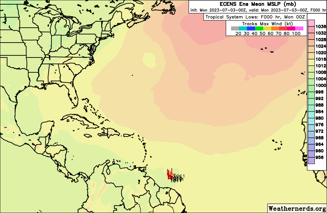
Latest model ensemble do not show any significant development in
the Atlantic at this time. July is typically a quiet month for tropical
cyclone formation.
RTW

No comments:
Post a Comment
Note: Only a member of this blog may post a comment.