
The tropical wave south of the Cabo Verde Islands and west of the coast of Africa is moving into an area of showers and storms. Some of the models are hinting that a low pressure could form near or along the wave's axis, but no development as it tracks west. I will keep monitoring it.
RTW
ZCZC MIATWOAT ALL
TTAA00 KNHC DDHHMM
Tropical Weather Outlook
NWS National Hurricane Center Miami FL
800 AM EDT Tue May 20 2025
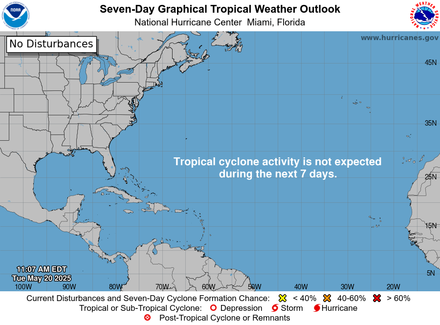
For the North Atlantic...Caribbean Sea and the Gulf of America:
Tropical cyclone formation is not expected during the next 7 days.
$$
Forecaster Kelly
-----------------------------------------------------------------------------------------------
223
ACCA62 KNHC 201125
TWOSAT

Pronóstico del Tiempo Tropical
Centro Nacional de Huracanes del SNM Miami FL
800 AM EDT martes 20 de mayo de 2025

Para el Atlántico Norte...Mar Caribe y el Golfo de América:

No se espera la formación de ciclones tropicales durante los
próximos 7 días.

$$
Pronosticador Kelly

*** Este producto ha sido procesado automáticamente utilizando un
programa de traducción y puede contener omisiones y errores. El
Servicio Nacional de Meteorología no puede garantizar la precisión
del texto convertido. De haber alguna duda, el texto en inglés es
siempre la versión autorizada. ***
.png)


Upper Level winds are some what favorable in the area of the
inter-tropical convergence zone as well.
.gif)
.gif)
.png)
No comments:
Post a Comment
Note: Only a member of this blog may post a comment.