Invest 95L in the Gulf has a low 30/30% chance for development during the next 48 hrs and 5-days. Intensity models hint at a lower level tropical storm and the Ship model a cat 1 hurricane. I am not very confident at either but since it is close to the coast I will keep a close watch.
This system will be a heavy rainfall problem instead of a tropical cyclone problem, but this is just my opinion.
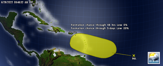
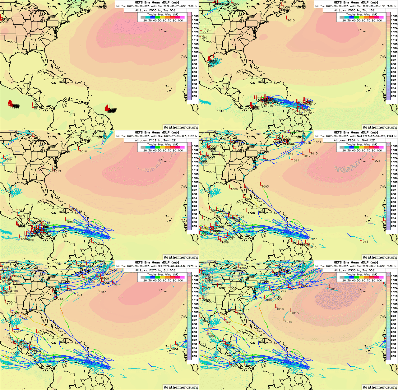
As for the Invest 96L in the Atlantic, models don't seem to develop this system much. If it were to develop with the dominant Azores high pressure in place it should steer this system westward as well. However, ECENS Ensemble and GEPS ensemble track this system west-northwest to northwest. So I continue to watch it closely even though confidence with this system in my opinion is low at this time.
Satellite shows another strong wave about to move off the African coast.
RTW
178
ABNT20 KNHC 281155
TWOAT

Tropical Weather Outlook
NWS National Hurricane Center Miami FL
800 AM EDT Tue Jun 28 2022

For the North Atlantic...Caribbean Sea and the Gulf of Mexico:

East of the Windward Islands:
The National Hurricane Center is issuing advisories on Potential
Tropical Cyclone Two, located a few hundred miles east of the
southern Windward Islands.
* Formation chance through 48 hours...high...70 percent.
* Formation chance through 5 days...high...90 percent.

Northern Gulf of Mexico:
An area of low pressure is centered over the northwestern Gulf of
Mexico. Shower and thunderstorm activity associated with the low has
increased overnight but remains disorganized. Some additional
development of this system is possible as it moves slowly westward
or west-southwestward and approaches the coast of Texas during the
next two days. Regardless of development, heavy rain will be
possible along portions of the Texas coast later this week. For more
information about the potential for heavy rain, please see products
issued by your National Weather Service office.
* Formation chance through 48 hours...low...30 percent.
* Formation chance through 5 days...low...30 percent.

Central Tropical Atlantic:
A tropical wave located more than 1000 miles east of the Windward
Islands continues to produce disorganized showers and thunderstorms.
This system is forecast to interact with another tropical wave to
its east over the next several days, and some gradual development is
possible later this week while the overall system moves
west-northwestward at around 15 mph across the central tropical
Atlantic.
* Formation chance through 48 hours...low...near 0 percent.
* Formation chance through 5 days...low...20 percent.

&&

Public Advisories on Potential Tropical Cyclone Two are issued
under WMO header WTNT32 KNHC and under AWIPS header MIATCPAT2.
Forecast/Advisories on Potential Tropical Cyclone Two are issued
under WMO header WTNT22 KNHC and under AWIPS header MIATCMAT2.

$$
Forecaster D. Zelinsky


No comments:
Post a Comment
Note: Only a member of this blog may post a comment.