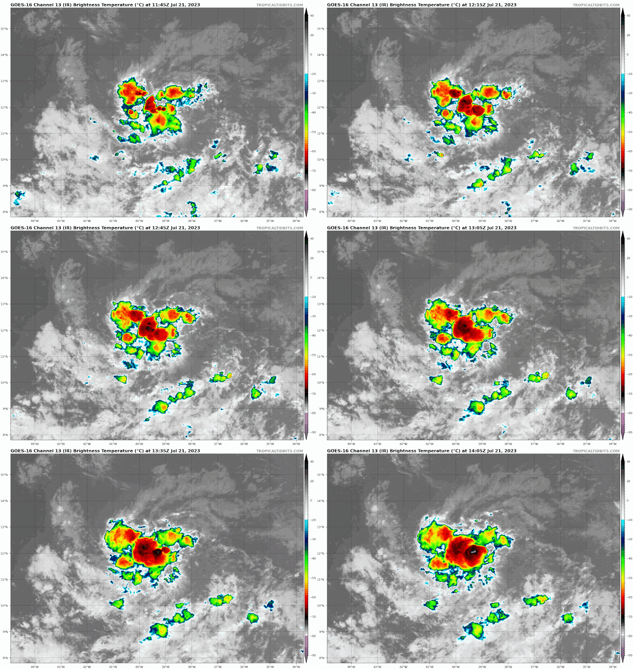
A westward tracking tropical wave located between 30-35 West Latitude is accompanied by scattered showers and storms enhanced by the moist African monsoon trough. This wave is west of a 1014 mb low know as Storm Invest 95L. These are separate entities and are being monitored as such.
Storm Investigation 95L a small cluster showers and storms associated with a 1014 mb low pressure, has a low 20% formation chance within 48 hours and a med 40% formation chance within 7 days.
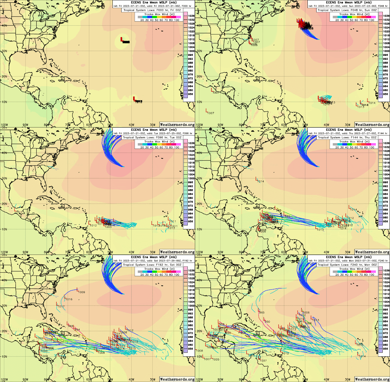
Intensity Models courtesy of Tropical Tidbits possible hurricane from a cat 1 to a 3. Small clustered lows such as this one in the past have grown to major cyclones. I will monitor this one closely!
GFS as always gets carried away during the end of the forecast run and shows a possible major storm. The Euro model does not show much development in this mornings run, but it is important we continue to monitor. Weaker systems tend to track westward so we watch and always "Be Storm Ready!".
Sea Surface temps remain very warm for tropical cyclone formation.
See maps below.
UPDATED 0200 PM EDT JULY 21, 2023ZCZC MIATWOAT ALL
TTAA00 KNHC DDHHMM

Tropical Weather Outlook
NWS National Hurricane Center Miami FL
200 PM EDT Fri Jul 21 2023

For the North Atlantic...Caribbean Sea and the Gulf of Mexico:

Active Systems:
The National Hurricane Center is issuing advisories on Tropical
Storm Don, located over the central Atlantic.

1. Central Tropical Atlantic (AL95):
A small area of low pressure, located several hundred miles
west-southwest of the Cabo Verde Islands, is producing an area of
disorganized showers and thunderstorms over the central tropical
Atlantic.  Although there is dry air located to the north of
the system, favorable upper-level winds are expected to allow for
gradual development during the next several days.  This system
could become a tropical depression early next week, as it moves
westward across the tropical Atlantic.
* Formation chance through 48 hours...medium...40 percent.
* Formation chance through 7 days...medium...60 percent.

Forecaster Kelly/Brown

.gif)


.gif)


No comments:
Post a Comment
Note: Only a member of this blog may post a comment.