Monday, January 30, 2023

DAYS 1-3 SEVERE STORM OUTLOOK PER STORM PREDICTION CENTER


THE STORM PREDICTION CENTER DAYS 1-3 SEVERE STORM FORECAST CALL FOR NO ORGANIZED SEVERE STORMS DURING THE NEXT THREE DAYS.  THERE IS A CHANCE FOR ISOLATED THUNDERSTORMS, BUT THERE IS LESS THAN A 5% CHANCE THAT THESE THUNDERSTORMS WOULD BECOME SEVERE. 

RTW

DAY 1


THUNDERSTORM OUTLOOK FOR TODAY


DAY 2


DAY 3


NATIONAL RADAR


Saturday, January 28, 2023

SEVERE STORM OUTLOOK DAY 2 TORNADO WIND AND HAIL PROBABILITIES

HERE IS THE AREAS THAT MAY BE AFFECTED BY SEVERE STORMS.

MARGINAL RISK: ...Houston, TX...New Orleans, LA...Baton Rouge, LA...Mobile, AL...Pasadena, TX...


 2% TORNADO PROBABILITY

Houston, TX...New Orleans, LA...Baton Rouge, LA...Mobile, AL...Pasadena, TX...


 5% DAMAGING WIND PROBABILITY

Houston, TX...New Orleans, LA...Baton Rouge, LA...Mobile, AL...Pasadena, TX...


 5% HAIL PROBABILITY

Houston, TX...Pasadena, TX...Beaumont, TX...College Station, TX...Sugar Land, TX...


Friday, January 27, 2023

DAY 3 EXCESSIVE RAINFALL OUTLOOK

 WEATHER PREDICITION CENTER EXCESSIVE RAINFALL OUTLOOK.

DAY 3 MARGINAL RAISK


DAY 3 SLIGHT RISK/ MARGINAL RISK


SEVERE STORM OUTLOOK SPC ADDED A MARGINAL RISK FOR DAY-3!

YESTERDAY JAN 26, 2023 SPC HAD NO SEVERE STORMS FORECAST FROM DAY 1-8 WITH A CHANCE FOR GENERAL THUNDERSTORMS A LESS THAN 5% CHANCE FOR DEVELOPMENT.  

TODAY JAN 27, 2023 THE STORM PREDICITION CENTER HAS ADDED A MARGINAL RISK DAY 3 SEE THE AREAS THAT COULD BE AFFECTED BY SEVERE STORMS BELOW.

NOTE VISIT STORM PREDICITION CENTER DAILY FOR UPDATES.

AREAS WITH A MARGINAL RISK FOR DEVELOPMENT:

Houston, TX...New Orleans, LA...Baton Rouge, LA...Pasadena, TX...Metairie, LA...

DAY 3 SEVERE STORM OUTLOOK


DAY 3 SEVERE STORM PROBABILITY 5%

Houston, TX...New Orleans, LA...Baton Rouge, LA...Pasadena, TX...Metairie, LA...


DAY 2 SEVERE STORM PROBABILITY REMAINS LESS THAN 5%


Wednesday, January 25, 2023

SEVERE STORM OUTLOOK FOR NORTHERN FLORIDA AND LATEST MESO DISCUSSION FROM SPC


 GET THE LATEST UPDATES HERE>> STORM PREDICTION CENTER
SAW0 
   WW 30 TORNADO AL FL CW 250900Z - 251600Z
   AXIS..50 STATUTE MILES NORTH AND SOUTH OF LINE..
   50NW PFN/PANAMA CITY FL/ - 30NE AAF/APALACHICOLA FL/
   ..AVIATION COORDS.. 45NM N/S /22ESE CEW - 35SSW TLH/
   HAIL SURFACE AND ALOFT..1 INCH. WIND GUSTS..60 KNOTS.
   MAX TOPS TO 450. MEAN STORM MOTION VECTOR 24045.

   LAT...LON 31458628 30768468 29318468 30018628

   THIS IS AN APPROXIMATION TO THE WATCH AREA.  FOR A
   COMPLETE DEPICTION OF THE WATCH SEE WOUS64 KWNS
   FOR WOU0.

Watch 30 Status Report Messages:

STATUS REPORT #2 ON WW 30

VALID 251335Z - 251440Z

SEVERE WEATHER THREAT CONTINUES RIGHT OF A LINE FROM 35 S PFN TO
15 NE MAI.

..GOSS..01/25/23

ATTN...WFO...TAE...

&&

STATUS REPORT FOR WT 30 

SEVERE WEATHER THREAT CONTINUES FOR THE FOLLOWING AREAS 

FLC005-013-037-045-077-251440-

FL 
.    FLORIDA COUNTIES INCLUDED ARE

BAY		     CALHOUN		 FRANKLIN	     
GULF		     LIBERTY		 
$$


GMZ752-755-251440-

CW 

.    ADJACENT COASTAL WATERS INCLUDED ARE

COASTAL WATERS FROM MEXICO BEACH TO APALACHICOLA OUT 20 NM 

COASTAL WATERS FROM  OCHLOCKONEE RIVER TO APALACHICOLA FL OUT TO
20 NM 

$$
THE WATCH STATUS MESSAGE IS FOR GUIDANCE PURPOSES ONLY.  PLEASE
REFER TO WATCH COUNTY NOTIFICATION STATEMENTS FOR OFFICIAL
INFORMATION ON COUNTIES...INDEPENDENT CITIES AND MARINE ZONES
CLEARED FROM SEVERE THUNDERSTORM AND TORNADO WATCHES.
$$

STATUS REPORT #1 ON WW 30

VALID 251125Z - 251240Z

SEVERE WEATHER THREAT CONTINUES RIGHT OF A LINE FROM 40 WSW PFN
TO 20 W DHN.

..GOSS..01/25/23

ATTN...WFO...TAE...

&&

STATUS REPORT FOR WT 30 

SEVERE WEATHER THREAT CONTINUES FOR THE FOLLOWING AREAS 

ALC061-069-251240-

AL 
.    ALABAMA COUNTIES INCLUDED ARE

GENEVA		     HOUSTON		 
$$


FLC005-013-037-045-059-063-077-133-251240-

FL 
.    FLORIDA COUNTIES INCLUDED ARE

BAY		     CALHOUN		 FRANKLIN	     
GULF		     HOLMES		 JACKSON	     
LIBERTY 	     WASHINGTON 	 
$$


GMZ750-752-755-251240-

CW 

.    ADJACENT COASTAL WATERS INCLUDED ARE

COASTAL WATERS FROM OKALOOSA-WALTON COUNTY LINE TO MEXICO BEACH
OUT 20 NM 

COASTAL WATERS FROM MEXICO BEACH TO APALACHICOLA OUT 20 NM 

COASTAL WATERS FROM  OCHLOCKONEE RIVER TO APALACHICOLA FL OUT TO
20 NM 

$$
THE WATCH STATUS MESSAGE IS FOR GUIDANCE PURPOSES ONLY.  PLEASE
REFER TO WATCH COUNTY NOTIFICATION STATEMENTS FOR OFFICIAL
INFORMATION ON COUNTIES...INDEPENDENT CITIES AND MARINE ZONES
CLEARED FROM SEVERE THUNDERSTORM AND TORNADO WATCHES.
Mesoscale Discussion 0106
   NWS Storm Prediction Center Norman OK
   0936 AM CST Wed Jan 25 2023

   Areas affected...Southern GA...Eastern FL Panhandle into northern FL

   Concerning...Tornado Watch 30...

   Valid 251536Z - 251700Z

   The severe weather threat for Tornado Watch 30 continues.

   SUMMARY...Isolated wind gusts will remain possible, particularly
   along the coast, within the convective line moving across southern
   GA, the eastern FL Panhandle, and northern FL. Overall limited
   severe potential should preclude the need for a watch downstream
   across northern FL.

   DISCUSSION...Regional radar imagery shows a line of thunderstorm
   extending from southwest GA southwestward through the central FL
   Peninsula and off the coast at AAF. Individual cells within the line
   are moving northeastward at around 35 kt, while the line itself
   moves eastward at about 16 kt. This motion takes the northern
   portion of line to the edge of Tornado Watch 30 within the next
   hour, and the southern portion within the next two hours. 

   VAD wind profile at TLH continue to show strong wind fields, with 50
   kt recently sampled at 1 km. However, buoyancy within the air mass
   remains limited, evidenced by the low storm tops and somewhat
   anafrontal structure across much of the line. Convective wind gusts
   have also been muted as the line moves through, with surface
   observations sampling only modest gusts. Expectation is for this
   general trend to continue as it progresses eastward over the next
   few hours, limiting the downstream severe potential. 

   Even so, given the strong low-level flow, a few stronger gusts and a
   brief tornado could still occur, particularly close to the coast.
   Overall limited severe potential is expected to preclude the need
   for a watch downstream across northern FL, but convective trends
   will be monitored closely.

   ..Mosier/Hart.. 01/25/2023

   ...Please see www.spc.noaa.gov for graphic product...
SEVERE STORM OUTLOOK


Friday, January 20, 2023

SPC SEVERE STORM OUTLOOK FOR JANUARY 20, 2023

TODAY THERE ARE NO SEVERE STORMS FORECAST BUT THERE IS A CHANCE FOR THUNDERSTORMS TO FORM WITHIN THE SHADED LIGHT GREEN AREAS.

DAY 1 THUNDERSTORM OUTLOOK


DAY 2 THUNDERSTORM OUTLOOK


DAY 3 SEVERE THUNDERTORM STORM OUTLOOK

MARGINAL RISK FOR THE FOLLOWING AREAS:

Jacksonville, FL...Tallahassee, FL...Savannah, GA...Gainesville, FL...Charleston, SC...


DAY 3 SEVERE STORM PROBABILITY

SEVERE STORM PROBABILITY AREAS AT RISK:

5% Jacksonville, FL...Tallahassee, FL...Savannah, GA...Gainesville, FL...Charleston, SC...


DAY 5 SEVERE WEATHER OUTLOOK HAS A SLIGHT RISK STAY TUNED FOR DAILY UPDATES FROM SPC!  REMEMBER LONG RANGE SEVERE WEATHER RISK AREAS ARE SUBJECT TO CHANGE.

HERE ARE THE FOLLOWING AREAS AT RISK FOR DAY 5:

15% New Orleans, LA...Montgomery, AL...Mobile, AL...Columbus, GA...Metairie, LA...


Thursday, January 19, 2023

SEVERE STORM OUTLOOK THURSDAY 19, 2023

STAY UP TO DATE WITH SEVERE STORM OUTLOOK BY VISITING STORM PREDICTION CENTER.

EHANCED, SLIGHT AND MARGINAL RISK FOR SEVERE STORMS TODAY THURSDAY 19, 2023 FOR THE FOLLOWING OHIO COUNTIES:

ENHANCED RISK: Columbus, OH...Springfield, OH...Mansfield, OH...Newark, OH...Huber Heights, OH...

SLIGHT RISK: Cleveland, OH...Akron, OH...Dayton, OH...Parma, OH...Canton, OH...

MARGINAL RISK: Pittsburgh, PA...Toledo, OH...Cincinnati, OH...Fort Wayne, IN...Euclid, OH...


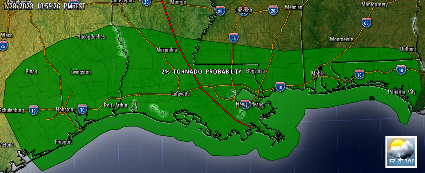
TORNADO PROBABILITIES
TORNADO PROB FOR THE FOLLOWING AREAS IN OHIO:

2% Columbus, OH...Akron, OH...Dayton, OH...Canton, OH...Youngstown, OH...


HAIL PROBABILITIES
HAIL PROB FOR THE FOLLOWING AREAS IN OHIO:

5% Columbus, OH...Dayton, OH...Springfield, OH...Kettering, OH...Middletown, OH...


DAMAGING WIND PROBABILITIES
DAMAGING WIND PROB FOR THE FOLLOWING AREAS IN OHIO:

30% Columbus, OH...Springfield, OH...Mansfield, OH...Newark, OH...Huber Heights, OH...

15% Cleveland, OH...Akron, OH...Dayton, OH...Parma, OH...Canton, OH...

5% Pittsburgh, PA...Toledo, OH...Cincinnati, OH...Fort Wayne, IN...Euclid, OH...


Mesoscale Discussion 0077
   NWS Storm Prediction Center Norman OK
   0648 AM CST Thu Jan 19 2023

   Areas affected...Parts of Upper MI

   Concerning...Heavy snow 

   Valid 191248Z - 191745Z

   SUMMARY...Snow rates of 1-2 inches/hour will be possible for a few
   hours this morning.

   DISCUSSION...An area of moderate to heavy snow has been moving
   quickly northward across central/northern WI early this morning,
   within a strongly difluent upper-level flow regime to the northeast
   of a deepening mid/upper-level cyclone that is moving eastward out
   of the central Plains. This area of snow is moving into Upper
   Michigan, where colder temperature profiles may support somewhat
   higher snow ratios compared to farther south. In addition,
   large-scale ascent will likely become maximized between 15-18Z, as
   the mid/upper-level cyclone reaches peak intensity, and 1-2
   inch/hour snow rates may develop and persist over portions of Upper
   MI into the late morning hours, before a weakening trend commences
   by early/mid afternoon.

   ..Dean.. 01/19/2023

   ...Please see www.spc.noaa.gov for graphic product...


Wednesday, January 18, 2023

DAY 1 SEVERE WEATHER OUTLOOK SLIGHT/MARGINAL RISK

 THOSE OF YOU IN THE SEVERE STORM OUTLOOK RISK AREA NEED TO PAY CLOSE ATTENTION TO SPC UPDATES AND BE READY TO TAKE SHLETER IF A WARNING IS ISSUED FOR YOUR AREA.  

RTW

HERE ARE THE FOLLOWING AREAS AT RISK FOR SEVERE STORMS:

SLIGHT RISK: Memphis, TN...Shreveport, LA...Little Rock, AR...Jackson, TN...Bossier City, LA...

MARGINAL RISK: Houston, TX...Nashville, TN...Baton Rouge, LA...Jackson, MS...Pasadena, TX...


TORNADO PROBABILITY

AREAS AT RISK FOR TORNADO:

5% Memphis, TN...Shreveport, LA...Little Rock, AR...Bossier City, LA...North Little Rock, AR...

2% Houston, TX...Nashville, TN...Baton Rouge, LA...Jackson, MS...Pasadena, TX...


HAIL PROBABILITY

AREAS AT RISK FOR HAIL:

5% Memphis, TN...Shreveport, LA...Little Rock, AR...Tyler, TX...Fort Smith, AR...


DAMAGING WIND PROBABILITY

AREAS AT RISK FOR DAMAGING WINDS:

15% Memphis, TN...Shreveport, LA...Little Rock, AR...Jackson, TN...Bossier City, LA...

5% Houston, TX...Nashville, TN...Baton Rouge, LA...Jackson, MS...Pasadena, TX...


Tuesday, January 17, 2023

DAY 2 WEDNESDAY SEVERE STORM OUTLOOK

 A SLIGHT RISK ON WEDNESDAY IS STILL EXPECTED FOR A PORTION OF THE SOUTHEAST.

FOR LATEST SPC UPDATES CLICK (HERE)!

HERE ARE THE FOLOWING AREAS THE STORM PREDICITION CENTER HAS UNDER THIS RISK:

SLIGHT: Memphis, TN...Jackson, MS...Lake Charles, LA...Jackson, TN...Pine Bluff, AR...

MARGINAL: Houston, TX...Nashville, TN...Birmingham, AL...Baton Rouge, LA...Shreveport, LA...


TORNADO PROBABILITY

HERE ARE THE FOLLOWING AREAS IN THIS PROBABILITY RISK:

5% Memphis, TN...Jackson, TN...Pine Bluff, AR...Monroe, LA...Alexandria, LA...

2% Nashville, TN...Baton Rouge, LA...Shreveport, LA...Jackson, MS...Evansville, IN...


PROBABILITY OF HAIL

HERE ARE THE FOLLOWING AREAS IN THIS PROBABILITY RISK:

5% Memphis, TN...Nashville, TN...Shreveport, LA...Little Rock, AR...Jackson, MS...


PROBABILITY OF DAMAGING WINDS

HERE ARE THE FOLLOWING AREAS IN THIS PROBABILITY RISK:

15% Memphis, TN...Jackson, MS...Lake Charles, LA...Jackson, TN...Pine Bluff, AR...

5% Houston, TX...Nashville, TN...Birmingham, AL...Baton Rouge, LA...Shreveport, LA...


Monday, January 16, 2023

... A WINTER TYPE SUB-TROPICAL CYCLONE OR TROPICAL CYCLONE OFF SHORE THE EAST COAST IS BEING MONITORED BY NHC...


A RARE STORM SYSTEM WITH A CLOSED CIRCULATION FORMED FROM A COLD CORE WINTER STORM OFF THE U.S. EAST COAST.  THIS SYSTEM HAS A 0% CHANCE FOR DEVELOPMENT AT THIS TIME AND THE ONLY AFFECTS FROM THIS SYSTEM TO THE U.S. IS WINTRY CONDITIONS WITH SNOW AND GUSTY WINDS ALONG THE NORTHEAST COAST, MIXED SNOW AND ICE.  YOU CAN'T RULE OUT THIS SYSTEM BECOMING A WARM CORE TROPICAL STORM OR HURRICANE BEFORE MOVING OVER NOVA SCOTIA.

RTW

000
ABNT20 KNHC 161502
TWOAT 

Special Tropical Weather Outlook
NWS National Hurricane Center Miami FL
1005 AM EST Mon Jan 16 2023

For the North Atlantic...Caribbean Sea and the Gulf of Mexico:

Special Tropical Weather Outlook issued to discuss the potential for 
subtropical development over the northwest Atlantic.

Northwestern Atlantic:
A non-tropical low pressure system centered over the northwestern 
Atlantic Ocean about 300 miles north of Bermuda is producing 
storm-force winds.  Although the cyclone is producing some 
thunderstorm activity near the center, it is embedded in a cold air 
mass with nearby frontal boundaries.  The low is expected to move 
northeastward today and northward tonight, bringing the system over 
much colder waters and across Atlantic Canada by early Tuesday.  
Therefore, it is unlikely that the low will transition to a 
subtropical or tropical cyclone.  Nevertheless, the system is 
expected to remain a strong non-tropical low during the next day or 
so, and additional information, including storm-force wind warnings, 
can be found in High Seas Forecasts issued by the National Weather 
Service.  

No additional Special Tropical Weather Outlooks are scheduled for 
this system.  Regularly scheduled Tropical Weather Outlooks will 
resume on May 15, 2023, while Special Tropical Weather Outlooks will 
be issued as necessary during the off-season. 
* Formation chance through 48 hours...low...near 0 percent.
* Formation chance through 5 days...low...near 0 percent.

&&
High Seas Forecasts issued by the National Weather Service can be 
found under AWIPS header NFDHSFAT1, WMO header FZNT01 KWBC, and 
online at ocean.weather.gov/shtml/NFDHSFAT1.php

$$
Forecaster Cangialosi