A westward tracking tropical wave near the western Cabo Verde Islands between 25-26 west degrees latitude. This wave is passing through the African monsoonal trough and this is enhancing storms activity in this area. I will be monitoring these waves as one of them may have a chance for development in the week to come as it tracks west to west-northwestward.
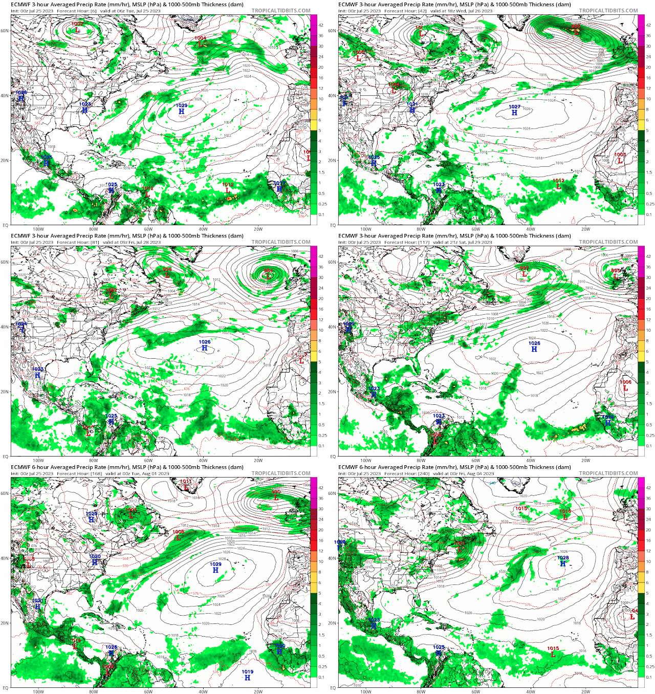
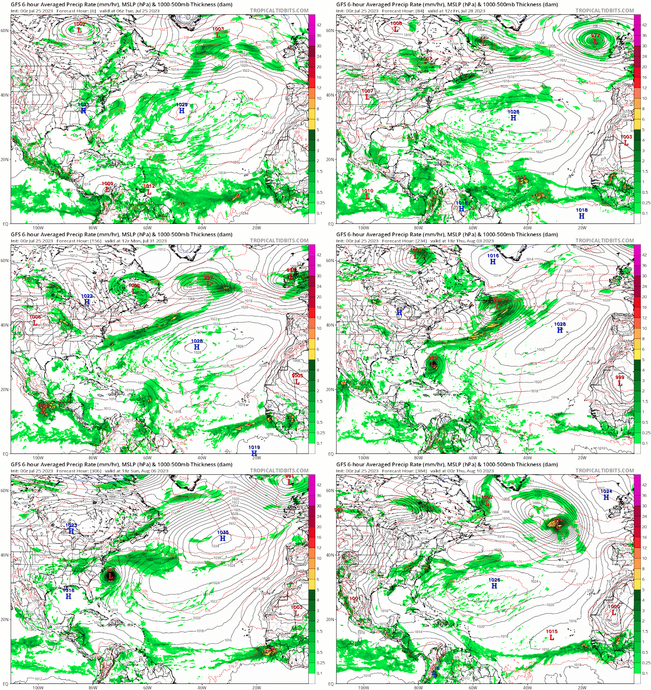
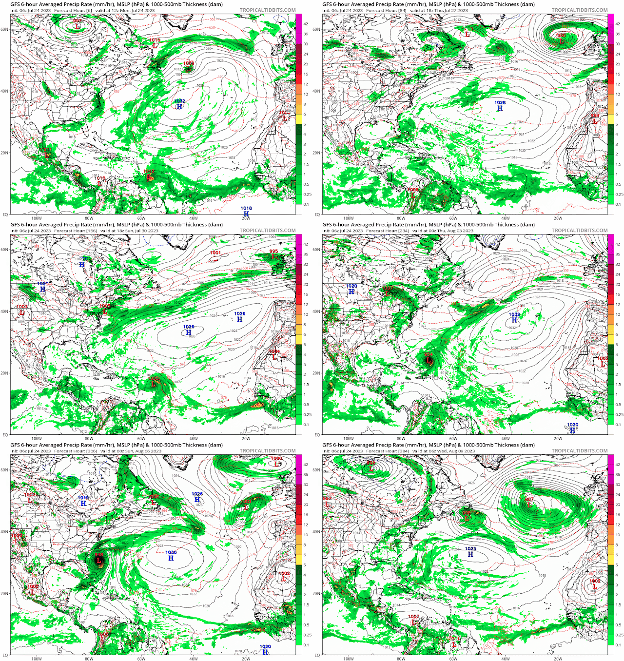
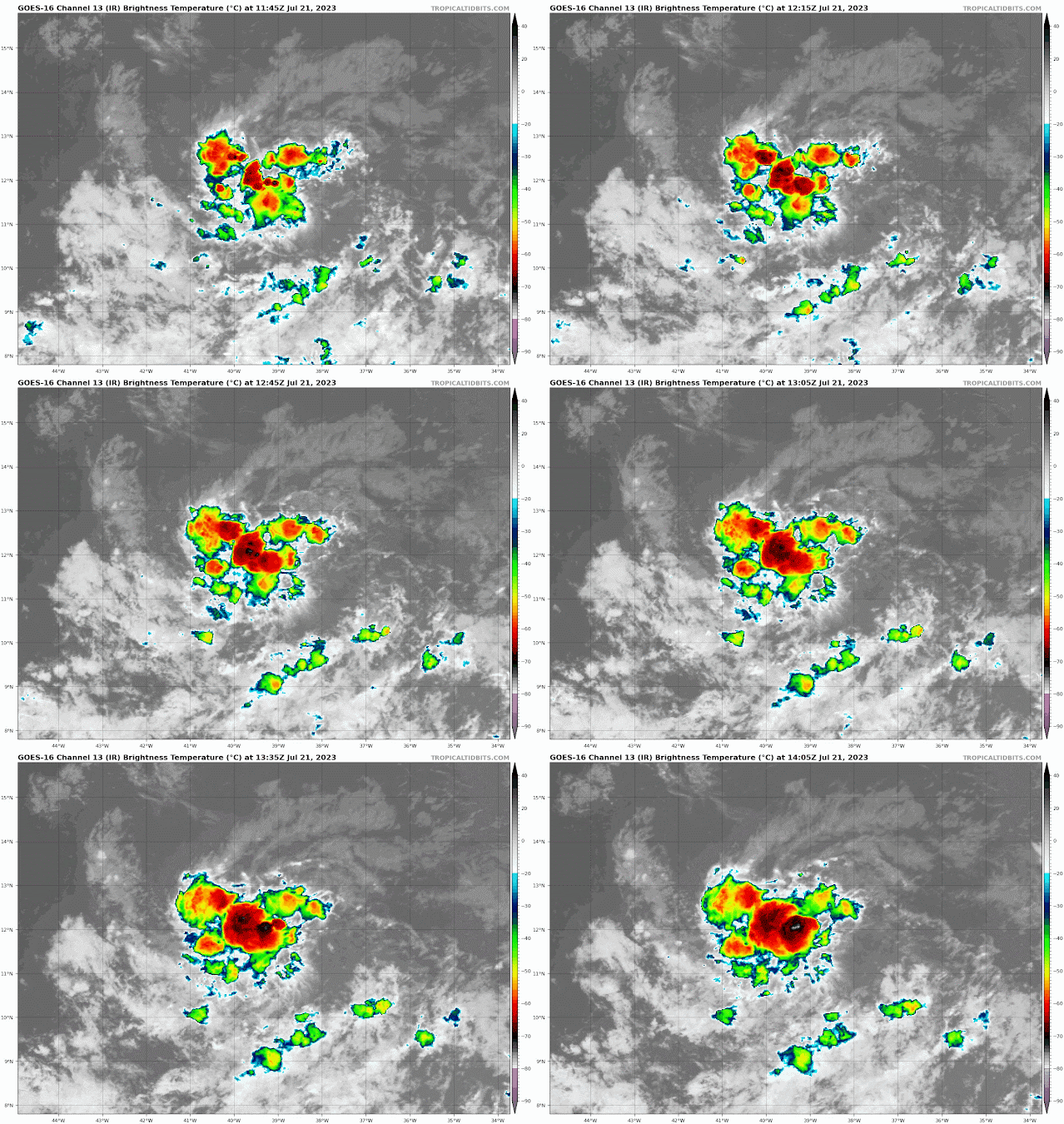
A tropical wave between 40-41 west degrees latitude has some scattered showers and storms along the southern axis of the wave as the wave moves through the moist environment of the inter-tropical convergence zone (ITCZ). This wave is shown in the 12z surface map catching up with the 1012 mb low associated with storm investigation 95L and becoming part of the low.
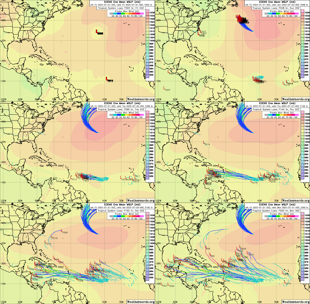
There is a small window for invest 95L to develop some before running into an unfavorable environment further west over the Central Caribbean. The Lesser Antilles will see showers and storms in squalls moving as 95L passes over the Islands in a day or so. The low is presently moving through mid level dry air.
Wind shear is unfavorable to the north and south of the low, however, as it tracks east over the lower Windward Islands and north of Venezuela, the upper level winds are more favorable for development at this time.
RTW
NEW STORM INVESTIGATION BELOW #2
ZCZC MIATWOAT ALL
TTAA00 KNHC DDHHMM

Tropical Weather Outlook
NWS National Hurricane Center Miami FL
200 PM EDT Mon Jul 24 2023

For the North Atlantic...Caribbean Sea and the Gulf of Mexico:

Active Systems:
The National Hurricane Center has issued the last advisory on
Post-Tropical Cyclone Don, located over the north-central Atlantic.

1. East of the Windward Islands (AL95):
A tropical wave is located a few hundred miles east of the Windward
Islands.  Although this system has not become any better organized
since yesterday, some slow development remains possible during the
next couple of days while it moves westward near 20 mph across the
tropical Atlantic and into the eastern Caribbean Sea.  Regardless of
development, locally heavy rains and strong gusty winds are possible
across portions of the Lesser Antilles during the next day or two.
Environmental conditions are expected to become unfavorable for
development of this system by the middle of the week.
* Formation chance through 48 hours...low...20 percent.
* Formation chance through 7 days...low...20 percent.

2. Southwestern Western Atlantic:
A weak trough of low pressure is located a few hundred miles south
of Bermuda.  Environmental conditions are expected to become
marginally conducive for some gradual development of this system as
it moves towards the southeastern U.S. coast later this week and
into the weekend.
* Formation chance through 48 hours...low...near 0 percent.
* Formation chance through 7 days...low...20 percent.

Forecaster Pasch/Kelly


STORM INVEST 95L
NEW STORM INVESTIGATION 0200 PM EDT JULY 24, 2023
000
AXNT20 KNHC 241743
TWDAT

Tropical Weather Discussion
NWS National Hurricane Center Miami FL
1805 UTC Mon Jul 24 2023

Tropical Weather Discussion for North America, Central America
Gulf of Mexico, Caribbean Sea, northern sections of South
America, and Atlantic Ocean to the African coast from the
Equator to 31N. The following information is based on satellite
imagery, weather observations, radar and meteorological analysis.

Based on 1200 UTC surface analysis and satellite imagery through
1700 UTC.

...SPECIAL FEATURES...

Post-Tropical Cyclone Don is centered near 47.6N 40.7W at
24/1500 UTC or 510 nm E of Cape Race Newfoundland moving ENE at
17 kt. Estimated minimum central pressure is 1007 mb. Maximum
sustained wind speed is 40 kt with gusts to 50 kt. Peak seas are
near 12 ft. No deep convection remains with the system. The post-
tropical cyclone is moving toward the east-northeast near 17 kt,
and this general motion is expected to continue until
dissipation tomorrow. Don should continue to gradually weaken,
before dissipating tomorrow. Please read the latest HIGH SEAS
FORECAST issued by Ocean Prediction Center at website
https://ocean.weather.gov/shtml/NFDHSFAT1.php and the latest
Post-Tropical Cyclone Don Forecast/Advisory and Public Advisory
at www.hurricanes.gov for more details.

...TROPICAL WAVES...

A far eastern Atlantic tropical wave has its axis along 31W from
04N-20N. It is moving westward at 10-15 kt. Scattered moderate
convection is seen from 07N-10N and 28W-35W.

A Atlantic tropical wave has been added in association with
Invest 95L low pressure. The wave has its axis along 54W from
05N-20N with a 1012 mb low centered at 11N53W, moving westward
at 10-15 kt. Winds fresh to strong from 12N-20N between 49W-58W
with seas 8-10 ft. Scattered moderate and isolated strong
convection is from 10N-17N between 51W-60W.

...MONSOON TROUGH/ITCZ...

The monsoon trough reaches the Atlantic through the coast of
Senegal near 16N17W to 09N33W to a weak 1012 mb low at 11N53W.
The ITCZ extends from 10N54W to 09N61W. Aside from convection
associated to the tropical waves as described above, scattered
moderate to isolated strong convection is seen from 07N-13N
between 19W-27W.

...GULF OF MEXICO...

A stationary front is draped along the N Gulf Coast from the
upper Texas coast to Louisiana to the Florida panhandle coast. A
pre-frontal trough extends from 29N91W east-northeastward to
30N84W. Scattered moderate convection is noted from 27N-29N
between 87W-91W. The diurnally-forced surface trough in the Bay
of Campeche is associated with scattered moderate and isolated
strong convection south of 23N west of 94W. Away from the
convection, winds across the basin are moderate or weaker with
seas of 2-4 ft.

For the forecast, the weak high pressure centered near the
Florida Peninsula will remain dominant the feature for the Gulf
into late week. This will support mainly gentle to moderate
winds, except over the eastern Bay of Campeche where winds will
be enhanced by a thermal trough that will emerge off the Yucatan
Peninsula nightly. A stationary front just inland the northern
Gulf coast will provide a focus for showers and thunderstorms in
adjacent waters for the next couple of days.

...CARIBBEAN SEA...

The pressure gradient between the Bermuda High and a 1010 mb
Colombian Low is forcing strong to near gale trades in the S
central Caribbean with moderate to fresh elsewhere. Seas are 6-
10 ft in the S central Caribbean and 3-6 ft elsewhere. Aside
from the convection associated with Invest 95L, scattered
moderate convection is noted south of 11N west of 80W due to the
eastern extent of eastern North Pacific's monsoon trough. An
extensive Saharan Air Layer is noted over the western and
central Caribbean, helping to suppress convection over the Great
Antilles and the Yucatan.

For the forecast, winds should diminish slightly to fresh to
strong tonight into Thu over the central Caribbean. Fresh to
locally strong trades will occur over the Gulf of Honduras into
tonight. Low pressure, Invest AL95, over the tropical N Atlantic
is several hundred nm east of the Windward Islands. Some slow
development of the low remains possible during the next couple
of days while it moves westward across the tropical Atlantic and
eastern Caribbean Sea. Expect increasing winds and seas with the
low.

...ATLANTIC OCEAN...

Please see the SPECIAL FEATURES section for information on
Post-Tropical Cyclone Don in the north-central Atlantic.

An expansive ridge extends across the Atlantic from the 1033 mb
Bermuda High near 33N45W. Aside from the winds/seas/convection
associated with the Invest 95L disturbance, the trades are
generally moderate to fresh 15N-30N east of 60W and weaker
elsewhere. Seas are 5-7 ft east of 55W and 2-5 ft west of 55W. A
weak surface trough extends from 22N67W to 28N63W with isolated
moderate convection noted from 22N-29N between 59W-67W.

For the forecast west of 55W, weak high pressure dominating the
area will gradually shift northward this week. Fresh trades will
pulse nightly N just N of Hispaniola and over the Windward
Passage. Elsewhere across forecast waters, winds will be
moderate or weaker over most of the area with moderate to
locally fresh speeds for waters NE of the Leeward Islands.

$$
Landsea/Konarik

.gif)



.gif)

.gif)


.png)








.gif)


.gif)

.gif)




.gif)


