Monday, June 10, 2024

..TROPICAL OUTLOOK JUNE 10, 2024..


Still seeing a heavy rain and flooding potential for this week with a shift into the Gulf of Mexico into early next week.  The only problem with this are the model inconsistencies when forecasting this rainfall event.  There has been to much flip flopping from the western Gulf to the eastern Gulf and over Florida.  

So far indications at this time are that Florida will see deep tropical moisture streaming northward from the Caribbean which will interact with a stationary front to the north. This will enhance the rain and storms that will be slow moving cells with heavy downpours and gusty winds. These slow moving thunderstorms will produce periodic heavy rainfall that can produce localized flooding in flood prone areas.

The Weather Prediction Center shows a (Slight) risk for excessive rainfall over a portion of Florida during the next 4 days.  See below maps!


Day 1-5 rainfall probabilities


7 day accumulated rainfall. 
That is impressive rainfall in the yellows 10-15 inches along the gulf coast.


EURO Total Precipitable Water.
The Dark shades of blue is the heaviest of the rains.


GFS TPW model

National Forecast Maps


As for the Storm Prediction Center they only show (General) Thunderstorms for the state of Florida but you can't rule out strong to maybe severe storms with gusty winds.  See maps below!


000
ABNT20 KNHC 101712
TWOAT 

Tropical Weather Outlook
NWS National Hurricane Center Miami FL
200 PM EDT Mon Jun 10 2024

For the North Atlantic...Caribbean Sea and the Gulf of Mexico:

Tropical cyclone formation is not expected during the next 7 days.

$$
Forecaster Cangialosi
-----------------------------------------------------------------
718 
ACCA62 KNHC 101713
TWOSAT

Perspectiva sobre las Condiciones del Tiempo en el Trópico
Centro Nacional de Huracanes del SNM Miami FL
200 PM EDT lunes 10 de junio de 2024

Para el Atlántico Norte...Mar del Caribe y el Golfo de México:

No se espera la formación de ciclones tropicales durante los
próximos 7 días.

$$
Pronosticador Cangialosi

*** Este producto ha sido procesado automáticamente utilizando un
programa de traducción y puede contener omisiones y errores. El
Servicio Nacional de Meteorología no puede garantizar la precisión
del texto convertido. De haber alguna duda, el texto en inglés es
siempre la versión autorizada. ***
----------------------------------------------------------------------------------------------

000
AXNT20 KNHC 101643
TWDAT 

Tropical Weather Discussion
NWS National Hurricane Center Miami FL
1805 UTC Mon Jun 10 2024

Tropical Weather Discussion for North America, Central America
Gulf of Mexico, Caribbean Sea, northern sections of South
America, and Atlantic Ocean to the African coast from the
Equator to 31N. The following information is based on satellite
imagery, weather observations, radar and meteorological analysis.

Based on 1200 UTC surface analysis and satellite imagery through 
1632 UTC.

...SPECIAL FEATURES...

Heavy Rainfall in the NW Caribbean and SE Gulf of Mexico: 
Abundant tropical moisture surging northward combined with mid 
to upper level diffluent flow continue to generate showers and 
thunderstorms across parts of the NW Caribbean, and portions of 
the SW Caribbean. Dangerous lightning, strong gusty winds, rough 
seas and low visibility are likely ongoing within this 
convective activity over these areas, including the offshore 
waters of E Honduras and Nicaragua. This convection will amplify 
while it shifts towards the SE Gulf of Mexico and the Florida 
Straits through at least Thu. Mariners should exercise caution. 
Please refer to bulletins and forecasts from your local weather 
forecast offices for detailed information.

...TROPICAL WAVES...

A tropical wave in the eastern Atlantic has been relocated and 
is extending from 01N to 17N with axis near 20W. Scattered 
moderate convection is from 05N to 07N between 17.5W and 22W. 

A tropical wave in the eastern Atlantic has been relocate and is 
extending S of 11N to inland Suriname with axis near 56.5W. 
Scattered moderate isolated strong convection is from 07N to 11N 
between 53W and 59W. 

A tropical wave is in the south-central Caribbean Sea S of 12N to
inland W Venezuela with axis near 71W, moving westward at 10-15 
kt. No deep convection is evident in the Caribbean waters in 
association with this wave.

A tropical wave in the SW Caribbean Sea has been relocated with 
axis extending S of 15N across Panama and into E Pac waters near 
81W. Numerous moderate to strong convection is from 10N to 20N 
between 75.5W and 83.5W. 

...MONSOON TROUGH/ITCZ...

The monsoon trough enters the Atlantic near 11N15W and continues 
southwestward to 07N19W. The ITCZ extends from 07N22W to 04N41W 
and to 08N55W. Aside from the convection associated with the 
tropical waves, scattered moderate convection is from 02.5N to 
09N between 24W and 52W.

...GULF OF MEXICO...

A weak pressure gradient persists across the Gulf of Mexico,
resulting in primarily moderate or weaker winds and slight seas. 
A dry airmass continues to suppress the development of showers 
and thunderstorms. Light concentration of smoke continue over 
the western Gulf, including the Bay of Campeche, due to ongoing 
agricultural fires, creating hazy conditions.

For the forecast, a weak pressure gradient will support mainly 
gentle to moderate winds most of the forecast period. Moderate 
to fresh S to SE winds will develop over the E half of the basin 
toward the end of the week. Otherwise, hazy conditions due to 
agricultural fires over Central America and Mexico will continue 
for at least the next couple of days, reducing visibility to 
around 3 nm at times, mainly over the SW Gulf. 

...CARIBBEAN SEA...

Please read the Special Features section for information about 
heavy rainfall in the NW Caribbean. 

Broad subtropical ridge centered over the central Atlantic 
extends into the E Caribbean Sea, maintaining fairly tranquil 
weather conditions outside of the NW and SW Caribbean. The 
pressure gradient between this ridge and lower pressures in 
northern South America results in fresh to strong easterly trade 
winds in the south-central Caribbean. Seas in these waters are 5-
7 ft. Moderate to fresh E to SE breezes and moderate seas are 
occurring in the north-central, eastern and NW Caribbean.

For the forecast, scattered showers and thunderstorms are 
expected across the NW Caribbean through Tue. Moderate to fresh 
trades will prevail across the central and eastern Caribbean 
through the forecast period, pulsing to locally strong winds at 
night. Moderate to occasionally fresh SE winds are forecast for 
the NW Caribbean most of the forecast period.

...ATLANTIC OCEAN...

A stationary front enters our area near 31N26W then continues 
southwestward to 24N47W where it begins to dissipate to 21N56W. 
Isolated light showers are found along this front. Broad ridging 
continues to dominate much of the subtropical Atlantic, 
sustaining moderate to locally fresh SW winds and seas of 3-5 ft 
north of 27N and west of 65W, with the highest winds and seas 
occurring off NE Florida. Moderate to locally fresh SE winds are 
also noted across the offshore waters of Puerto Rico, Hispaniola 
and southern Bahamas along with moderate seas to 5 ft. Farther 
east, moderate to locally fresh NE winds and seas of 4-6 ft are 
noted N of 15N off the coast of W Africa to 27W. Over the 
tropical Atlantic, trades are moderate to fresh between 27W and 
the Lesser Antilles. Elsewhere in the basin, moderate or weaker 
winds and slight to moderate seas prevail.

For the forecast W of 55W, surface high pressure and associated 
ridging will prevail across the region through Thu, then 
gradually shift northward through the end of the week. Moderate 
to fresh S to SW winds over the NE Florida offshore waters will 
continue through Tue night, briefly reaching strong speeds N of 
29N between 74W and 80W tonight and Tue evening. Elsewhere, 
gentle to moderate winds are expected on either side of the 
ridge, with light to gentle winds along the ridge axis.

$$
KRV

FLZ063-066>075-168-172>174-110900-
/O.NEW.KMFL.FA.A.0002.240611T0400Z-240613T0400Z/
/00000.0.ER.000000T0000Z.000000T0000Z.000000T0000Z.OO/
Glades-Hendry-Inland Palm Beach County-Metro Palm Beach County-
Coastal Collier County-Inland Collier County-Inland Broward
County-Metro Broward County-Inland Miami-Dade County-Metropolitan
Miami Dade-Mainland Monroe-Coastal Palm Beach County-Coastal
Broward County-Coastal Miami Dade County-Far South Miami-Dade
County-
Including the cities of East Naples, Davie, Lion Country Safari
Park, Muse, Miramar, Royal Palm Beach, Boca Raton, Clewiston,
Hialeah, Miami, Sunniland, Greenacres City, Pembroke Pines, Lake
Worth, Pompano Beach, Golden Gate, Fortymile Bend, Felda, Royal
Palm Hammock, Miles City, Pa-Hay Okee Overlook, Ortona, Coral
Springs, Redland, Palm Beach Gardens, Kendall, Riviera Beach,
Marco Island Airport, The Acreage, Buckhead Ridge, Hendry
Correctional, Palmdale, Sawgrass Mills Mal, Shark Valley Obs
Tower, Royal Palm Ranger, Mahogany Hammock, Sandalfoot Cove,
Orange Tree, Jupiter, Caloosa, Lakeport, Florida City, Brighton
Seminole, Bonita Shores, Florida Gardens, North Blocks Golde,
Hollywood, Sunrise, Delray Beach, Fort Lauderdale, Boynton Beach,
Carol City, Naples, Moore Haven, North Naples, Belle Glade,
Kendale Lakes, Immokalee, Northwest Cape Sable, Wellington,
Miccosukee Indian Reservation, West Palm Beach, Deerfield Beach,
Bunker Hill, and Marco Island
209 PM EDT Mon Jun 10 2024

...FLOOD WATCH IN EFFECT FROM MIDNIGHT EDT TONIGHT THROUGH WEDNESDAY
EVENING...

* WHAT...Flooding caused by excessive rainfall is possible.

* WHERE...Portions of southeast, southern, and southwest Florida,
including the following areas, in southeast Florida, Coastal
Broward County, Coastal Miami Dade County, Coastal Palm Beach
County, Far South Miami-Dade County, Inland Broward County, Inland
Miami-Dade County, Inland Palm Beach County, Metro Broward County,
Metro Palm Beach County and Metropolitan Miami Dade. In southern
Florida, Glades and Hendry. In southwest Florida, Coastal Collier
County, Inland Collier County and Mainland Monroe.

* WHEN...From midnight EDT tonight through Wednesday evening.

* IMPACTS...Excessive runoff may result in flooding of rivers,
creeks, streams, and other low-lying and flood-prone locations.
Flooding may occur in poor drainage and urban areas.

* ADDITIONAL DETAILS...
- Enhanced tropical moisture is expected to pool across South
Florida beginning on Tuesday. This will result in periods of
heavy rain. High rainfall rates and slow moving storms will
result in flooding concerns, especially in urban and poor
drainage locations. Rainfall totals from Tuesday morning
through Wednesday evening are forecast to be 5-8 inches
across Southwest Florida and the Lake Okeechobee region, and
2-5 inches over the east coast metro, with locally higher
amounts possible. Additional heavy rain is possible later in
the week.
- http://www.weather.gov/safety/flood

PRECAUTIONARY/PREPAREDNESS ACTIONS...

You should monitor later forecasts and be alert for possible Flood
Warnings. Those living in areas prone to flooding should be prepared
to take action should flooding develop.


Saturday, June 8, 2024

..TROPICAL OUTLOOK JUNE 8, 2024..


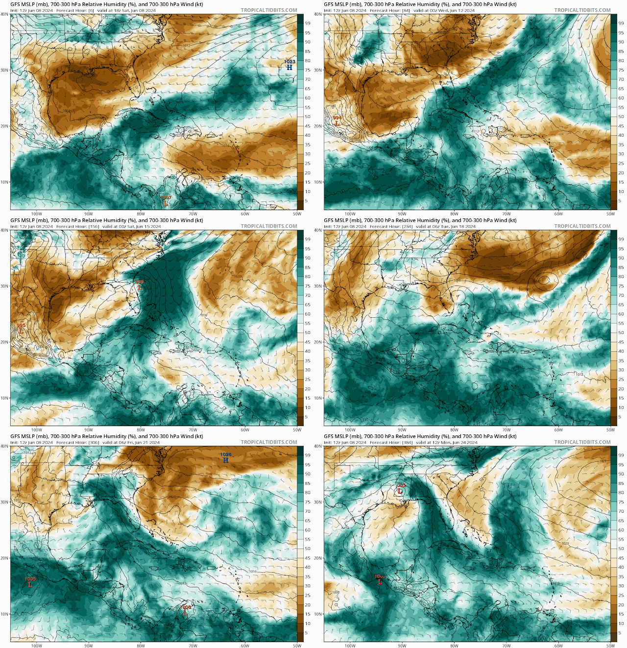
I continue to see the potential for heavy rains and flooding and the potential for strong thunderstorms with gusty winds and maybe severe storms over South Florida on both coasts. Models are not in agreement and bit of confusion with what is to develop or not. Regardless of development, the potential for heavy rains from deep tropical moisture rising north from the Caribbean seems to be increasing.
 
I posted below precipitation models and wind gust models for you to see. I will continue to monitor the Central American Gyre for this possible spin-up of this low pressure into next week. So far, NHC says no tropical cyclone formation for the next 7 days. So I will continue to monitor the NHC website for the latest on the tropics.

RTW

Total Precipitable Water


Wind gust model below 30-50 mph gust in some areas.


ZCZC MIATWOAT ALL
TTAA00 KNHC DDHHMM

Tropical Weather Outlook
NWS National Hurricane Center Miami FL
800 PM EDT Sat Jun 8 2024

For the North Atlantic...Caribbean Sea and the Gulf of Mexico:

Tropical cyclone formation is not expected during the next 7 days.

$$
Forecaster Hagen/Berg
----------------------------------------------------------------------------------------------
445 
ACCA62 KNHC 082307
TWOSAT

Perspectiva sobre las Condiciones del Tiempo en el Trópico
Centro Nacional de Huracanes del SNM Miami FL
800 PM EDT sábado 8 de junio de 2024

Para el Atlántico Norte...Mar del Caribe y el Golfo de México:

No se espera la formación de ciclones tropicales durante los
próximos 7 días.

$$
Pronosticador Hagen/Berg

*** Este producto ha sido procesado automáticamente utilizando un
programa de traducción y puede contener omisiones y errores. El
Servicio Nacional de Meteorología no puede garantizar la precisión
del texto convertido. De haber alguna duda, el texto en inglés es
siempre la versión autorizada. ***
----------------------------------------------------------------------------------------------
000
AXNT20 KNHC 082320
TWDAT

Tropical Weather Discussion
NWS National Hurricane Center Miami FL
0005 UTC Sat Jun 8 2024

Tropical Weather Discussion for North America, Central America
Gulf of Mexico, Caribbean Sea, northern sections of South
America, and Atlantic Ocean to the African coast from the
Equator to 31N. The following information is based on satellite
imagery, weather observations, radar and meteorological analysis.

Based on 1800 UTC surface analysis and satellite imagery through
2300 UTC.

...SPECIAL FEATURES...

Heavy Rainfall in the NW Caribbean and SW N Atlantic: Abundant 
tropical moisture surging northeastward combined with a diffluent
pattern aloft continues to generate a large area of scattered 
heavy showers and thunderstorms across the Bahamas and the NW 
Caribbean, including Cuba, Jamaica and the Cayman Islands and 
regional waters. Dangerous lightning, strong gusty winds, rough
seas and low visibility are likely ongoing in these regions. 
Currently, numerous showers, with embedded thunderstorms, are 
affecting most of the Bahamas, and the Caribbean waters from 18N
to 20N between 76W and 87W. The soils remain saturated over the 
Greater Antilles, therefore, it is possible that more heavy rain 
may lead to flash flooding and mudslides, especially in 
mountainous terrain. Mariners should exercise caution as these 
conditions are forecast to continue through the weekend. Please, 
refer to bulletins and forecasts from the local weather forecast 
offices for detailed information.

Looking ahead, weather conditions are expected to favor additional
heavy rainfall next week, with the heaviest rains likely impacting
western Cuba and Florida.

...TROPICAL WAVES...

An Atlantic tropical wave is along 42W from 11N southward, moving
west at 10-15 kt. Scattered moderate convection is mainly ahead
of the wave axis from 04N to 10N between 42W and 47W.

A tropical wave is approaching the Windward Islands. Its axis is
along 60W, from 14N southward, moving west at 10-15 kt. The wave
appears to enhance convection over Guyana and eastern Venezuela 
as well as over the southern Windward Islands. 

A Caribbean tropical wave is along 76W, from 14N southward, moving
west at 5-10 kt. Scattered moderate to isolated strong convection
is noted near the wave axis over Colombia.

...MONSOON TROUGH/ITCZ...

The monsoon trough extends from 12N16W to 06N22W. The ITCZ then 
extends from 06N22W to 07N45W to 09N57W. Aside from the convection
associated with the tropical waves, scattered moderate convection
is noted from 02N to 06N between 25W and 34W, and from 08N to 
10N between 48W and 53W. 

GULF OF MEXICO...

Weak high pressure of 1015 mb located over the NE Gulf dominates
the basin while a stationary front is along the Florida Panhandle.
A broad area of low pressure is observed over the Yucatan Peninsula
and SE Mexico where scattered moderate to isolated strong convection
is occurring. Under this weather pattern, mainly light to gentle
winds prevail across most of the Gulf waters with seas of 2 to 4
ft. 

For the forecast, a weak pressure gradient will support mainly gentle
to moderate winds the next several days. Winds will pulse to fresh
speeds near the Yucatan Peninsula during the late afternoon and evening
hours. Hazy conditions due to agricultural fires over Central America
and Mexico will continue for at least the next couple of days, reducing
visibility to around 3 nm at times, mainly over the SW Gulf. 

CARIBBEAN SEA...

Please read the Special Features section for information about heavy
rainfall in the NW Caribbean. 

The pressure gradient between subtropical Atlantic high pressure
and lower pressure over Colombia and Venezuela is supporting fresh
to locally strong trades in the central Caribbean, including the
Gulf of Venezuela. Seas are 5 to 8 ft within these winds based 
on altimeter data. In the eastern and western Caribbean, mostly 
moderate trade winds are seen per satellite derived wind data, 
except in the Gulf of Honduras, and in the SW Caribbean S of 11N
where winds are light and variable. Seas are 3 to 5 ft elsewhere
N of 11N and E of 80W, and N of 18N W of 80W. Seas in the 1 to 3
ft range are noted across the remainder of the basin.

For the forecast, a mid to upper level trough will support showers 
and thunderstorms through the weekend across the NW Caribbean, 
including Cuba and the Windward Passage. A second upper level 
trough may extend this shower activity over the NW Caribbean 
through early next week. Moderate to fresh trades will prevail 
across the central and eastern Caribbean through the forecast 
period, except locally strong winds pulsing tonight as well as 
Mon through Wed nights. Moderate to fresh SE winds are forecast 
for the NW Caribbean most of the forecast period. 

ATLANTIC OCEAN...

Please see the Special Features section for information on heavy
rainfall over the western Atlantic.

A persistent deep layer trough over Florida and the SE Gulf of
Mexico continues to support the development of numerous showers 
and thunderstorms over parts of south and central Florida as well
as over the Bahamas and surrounding waters, particularly S of 27N
and W of 65W. Winds and seas could be higher near tstms. A 
frontal boundary extends from 31N30W to 22N51W. A few showers 
are near the front. The remainder of the Atlantic forecast area
is under the influence of 1022 mb high pressure located near 
30N50W. Mainly light to gentle winds and seas of 2 to 4 ft are 
noted N of 20N. Moderate trade winds dominate the tropical
Atlantic with seas in the 4 to 7 ft range.

For the forecast W of 55W, a deep layer trough will support showers 
and tstms over the Bahamas offshore waters through Sun. A weak 
frontal boundary over the far NW waters will lift north of the 
area Sun as high pressure builds back in across the region. 


$$
GR


Friday, June 7, 2024

..TROPICAL OUTLOOK JUNE 7, 2024..


Well, I continue to see deep tropical moisture rising up out of the Caribbean during next week. So far, the GFS is the only one suggesting tropical cyclone formation. I will continue to monitor the East Pacific and Central America for low-pressure development and a track north into the northwest Caribbean or into the bay of Campeche. This could be what the GFS and ensemble models are hinting at. I will also monitor NHC updates and models for any changes.

RTW


7 day rainfall accumulation probability


000
ABNT20 KNHC 072308
TWOAT 

Tropical Weather Outlook
NWS National Hurricane Center Miami FL
800 PM EDT Fri Jun 7 2024

For the North Atlantic...Caribbean Sea and the Gulf of Mexico:

Tropical cyclone formation is not expected during the next 7 days.

$$
Forecaster Hagen/Berg
-----------------------------------------------------------------
805 
ACCA62 KNHC 080028
TWOSAT

Perspectiva sobre las Condiciones del Tiempo en el Trópico
Centro Nacional de Huracanes del SNM Miami FL
800 PM EDT viernes 7 de junio de 2024

Para el Atlántico Norte...Mar del Caribe y el Golfo de México:

No se espera la formación de ciclones tropicales durante los
próximos 7 días.

$$
Pronosticador Hagen/Berg

*** Este producto ha sido procesado automáticamente utilizando un
programa de traducción y puede contener omisiones y errores. El
Servicio Nacional de Meteorología no puede garantizar la precisión
del texto convertido. De haber alguna duda, el texto en inglés es
siempre la versión autorizada. ***

000
AXNT20 KNHC 072313
TWDAT 

Tropical Weather Discussion
NWS National Hurricane Center Miami FL
0005 UTC Sat Jun 8 2024

Tropical Weather Discussion for North America, Central America
Gulf of Mexico, Caribbean Sea, northern sections of South
America, and Atlantic Ocean to the African coast from the
Equator to 31N. The following information is based on satellite
imagery, weather observations, radar and meteorological analysis.

Based on 1800 UTC surface analysis and satellite imagery through 
2300 UTC.

...SPECIAL FEATURES...

Heavy Rainfall in the NW Caribbean and Hispaniola: Divergent flow
aloft and abundant tropical moisture surging northward continues 
to generate a large area of heavy showers and thunderstorms 
affecting the Gulf of Honduras, the Cayman Islands, Cuba, Jamaica,
Hispaniola and the Bahamas. Dangerous lightning, rough seas, 
gusty winds and low visibility are likely ongoing in these 
regions. The soils remain saturated, therefore, it is possible 
that more heavy rain may lead to flash flooding and mudslides, 
especially in mountainous terrain. Mariners should exercise 
caution as these conditions are forecast to continue through the 
weekend. Please, refer to bulletins and forecasts from the local 
weather forecast offices for detailed information.

...TROPICAL WAVES...

A tropical wave is in the eastern Atlantic, analyzed with axis 
along 32W and S of 11N, moving W at 5 to 10 kt. Scattered showers
are noted along the wave axis.

A tropical wave is in the central Atlantic extending from 
01N to 12N with axis near 43W, moving westward at about 10 kt. 
Scattered moderate to isolated strong convection is noted from 
05N to 12N and between 40W and 50W.

A tropical wave is just E of Brazil, extending from 01N to 11N
with axis near 52W, moving westward at about 10 kt. Scattered 
showers are noted along the axis.

A tropical wave is in the central Caribbean S of 14N with axis
near 75W, moving westward at 10-15 kt. No significant deep 
convection is occurring in the Caribbean Sea associated with it.

...MONSOON TROUGH/ITCZ...

The monsoon trough enters the Atlantic through the coast of
Africa near 11N16W and continues southwestward to 06N23W. The 
ITCZ extends from 06N23W to 07N58W. Aside from the convection 
associated with the tropical waves described above, numerous 
moderate isolated strong convection is evident from 06N to 09N 
between 34W and 40W.

...GULF OF MEXICO...

A weak pressure gradient prevails across the basin between weak
surface ridging extending SW across Florida and the Straits, and
lower pressures over Mexico and the western Gulf. This pattern is
resulting in light to gentle variable winds and slight to moderate
seas. Hazy skies continue across the western Gulf and Bay of 
Campeche due to agricultural fires in southern Mexico and western 
Central America. Reduced visibilities are noted across coastal 
observation sites in the western and southern Gulf.

For the forecast, weak pressure gradient will support mainly gentle
to moderate winds the next several days. Winds will pulse to
fresh speeds near the Yucatan Peninsula during the late afternoon
and evening hours. Hazy conditions due to agricultural fires over
Central America and Mexico will continue for at least the next 
couple of days, reducing visibility to around 3 nm at times, 
mainly over the SW Gulf.  

...CARIBBEAN SEA...

Please read the Special Features section for information about 
the heavy rainfall event in the NW Caribbean and Hispaniola.

The pressure gradient between the Atlantic subtropical ridge and 
lower pressures in northern South America result in moderate to 
fresh SE winds across the eastern, central and NW Caribbean. Seas
in these waters are slight to moderate with the highest seas being
in the central and eastern portions of the basin.

For the forecast, the mid to upper level trough extending from the E
Gulf of Mexico to just E of the Bahamas will shift E-NE across
the Atlantic through the weekend, which will support showers and
thunderstorms across the NW Caribbean, the Windward Passage and
Hispaniola through the weekend. A second upper level trough may
extend this shower activity over the NW Caribbean through early
next week. Moderate to fresh trades will prevail across the
central and eastern Caribbean through the forecast period,
except locally strong winds pulsing tonight and Sat night.
Moderate to fresh SE winds are also forecast for the NW
Caribbean most of the forecast period.

...ATLANTIC OCEAN...

Upper level diffluent flow and abundant tropical moisture are 
supporting scattered moderate convection over Bahamas and the W
Atlantic W of 63W. The remainder of the Atlantic is under the 
influence of a 1020 mb high centered SE of Bermuda, which is 
supporting gentle to moderate SE winds, except in the areas of 
strong tstms. 

Farther east, a cold front extends from a low N of the area near
32N38W to 25N46W then becomes a trough to 24N57W. Moderate to 
fresh SW winds are occurring east of these features to 35W and 
north of 27N. Seas are 4-7 ft in the area described. 

A 1012 mb low pres is near the Canary Islands in the NE Atlantic,
but no significant convection is noted near the boundary. 
Moderate N-NE winds and seas of 4-5 ft are evident behind the 
front. Elsewhere, moderate or weaker winds and moderate seas 
prevail.

For the forecast W of 55W, the deep layer trough will continue to 
support showers and tstms across the Great Bahama Bank and the Bahamas
offshore waters through Sun. High pressure centered SE of Bermuda
is forecast to shift slowly E-NE through the weekend enabling a 
weak frontal boundary to move into the far NW waters Sat. The 
front will stall and lift north of the area Sun as high pressure 
builds back in across the area. 

$$
ERA


Thursday, June 6, 2024

..TROPICAL OUTLOOK JUNE 6, 2024..


 Still looking like heavy rains early next week due to Caribbean deep tropical moisture rising northward over Cuba and Florida.  I will keep you posted.

RTW


692 
ABNT20 KNHC 062313
TWOAT 

Tropical Weather Outlook
NWS National Hurricane Center Miami FL
800 PM EDT Thu Jun 6 2024

For the North Atlantic...Caribbean Sea and the Gulf of Mexico:

Tropical cyclone formation is not expected during the next 7 days.

$$
Forecaster Berg
-----------------------------------------------------------------------------------------------

910 
ACCA62 KNHC 062314
TWOSAT

Perspectiva sobre las Condiciones del Tiempo en el Trópico
Centro Nacional de Huracanes del SNM Miami FL
800 PM EDT jueves 6 de junio de 2024

Para el Atlántico Norte...Mar del Caribe y el Golfo de México:

No se espera la formación de ciclones tropicales durante los
próximos 7 días.

$$
Pronosticador Berg

*** Este producto ha sido procesado automáticamente utilizando un
programa de traducción y puede contener omisiones y errores. El
Servicio Nacional de Meteorología no puede garantizar la precisión
del texto convertido. De haber alguna duda, el texto en inglés es
siempre la versión autorizada. ***

630 
AXNT20 KNHC 062312
TWDAT

Tropical Weather Discussion
NWS National Hurricane Center Miami FL
0005 UTC Fri Jun 7 2024

Tropical Weather Discussion for North America, Central America
Gulf of Mexico, Caribbean Sea, northern sections of South
America, and Atlantic Ocean to the African coast from the
Equator to 31N. The following information is based on satellite
imagery, weather observations, radar and meteorological analysis.

Based on 1800 UTC surface analysis and satellite imagery through 
2300 UTC.

...SPECIAL FEATURES...

...HEAVY RAINFALL IN HISPANIOLA AND CUBA...

Scattered to numerous moderate to strong convection is from 15N to
27N between 69W-85W. Broad upper level cyclonic wind flow spans 
the areas that are between 50W in the Atlantic Ocean and 90W in 
the Gulf of Mexico. Expect significant convection through Friday.
The hazards to land are: dangerous lightning, heavy rain, and 
gusty winds. The soils remain saturated therefore, it is possible
that more heavy rain may lead to flash flooding and mudslides, 
especially in north central Hispaniola for tonight. The rainfall 
for Hispaniola and Cuba will be influenced heavily by daytime 
heating, the local sea breezes, and the mountain upslope lifting. 
Abundant moisture will continue to cover most of Cuba and the 
Cayman Islands tonight, as another upper level trough reaches 
Florida and the SE Gulf of Mexico. Please, refer to bulletins and 
forecasts that are from your local weather forecast office for  
detailed information.

...TROPICAL WAVES...

A central Atlantic tropical wave is along 40W, from 11N 
southward, moving westward about 10 kt. 

A central Atlantic tropical wave is along 48W, from 11N 
southward, moving westward about 10-15 kt. Scattered moderate
convection is noted from 06N-09N between 46W-49W.

A central Caribbean tropical wave is along 67W, from 13N 
southward, moving westward about 10 kt. Scattered moderate
convection is within 300 nm on either side of the tropical wave, 
inland in South America. No significant deep convective 
precipitation is in the Caribbean Sea.

...MONSOON TROUGH/ITCZ...

The monsoon trough from 11N16W to 06N38W. The ITCZ continues from
07N40W to 08N59W. Scattered showers are noted in the vicinity of
the monsoon trough mainly E of 30W.

...GULF OF MEXICO...

Surface ridging extends across the basin. A 1010 mb low is
centered near 30N90W, with trough extending to the W of the low.
Scattered moderate convection prevails N of 27N between 88W-91W. 

Moderate to fresh NE winds are pulsing over the eastern Bay of 
Campeche, associated with the diurnal thermal trough. Light to
gentle anticyclonic flow prevails elsewhere across the basin with 
slight seas. The convective activity described above over
Hispaniola and Cuba is also affecting portions of the Straits of
Florida, S of 25N and E of 84W. Gusty winds and higher seas could
be expected with this activity.

For the forecast, weak Atlantic high pressure pattern will 
support mainly gentle to moderate winds through the next several 
days. Winds will pulse to fresh near the Yucatan Peninsula during 
the late afternoon and evening hours. Hazy conditions due to 
agricultural fires over Central America and Mexico will continue 
for at least the next couple of days, reducing visibility to 
around 3 nm at times, mainly over the southwestern Gulf. 

...CARIBBEAN SEA...

Please, read the SPECIAL FEATURES section above for information 
about the heavy rainfall event in Hispaniola and in Cuba.

Moderate or slower winds, and slight to moderate seas span the 
entire area. The monsoon trough extends from the coast of 
Colombia close to 11N74W, beyond the central coast of Nicaragua. 
Scattered to numerous moderate convection prevails inland over
northern Colombia and Central America in the vicinity of the 
trough and S of 12N.

For the forecast, weak high pressure extends across the western 
Atlantic along 30N. A deep layered upper-level trough from the W 
Atlantic to Puerto Rico will shift E-NE across the Atlantic, with 
associated showers and thunderstorms shifting from the north- 
central basin across the NE Caribbean and into the Atlantic 
through tonight, ahead of the trough. A second upper trough from 
Florida to the NW Caribbean will support active thunderstorms 
across the NW basin through the weekend. Fresh to strong trade 
winds will return to SE portions of the basin this evening through
Fri then gradually shift across south-central portions through 
the weekend, as high pressure builds across the western Atlantic 
along 25N. 

...ATLANTIC OCEAN...

Refer to the section above for details on the tropical waves
moving across the basin. 

Some of the convection that is currently affecting the NW
Caribbean and Straits of Florida, is also extending across the W 
Atlantic, mainly over the central Bahamas. A 1014 mb surface low 
is analyzed E of this activity near 25N65W, with trough extending
from the low to the Windward Passage. To the E, another 1014 mb
low is analyzed near 29N47W. A trough extends from this low to
19N60W. SCattered showers are noted in the vicinity of the low and
trough. A cold front extends from 31N17W to 28N37W with no 
significant activity at this time. 

Mostly moderate seas cover the entire area in general. The 
comparatively highest sea heights, range from 4 to 6 ft.  Fresh 
NE winds are from 14N to 21N from 25W eastward. Mostly moderate or
slower winds are in the rest of the Atlantic Ocean.

For the forecast, the low and frontal trough to the NW coast of 
Haiti, will drift eastward and weaken through tonight. The deep- 
layered upper trough across the W Atlantic extending from near 
Bermuda to Puerto Rico will shift E-NE across the region through 
Fri, maintaining active thunderstorms E of the upper trough. A 
second upper trough from Florida to the NW Caribbean will support 
active thunderstorms from central Cuba northeastward across the 
Bahamas and adjacent Atlantic S of 25N through Fri, then shift 
slowly eastward over the weekend. Weak high pressure will begin to
build across the basin tonight, then shift slowly E-NE through 
the weekend. A weak front will move into the far NW waters Sat and
stall there then lift north of the area Sun. 

$$
ERA


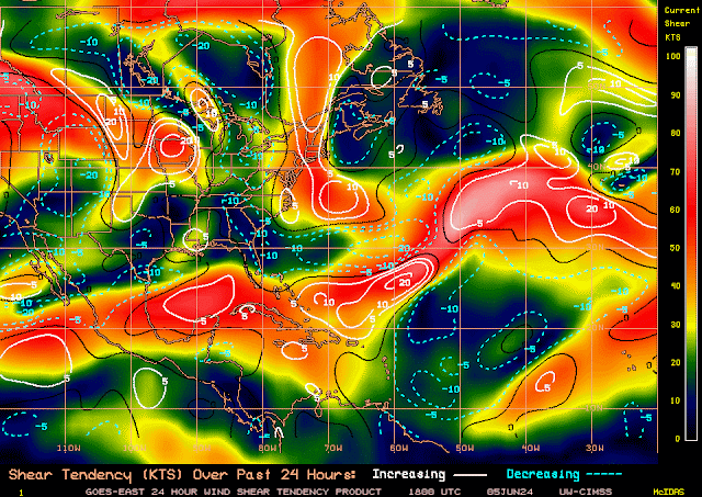
Upper level winds are still not favorable for development.


Wednesday, June 5, 2024

..TROPICAL OUTLOOK JUNE 5, 2024..


Well, that pesky upper-level trough of low pressure is still lingering over the northern Central Caribbean Islands. More gusty winds, lightning, and flash flooding with mudslides are likely in this region. Now Puerto Rico will also be getting some of this moisture moving over the island to aggravate the situation.
 
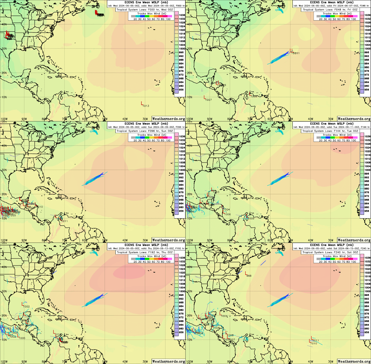
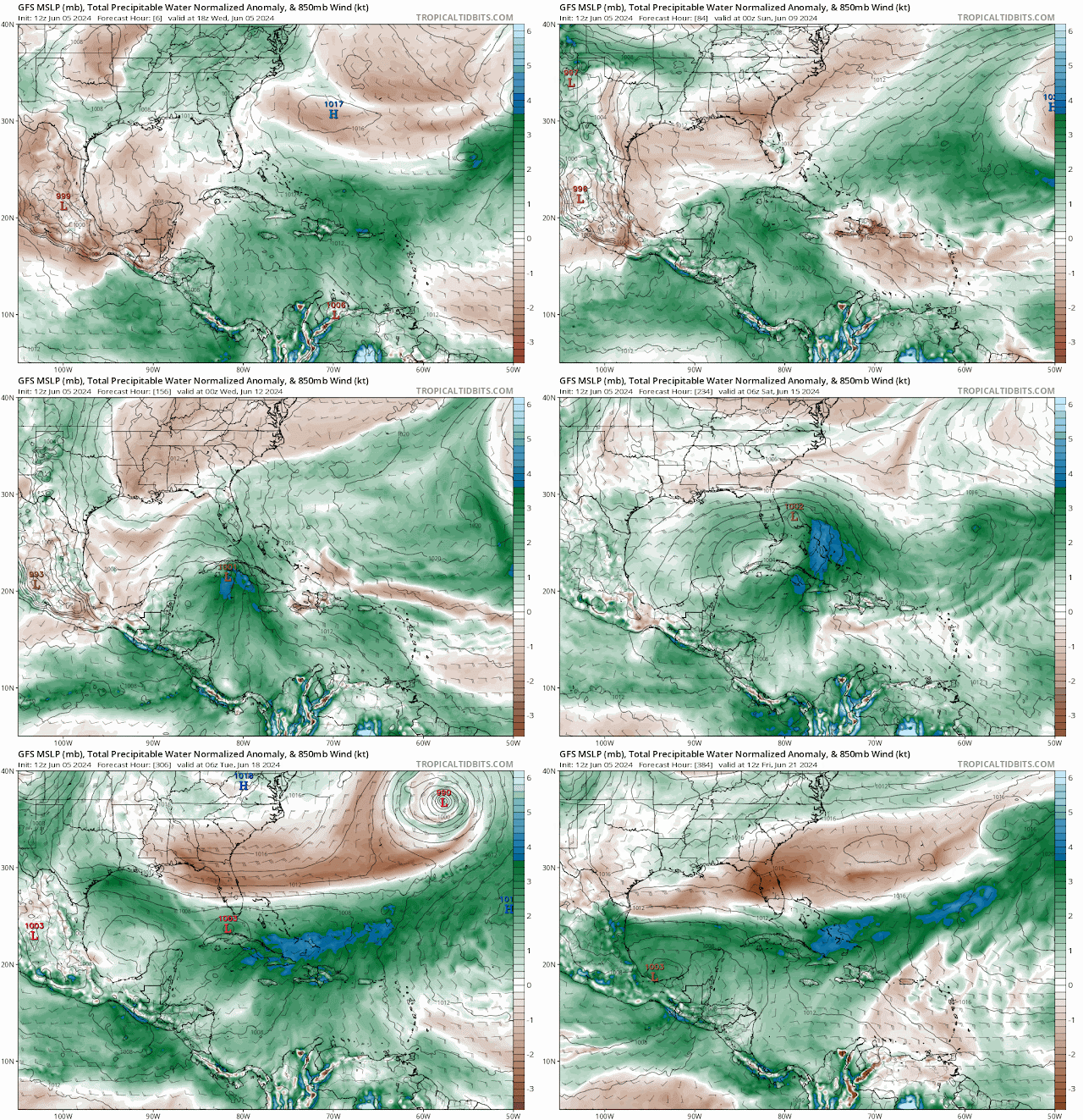
Some models are still hinting at development coming out of the northwest Caribbean. The GFS and the Canadian model are the only two models suggesting development. The Euro model has a trough digging southeast and only pulls moisture from the Caribbean northward over Cuba and Florida. Regardless of storm development or not, I do believe that we could see plenty of rain over Cuba and Florida that could produce some flooding concerns. However, since the Global Tropic Hazards Outlook forecast calls for a greater than 20% probability of storm development in the Bay of Campeche and the northwest Caribbean, I will monitor carefully because I don't like surprises. 
Always be storm-ready!

I will be away Thursday through Sunday celebrating my 44th anniversary. I will try to do brief updates when possible. You all have a great rest of this week and weekend. Enjoy the dry weather because the rainy season may be close by.

Remember to always check with the National Hurricane Center for the latest on the tropics.

RTW


Greens rain and blues heavier rains

Seven day rainfall accumulation shows and abundance of rain over Cuba and Florida