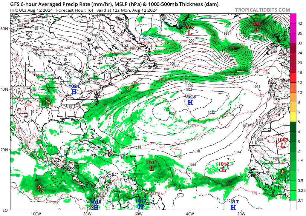
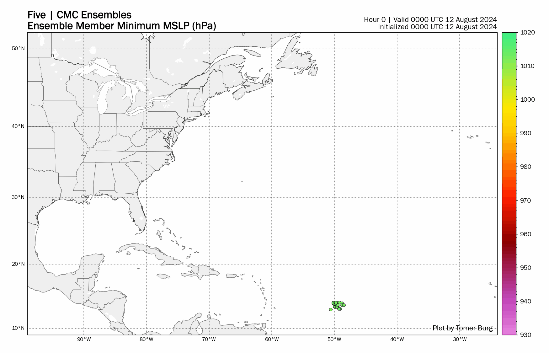
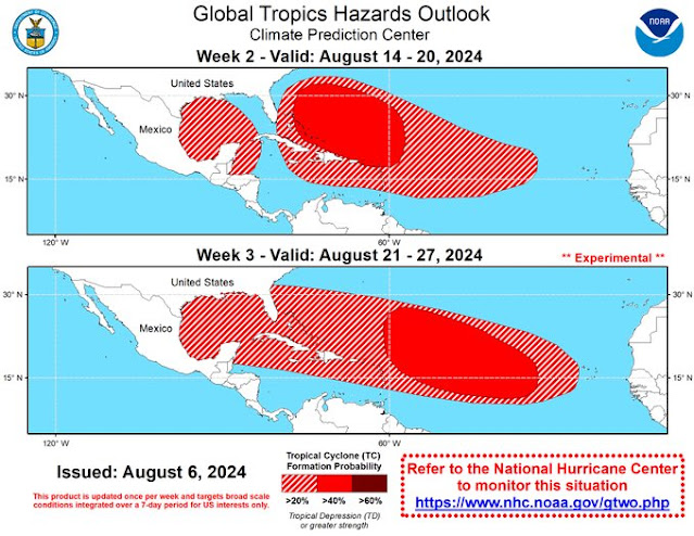
Well here we go again a long range storm investigation for the middle of next week. Model hitting that low pressure and possibly a tropical cyclone will form near the northern Leeward Islands, and track west-northwest and a turn north and northeast in response to a trough of low pressure that will move east off the northeast coast of the United States coast. Remember these are long range forecast and they will change from model run to run.
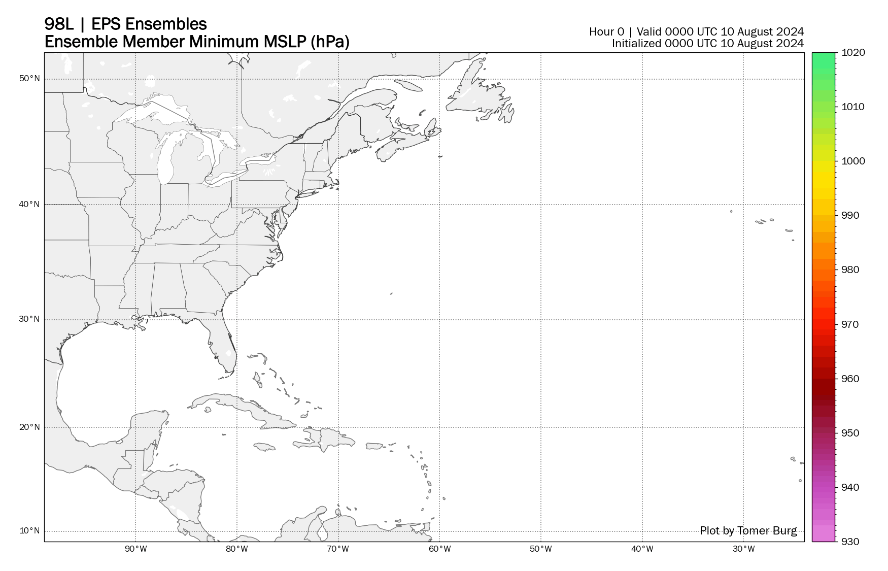
Model are also hinting at another low that will develop behind this system and that low or storm could move further west as high pressure re-builds west blocking any track toward the north. If this all pans out then the second low would be the one to monitor if you live in Florida. Once again this can all change and its not a forecast just my two cents worth of what I think will happen.
Be Storm Ready!
RTW
---------------------------------------------------------------------------------
Bueno, aquí vamos de nuevo con una investigación de tormenta de largo alcance para mediados de la próxima semana. El modelo se encuentra con esa baja presión y posiblemente se formará un ciclón tropical cerca de las Islas de Sotavento del norte, y seguirá una trayectoria oeste-noroeste y un giro al norte y noreste en respuesta a una vaguada de baja presión que se moverá al este frente a la costa noreste de los Estados Unidos. Recuerde que estos son pronósticos de largo alcance y cambiarán de una ejecución del modelo a otra.
Los modelos también están insinuando que se desarrollará otra baja presión detrás de este sistema y que esa baja o tormenta podría moverse más al oeste a medida que la alta presión se reconstruye hacia el oeste, bloqueando cualquier trayectoria hacia el norte. Si todo esto resulta como debe ser, entonces la segunda baja presión será la que debe monitorear si vive en Florida. Una vez más, todo esto puede cambiar y no es un pronóstico, solo mi opinión sobre lo que creo que sucederá.
¡Prepárese para las tormentas!
RTW
ZCZC MIATWOAT ALL
TTAA00 KNHC DDHHMM
Tropical Weather Outlook
NWS National Hurricane Center Miami FL
800 AM EDT Thu Aug 8 2024
For the North Atlantic...Caribbean Sea and the Gulf of Mexico:
Active Systems:
The National Hurricane Center is issuing advisories on Tropical
Storm Debby, located over South Carolina.
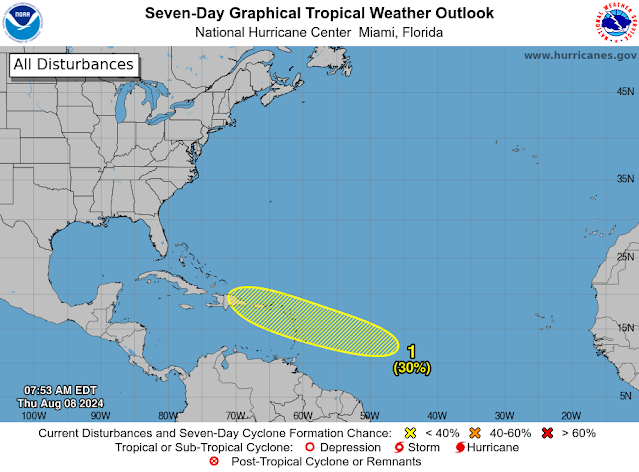
1. Near the Lesser and Greater Antilles:
An area of low pressure could form in the central or western
tropical Atlantic Ocean early next week. Some development of this
system is possible while it approaches the Lesser Antilles during
the early to middle part of next week and moves generally
west-northwestward toward the Greater Antilles thereafter.
* Formation chance through 48 hours...low...near 0 percent.
* Formation chance through 7 days...low...30 percent.
Forecaster Hagen/Cangialosi
-----------------------------------------------------------------
797
ACCA62 KNHC 081137
TWOSAT
Perspectiva sobre las Condiciones del Tiempo en el Trópico
Centro Nacional de Huracanes del SNM Miami FL
800 AM EDT jueves 8 de agosto de 2024
Para el Atlántico Norte...Mar Caribe y el Golfo de México:
Sistemas Activos: El Centro Nacional de Huracanes está emitiendo
advertencias sobre la Tormenta Tropical Debby, ubicada sobre
Carolina del Sur.
Cerca de las Antillas Menores y Mayores: Un área de baja presión
podría formarse en el Océano Atlántico tropical central u oeste a
principios de la próxima semana. Es posible algún desarrollo de este
sistema mientras se acerca a las Antillas Menores durante la parte
temprana a media de la próxima semana y se mueve generalmente hacia
el oeste-noroeste hacia las Grandes Antillas.
* Probabilidad de formación hasta 48 horas...baja...cerca del 0 por
ciento.
* Probabilidad de formación hasta 7 días...baja...30 por ciento.
$$
Pronosticador Hagen/Cangialosi
*** Este producto ha sido procesado automáticamente utilizando un
programa de traducción y puede contener omisiones y errores. El
Servicio Nacional de Meteorología no puede garantizar la precisión
del texto convertido. De haber alguna duda, el texto en inglés es
siempre la versión autorizada. ***


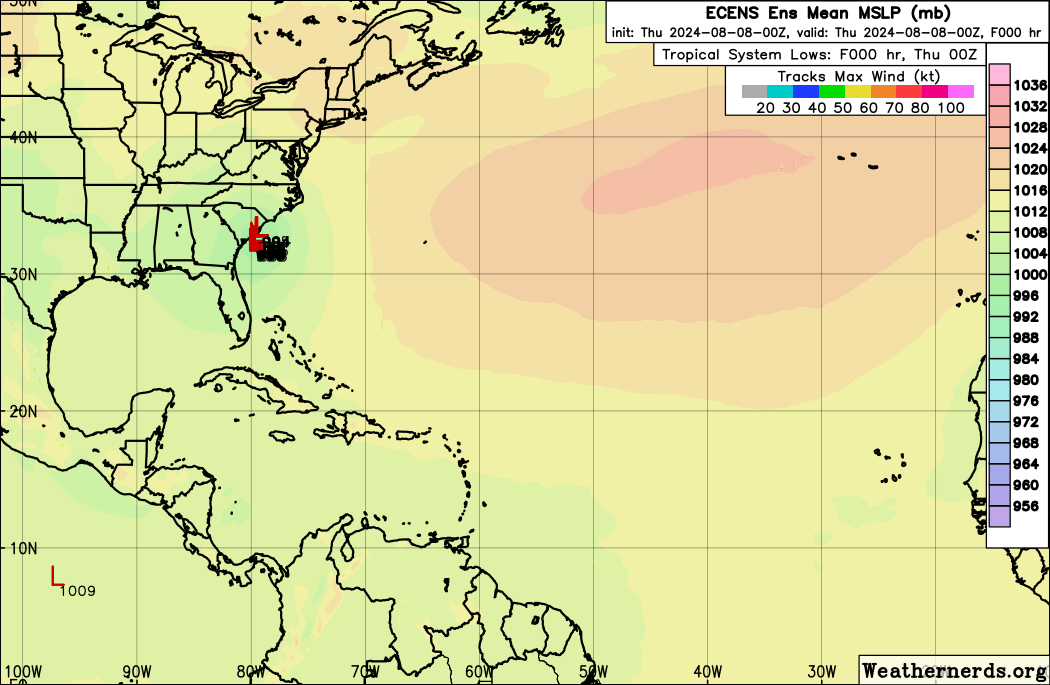
Water temperatures are nice and warm for tropical cyclone formation.


.png)
.png)

.png)


.png)


