Friday, September 7, 2018

FLORENCE UPDATE SEPT 7 2018...1122 AM EDT

FLORENCE UPDATE BY NHC
632 
WTNT31 KNHC 071442
TCPAT1

BULLETIN
Tropical Storm Florence Advisory Number  33
NWS National Hurricane Center Miami FL       AL062018
1100 AM AST Fri Sep 07 2018

...FLORENCE'S WEAKENING APPEARS TO HAVE STOPPED FOR THE MOMENT...
...RESTRENGTHENING EXPECTED OVER THE WEEKEND...


SUMMARY OF 1100 AM AST...1500 UTC...INFORMATION
-----------------------------------------------
LOCATION...25.0N 51.8W
ABOUT 865 MI...1390 KM NE OF THE NORTHERN LEEWARD ISLANDS
ABOUT 935 MI...1505 KM ESE OF BERMUDA
MAXIMUM SUSTAINED WINDS...65 MPH...100 KM/H
PRESENT MOVEMENT...W OR 270 DEGREES AT 8 MPH...13 KM/H
MINIMUM CENTRAL PRESSURE...996 MB...29.42 INCHES


WATCHES AND WARNINGS
--------------------
There are no coastal watches or warnings in effect.


DISCUSSION AND OUTLOOK
----------------------
At 1100 AM AST (1500 UTC), the center of Tropical Storm Florence was
located near latitude 25.0 North, longitude 51.8 West.  Florence is
moving toward the west near 8 mph (13 km/h), and this general motion
is expected to continue through Sunday.  A west-northwestward
motion with an increase in forward speed is forecast over the
southwestern Atlantic Ocean early next week.

Maximum sustained winds are near 65 mph (100 km/h) with higher
gusts.  Little change in intensity is expected during the next day
or so, but restrengthening is forecast over the weekend.  Florence
could become a hurricane again by Saturday night or Sunday.

Tropical-storm-force winds extend outward up to 140 miles (220 km)
from the center.

The estimated minimum central pressure is 996 mb (29.42 inches).


HAZARDS AFFECTING LAND
----------------------
SURF:  Swells generated by Florence will begin to affect Bermuda
later today and will reach portions of the U.S. East Coast over the
weekend.  These swells are likely to cause life-threatening surf and
rip current conditions.  Please consult products from your local
weather office.


NEXT ADVISORY
-------------
Next complete advisory at 500 PM AST.

$$
Forecaster Berg 
https://www.nhc.noaa.gov/ 
--------------------------------------------------------------------


 NHC official forecast track a tad to the left of previous forecast.  This seems to
have been the trend.  RTW
https://ralphstropicalweather.com/ 
Latest Guidance still a bit spread out but the focus seems to be the Carolinas
and points north of there.  RTW
 CMC model runs have been pretty consistent on a track toward Cape Hatteras.  RTW
 The NHC H-Models seems to be trending left of previous model run as well.  RTW
 UKMET has been consistent with a west to a west-northwest track while the
Hurricane Center models to the right of the UKMET and a track toward the 
Carolina's.  RTW


RUNNING BEHIND ON WEBSITE UPDATE! SEPT 7, 2018...1055 AM EDT


Sorry I been running behind this morning on my website update.  I been adding sections for the new invest 93L and I still have a few things to add.  I will stop this now and begin Florence forecast map and post that then go on to the tropical weather map.  Bare with me and will try to have it all done within an hour or so.

Thanks for your patience
RTW

Thursday, September 6, 2018

FLORENCE ENCOUNTERING WIND SHEAR DISRUPTING THE CYCLONES CLOUD STRUCTURE SEPT 6, 2018...0508 PM EDT

FLORENCE UPDATE BY NHC
218 
WTNT31 KNHC 062043
TCPAT1

BULLETIN
Hurricane Florence Advisory Number  30
NWS National Hurricane Center Miami FL       AL062018
500 PM AST Thu Sep 06 2018

...FLORENCE CLINGING TO HURRICANE STATUS...
...EXPECTED TO REINTENSIFY ON FRIDAY...


SUMMARY OF 500 PM AST...2100 UTC...INFORMATION
----------------------------------------------
LOCATION...25.0N 49.6W
ABOUT 985 MI...1585 KM ENE OF THE NORTHERN LEEWARD ISLANDS
ABOUT 1050 MI...1685 KM ESE OF BERMUDA
MAXIMUM SUSTAINED WINDS...80 MPH...130 KM/H
PRESENT MOVEMENT...NW OR 305 DEGREES AT 10 MPH...17 KM/H
MINIMUM CENTRAL PRESSURE...989 MB...29.21 INCHES


WATCHES AND WARNINGS
--------------------
There are no coastal watches or warnings in effect.


DISCUSSION AND OUTLOOK
----------------------
At 500 PM AST (2100 UTC), the center of Hurricane Florence was
located near latitude 25.0 North, longitude 49.6 West. Florence is
moving toward the northwest near 10 mph (17 km/h), and a turn
towards the west is expected tomorrow.  A westward to
west-northwestward motion should continue into early next week.

Maximum sustained winds are near 80 mph (130 km/h) with higher
gusts.  Continued weakening is forecast during the next day or so
followed by restrengthening late Friday into this weekend.

Hurricane-force winds extend outward up to 15 miles (30 km) from the
center and tropical-storm-force winds extend outward up to 90 miles
(150 km).

The estimated minimum central pressure is 989 mb (29.21 inches).


HAZARDS AFFECTING LAND
----------------------
SURF:  Swells generated by Florence will begin to affect Bermuda on
Friday and will reach portions of the U.S. East Coast over the
weekend.  These swells are likely to cause life-threatening surf and
rip current conditions.  Please consult products from your local
weather office.


NEXT ADVISORY
-------------
Next complete advisory at 1100 PM AST.

$$
Forecaster Berg/Rhome 
https://www.nhc.noaa.gov/ 
--------------------------------------------------------------------

HURRICANE FLORENCE WEAKENS SO MORE EXPECTED TO STRENGTHEN AGAIN SEPT 6, 2018...1108 AM EDT

FLORENCE UPDATE BY NHC
636 
WTNT31 KNHC 061438
TCPAT1

BULLETIN
Hurricane Florence Advisory Number  29
NWS National Hurricane Center Miami FL       AL062018
1100 AM AST Thu Sep 06 2018

...FLORENCE WEAKENS FURTHER...


SUMMARY OF 1100 AM AST...1500 UTC...INFORMATION
-----------------------------------------------
LOCATION...24.6N 48.6W
ABOUT 1030 MI...1660 KM ENE OF THE NORTHERN LEEWARD ISLANDS
ABOUT 1115 MI...1795 KM ESE OF BERMUDA
MAXIMUM SUSTAINED WINDS...105 MPH...165 KM/H
PRESENT MOVEMENT...NW OR 315 DEGREES AT 10 MPH...17 KM/H
MINIMUM CENTRAL PRESSURE...975 MB...28.80 INCHES


WATCHES AND WARNINGS
--------------------
There are no coastal watches or warnings in effect.


DISCUSSION AND OUTLOOK
----------------------
At 1100 AM AST (1500 UTC), the center of Hurricane Florence was
located near latitude 24.6 North, longitude 48.6 West.  Florence is
moving toward the northwest near 10 mph (17 km/h).  A turn toward
the west-northwest and west with a decrease in forward speed is
expected through Saturday.  Florence may begin to move faster toward
the west-northwest over the western Atlantic early next week.

Maximum sustained winds have decreased to near 105 mph (165 km/h)
with higher gusts.  Additional weakening is forecast during the
next day or two.  However, Florence is expected to remain a
hurricane and likely reintensify over the weekend.

Hurricane-force winds extend outward up to 15 miles (30 km) from the
center, and tropical-storm-force winds extend outward up to 90 miles
(150 km).

The estimated minimum central pressure is 975 mb (28.80 inches).


HAZARDS AFFECTING LAND
----------------------
SURF:  Swells generated by Florence will begin to affect Bermuda on
Friday and will reach portions of the U.S. East Coast over the
weekend.  These swells are likely to cause life-threatening surf and
rip current conditions.  Please consult products from your local
weather office.


NEXT ADVISORY
-------------
Next complete advisory at 500 PM AST.

$$
Forecaster Berg
https://www.nhc.noaa.gov/ 
--------------------------------------------------------------------


 https://ralphstropicalweather.com/
Not very comforting when you see such a wide spread in a model run. This is
like betting on the lottery.  Eastern Seaboard from New England to Florida 
continue to monitor the progress of Florence and be hurricane ready!  RTW
 A most definite westward trend seems like high pressure would be the cause of
this!
NHC model also more to the left of previous forecast tracks.  UKMET is
more consistent on a westward track
Florence forecast to regain cat 3 status! 

Wednesday, September 5, 2018

FLORENCE, INVEST 92L AND THE TROPICAL UPDATE...SEPT 5, 2018

FLORENCE UPDATE BY NHC
944 
WTNT31 KNHC 052032
TCPAT1

BULLETIN
Hurricane Florence Advisory Number  26
NWS National Hurricane Center Miami FL       AL062018
500 PM AST Wed Sep 05 2018

...FLORENCE STRENGTHENS INTO A CATEGORY 4 HURRICANE...


SUMMARY OF 500 PM AST...2100 UTC...INFORMATION
----------------------------------------------
LOCATION...22.7N 46.6W
ABOUT 1110 MI...1790 KM ENE OF THE NORTHERN LEEWARD ISLANDS
ABOUT 1295 MI...2080 KM ESE OF BERMUDA
MAXIMUM SUSTAINED WINDS...130 MPH...215 KM/H
PRESENT MOVEMENT...NW OR 305 DEGREES AT 13 MPH...20 KM/H
MINIMUM CENTRAL PRESSURE...953 MB...28.15 INCHES


WATCHES AND WARNINGS
--------------------
There are no coastal watches or warnings in effect.


DISCUSSION AND OUTLOOK
----------------------
At 500 PM AST (2100 UTC), the eye of Hurricane Florence was located
near latitude 22.7 North, longitude 46.6 West. Florence is moving
toward the northwest near 13 mph (20 km/h), and this general motion
is expected to continue through Thursday.  A turn toward the
west-northwest with a decrease in forward speed is forecast to begin
Thursday night, followed by a turn back toward the northwest early
next week.

Maximum sustained winds have increased to near 130 mph (215 km/h)
with higher gusts.  Florence is now a category 4 hurricane on the
Saffir-Simpson Hurricane Wind Scale.  Some weakening is forecast
during the next couple of days, but Florence is expected to remain
a powerful hurricane through early next week.

Hurricane-force winds extend outward up to 15 miles (30 km) from the
center and tropical-storm-force winds extend outward up to 90 miles
(150 km).

The estimated minimum central pressure is 953 mb (28.15 inches).


HAZARDS AFFECTING LAND
----------------------
SURF:  Swells generated by Florence will begin to affect Bermuda on
Friday.  These swells are likely to cause life-threatening surf and
rip current conditions.  Please consult products from your local
weather office.


NEXT ADVISORY
-------------
Next complete advisory at 1100 PM AST.

$$
Forecaster Berg/Rhome
--------------------------------------------------------------------
INVEST 92L AND STORM INVEST ABOUT TO EMERGE THE AFRICAN COAST
468 
ABNT20 KNHC 051742
TWOAT 

Tropical Weather Outlook
NWS National Hurricane Center Miami FL
200 PM EDT Wed Sep 5 2018

For the North Atlantic...Caribbean Sea and the Gulf of Mexico:

The National Hurricane Center is issuing advisories on Hurricane
Florence, located over the east-central tropical Atlantic Ocean,
and has issued its last advisory on Tropical Depression Gordon,
located over west central Mississippi.  Future information on
Gordon can be found in Public Advisories issued by the Weather
Prediction Center.

Shower activity associated with a broad area of low pressure
centered a couple of hundred miles south-southwest of the Cabo Verde
Islands is gradually becoming better organized.  Environmental
conditions are forecast to be conducive for additional development,
and a tropical depression is expected to form during the next
couple of days while the system moves west-northwestward across the
tropical Atlantic Ocean.
* Formation chance through 48 hours...high...70 percent.
* Formation chance through 5 days...high...90 percent.

A tropical wave is forecast to move off the west coast of Africa
in a few days.  Some development of the system is possible over the
weekend while the wave moves westward over the far eastern
tropical Atlantic Ocean.
* Formation chance through 48 hours...low...near 0 percent.
* Formation chance through 5 days...low...30 percent.

&&
Public Advisories on Gordon are issued by the Weather Prediction
Center under AWIPS header TCPAT2, WMO header WTNT32 KWNH, and on the
web at http://www.wpc.ncep.noaa.gov.

$$
Forecaster Beven 
https://www.nhc.noaa.gov/ 
--------------------------------------------------------------------

 18Z GUIDANCE MODEL
 18Z UKMET/NHC COMBO BY RTW
 18Z H-MODEL COMBO
FLORENCE FORECAST TRACK AND WIND FIELD RADIUS
STORM INVEST 92L 18Z GUIDANCE MODEL
STORM INVEST 92L 18Z H-MODEL COMBO BY RTW

 
VISIBLE SATELLITE
 COLOR SATELLITE CLOUD TEMPERATURE
 

GORDON AND FLORENCE SEPT 5, 2018... 1135 AM EDT

GORDON UPDATE BY NHC
227 
WTNT32 KNHC 051431
TCPAT2

BULLETIN
Tropical Depression Gordon Advisory Number  13
NWS National Hurricane Center Miami FL       AL072018
1000 AM CDT Wed Sep 05 2018

...GORDON CONTINUES TO WEAKEN OVER CENTRAL MISSISSIPPI...
...THREAT OF HEAVY RAINS AND FLOODING WILL CONTINUE FOR SEVERAL
DAYS...


SUMMARY OF 1000 AM CDT...1500 UTC...INFORMATION
-----------------------------------------------
LOCATION...32.3N 90.2W
ABOUT 5 MI...10 KM W OF JACKSON MISSISSIPPI
MAXIMUM SUSTAINED WINDS...30 MPH...45 KM/H
PRESENT MOVEMENT...NW OR 320 DEGREES AT 14 MPH...22 KM/H
MINIMUM CENTRAL PRESSURE...1008 MB...29.77 INCHES


WATCHES AND WARNINGS
--------------------
There are no coastal watches or warnings in effect.

For more information on Gordon, please see products issued by your
local National Weather Service office.


DISCUSSION AND OUTLOOK
----------------------
At 1000 AM CDT (1500 UTC), the center of Tropical Depression Gordon
was located near latitude 32.3 North, longitude 90.2 West.  The
depression is moving toward the northwest near 14 mph (22 km/h).  A
northwestward motion with a decrease in forward speed is expected
over the next couple of days.  On the forecast track, the center of
Gordon will move across the lower Mississippi Valley today and
tonight.  A turn toward the north-northwest and north is forecast to
occur on Friday.

Maximum sustained winds have decreased to near 30 mph (45 km/h) with
higher gusts.  Additional weakening is expected as Gordon moves
farther inland.  Jackson, Mississippi, recently reported a wind gust
of 35 mph (55 km/h).

The estimated minimum central pressure is 1008 mb (29.77 inches).


HAZARDS AFFECTING LAND
----------------------
RAINFALL:  Gordon is expected to produce total rain accumulations of
4 to 8 inches over the western Florida Panhandle, southwest Alabama,
central Mississippi, Arkansas, Missouri, southern Iowa and Illinois,
with isolated maximum amounts of 12 inches through early Saturday.
This rainfall will cause flash flooding across portions of these
areas.

WIND:  Wind gusts to tropical storm force could occur in showers
and thunderstorms associated with Gordon today.

TORNADOES:  A tornado or two is possible through this evening over
Mississippi and western Alabama.

STORM SURGE:  Water levels along the northern Gulf of Mexico coast
will gradually subside later today.


NEXT ADVISORY
-------------
This is the last public advisory issued by the National Hurricane
Center on Gordon.  Future information on Gordon can be found in
Public Advisories issued by the Weather Prediction Center beginning
at 4 PM CDT, under AWIPS header TCPAT2, WMO header WTNT32 KWNH, and
on the web at https://www.wpc.ncep.noaa.gov.

$$
Forecaster Beven 
--------------------------------------------------------------------
FLORENCE UPDATE BY NHC
438 
WTNT31 KNHC 051439
TCPAT1

BULLETIN
Hurricane Florence Advisory Number  25
NWS National Hurricane Center Miami FL       AL062018
1100 AM AST Wed Sep 05 2018

...FLORENCE FLOURISHING IN THE FACE OF SOUTHWESTERLY SHEAR...


SUMMARY OF 1100 AM AST...1500 UTC...INFORMATION
-----------------------------------------------
LOCATION...22.0N 45.7W
ABOUT 1160 MI...1865 KM ENE OF THE NORTHERN LEEWARD ISLANDS
ABOUT 1370 MI...2205 KM ESE OF BERMUDA
MAXIMUM SUSTAINED WINDS...125 MPH...205 KM/H
PRESENT MOVEMENT...NW OR 305 DEGREES AT 13 MPH...20 KM/H
MINIMUM CENTRAL PRESSURE...957 MB...28.26 INCHES


WATCHES AND WARNINGS
--------------------
There are no coastal watches or warnings in effect.


DISCUSSION AND OUTLOOK
----------------------
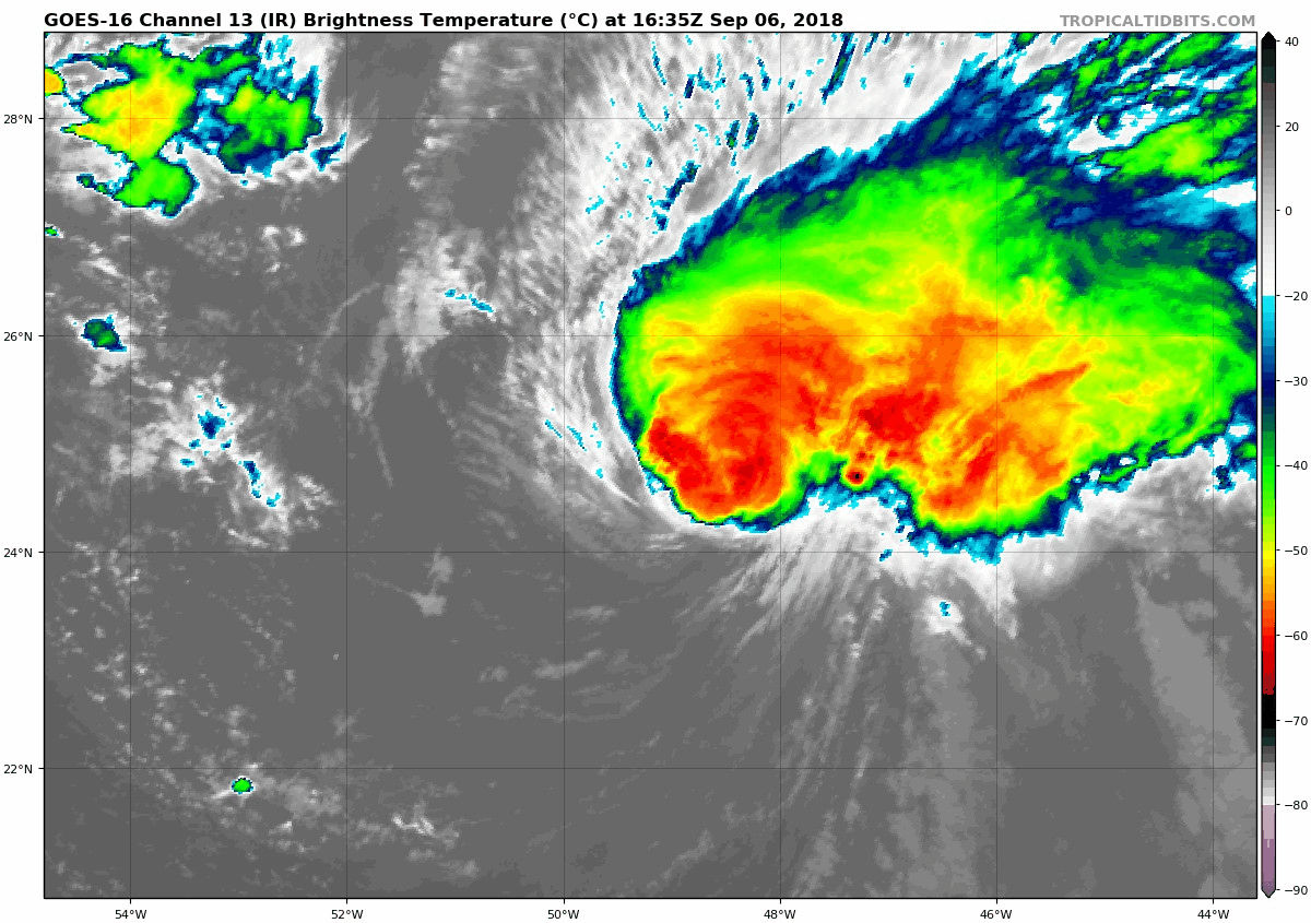
At 1100 AM AST (1500 UTC), the eye of Hurricane Florence was
located near latitude 22.0 North, longitude 45.7 West.  Florence is
moving toward the northwest near 13 mph (20 km/h), and this general
motion is expected to continue through tonight.  A turn toward the
west-northwest with a decrease in forward speed is forecast on
Thursday, followed by a turn back toward the northwest early next
week.

Satellite images indicate that maximum sustained winds have
increased to near 125 mph (205 km/h) with higher gusts.  Florence is
a category 3 hurricane on the Saffir-Simpson Hurricane Wind Scale.
Some weakening is possible during the next few days, but Florence is
expected to remain a strong hurricane through early next week.

Hurricane-force winds extend outward up to 15 miles (30 km) from the
center, and tropical-storm-force winds extend outward up to 90 miles
(150 km).

The estimated minimum central pressure is 957 mb (28.26 inches).


HAZARDS AFFECTING LAND
----------------------
None.


NEXT ADVISORY
-------------
Next complete advisory at 500 PM AST.

$$
Forecaster Berg/Rhome
https://www.nhc.noaa.gov/ 
---------------------------------------------------------------------


 Guidance models continue spread an uncertain forecast
 Noticing that NHC model more to the left than previous model run and  UKMET
continues to the left of NHC.  Euro model during this morning model run is also
back to the west and landfall in the Carolinas.  Big question mark to where it will
end up at this time.
The H- models also left with a bend back to the Northwest.  Could be picking up on rebuilding high pressure over the north Atlantic.
https://ralphstropicalweather.com/