Wednesday, July 5, 2023

..TROPICAL WEATHER OUTLOOK JULY 5, 2023..


I am watching an area of strong to moderate showers and storms near the Mexico coast and south-southeast of Southern Texas in the Bay of Campeche.  None of the models seems to be hinting at development but I will continue to watch closely. 

If this disturbance makes it on shore it will bring gusting winds heavy rains which could produce flooding and lightning.


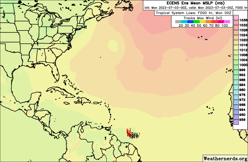
Yesterdays aggressive wave in the eastern Caribbean has lost its source of energy as it tracks west away from upper level low north of the waves axis.  However, the wave still has some isolated showers and storms along and west of the waves axis.  These storm cells are south of Haiti and south of eastern Cuba.


There are two other waves in the Central Atlantic accompanied by some storms as well which I will continue to monitor as well.  For now everything seems quiet though.


The ensemble models are hinting at possible development from one of the tropical waves, but let me caution you, these are long range forecast and are always subject to change, and have error.  I will monitor closely and will let you know if I see something of interest.


825 
AXNT20 KNHC 051018
TWDAT 

Tropical Weather Discussion
NWS National Hurricane Center Miami FL
1205 UTC Wed Jul 5 2023

Tropical Weather Discussion for North America, Central America
Gulf of Mexico, Caribbean Sea, northern sections of South
America, and Atlantic Ocean to the African coast from the
Equator to 31N. The following information is based on satellite
imagery, weather observations, radar and meteorological analysis.

Based on 0600 UTC surface analysis and satellite imagery through 
0900 UTC.

...TROPICAL WAVES...

An eastern Atlantic tropical wave is near 29W from just southwest
of the Cabo Verde Islands southward, and moving west around 15 
kt. Scattered moderate convection is noted between 06N to 13N
between 24W and 29W.

A central Atlantic tropical wave is near 46W from 17N 
southwestward, moving west at 10 to 15 kt. Scattered moderate to 
isolated strong convection is seen from 01N to 12N between 41W 
and 49W. 

A central Caribbean tropical wave is along 73W from Haiti to the
Venezuela-Colombia border, moving W at 15 kt. Scattered moderate
convection is noted within 90 nm on both sides of the wave axis
from Hispaniola to Venezuela and Colombia. 

...MONSOON TROUGH/ITCZ...

A monsoon trough enters the Atlantic along the coast of Senegal 
and curves southwestward to 11N28W. Scattered moderate convection
is found south of the trough from 08N to 12N between Sierra 
Leone/Liberia coast and 17W. An ITCZ continues from 11N28W across
10N36W to 07N43W, then resumes from 06N46W to near the French 
Guiana-Brazil border at 05N52W. Scattered moderate convection
extends 150 nm on either side of the eastern ITCZ segment, with
convection near the western segment primarily associated with the
tropical wave depicted in the section above.

The eastern end of the East Pacific monsoon trough near 10N is 
causing scattered moderate convection in the Caribbean waters 
near northwestern Colombia and Panama.

...GULF OF MEXICO...

A surface trough that extends from 27N94W to 21N96W is inducing
scattered moderate convection from 22N to 26N between 90W and
96W. The northern tip of an eastern Pacific tropical wave extends
into the Bay of Campeche, where scattered moderate convection is
occurring. Otherwise, a 1019 mb high centered offshore western 
Florida is dominating much of the region. Light to gentle winds 
and seas of 1 to 2 ft are present at the eastern Gulf, including 
the Florida Straits. Moderate with locally fresh ESE to SE return 
flow and 2 to 5 ft seas prevail for the rest of the Gulf.

For the forecast, the trough over the western Gulf will move NW 
and inland today, taking scattered showers and thunderstorms and 
fresh SE winds with it. Moderate to locally fresh winds will pulse
north and west of the Yucatan peninsula tonight as a diurnal 
trough develops and moves offshore. Elsewhere, weak high pressure 
will support gentle to moderate breezes and slight seas. 

...CARIBBEAN SEA...

Convection just S of Cuba has dissipated early this morning.
Ongoing convection in the central and SW basin are due to the
monsoon trough and a tropical wave, both describe in above
sections. Fresh to strong mainly E trades and seas of 7 to 9 ft 
are evident near the tropical wave at the central basin. Moderate 
to fresh ESE trades and 5 to 7 ft seas are seen at the eastern 
basin. Moderate ENE to ESE trades and seas at 4 to 6 ft are noted
for the southwestern basin and the Gulf of Honduras. Gentle with 
locally moderate NE to ENE winds and 2 to 4 ft seas prevail for 
elsewhere in the basin.

For the forecast, a tropical wave over the central Caribbean will
move west across the western Caribbean through Fri. Fresh to 
strong winds and rough seas will follow the tropical wave mainly 
across the central Caribbean, along with scattered showers and 
thunderstorms. Looking ahead, another tropical wave will enter the
eastern Caribbean Fri night. 

...ATLANTIC OCEAN...

A Sahara Dust Layer (SAL) outbreak of modest thickness covers 
much of the tropical Atlantic with its leading edge near 
Hispaniola and over the eastern Caribbean Sea. Hence, the lack of
tropical wave activity in the central Atlantic. Hazy conditions 
with slightly reduced visibilities are expected within this area 
for the next couple of days.

Deep layer low pressure S of Bermuda near 27N65W is inducing
scattered moderate convection from 24N to 30N between 55W and 
70W. Refer to the Monsoon Trough/ITCZ and Tropical Waves sections
above for details on additional convection in the Atlantic Basin.

The Atlantic Ridge extends WSW from a 1029 mb Azores High 
centered near 35N42W across Bermuda to the Florida Peninsula. This
ridging is supporting light to gentle winds and seas of 2 to 4 ft
N of 23N, except in the far E Atlantic in the vicinity of and
south of the Canary Islands, where fresh NE winds and seas of 4 
to 6 ft prevail. To the S of the main influence of the ridge,
moderate to fresh trades dominate, except for waters near and S of
the Cabo Verde Islands, where gentle and variable winds prevail.
Seas S of 23N are 4 to 7 ft, highest just E of the Lesser
Antilles. 

For the forecast west of 55W, weak Bermuda to Azores High will 
maintain a weak pressure gradient and lead to light gentle winds 
across most of the area through late week. S of 22N, moderate to 
fresh winds will prevail into Fri, occurring with and behind a 
tropical wave moving through the Caribbean. Looking ahead, the 
high pressure will shift south Sat, ahead of a series of weak 
troughs moving between northeast Florida and Bermuda through Sun. 

$$
KONARIK


Tuesday, July 4, 2023

..AN AGGRESSIVE TROPICAL WAVE IS MOVING THROUGH THE EASTERN CARIBBEAN..


An aggressive tropical wave is moving through the eastern Caribbean, producing squally conditions heavy rains and lightning over Puerto Rico and Dominican Republic. If this wave holds together, it could spread showers and storms across the greater Antilles, Cuba and Florida in the coming days.

Also a small area of showers and storms over the southwest Bahamas could enhance showers and storms over South Florida, the Florida Straits and Cuba over night as it tracks slowly west and interacts with a surface trough over the state.

RTW


000
AXNT20 KNHC 041743
TWDAT

Tropical Weather Discussion
NWS National Hurricane Center Miami FL
1805 UTC Tue Jul 4 2023

Tropical Weather Discussion for North America, Central America
Gulf of Mexico, Caribbean Sea, northern sections of South
America, and Atlantic Ocean to the African coast from the
Equator to 31N. The following information is based on satellite
imagery, weather observations, radar and meteorological analysis.

Based on 1200 UTC surface analysis and satellite imagery through 
1700 UTC.

...TROPICAL WAVES...

An eastern Atlantic tropical wave is located along 23W from S of 
the Cabo Verde Islands to 03N, moving W at 10 to 15 kt. Scattered 
moderate convection is seen from 07N to 12N E of the wave axis.

A central Atlantic tropical wave is located along 40W from 17N 
southward, moving W at 10 to 15 kt. Scattered moderate convection
is seen from 04N to 08N mainly E of the wave axis. 

A vigorous tropical wave is located just S of Puerto Rico and 
extends into Venezuela, moving west at 10 to 15 kt. This wave is 
producing scattered moderate convection across Puerto Rico and the
offshore waters in the eastern Carribbean and seas up to 8 ft. 
Recent scatterometer imagery shows fresh to strong winds S of 
Puerto Rico and Dominican Republic. 

A western Caribbean tropical wave is currently transitioning into
the eastern Pacific Ocean. This wave is located along 87W from 
19N into Honduras and Nicaragua. This wave is moving W at around 
15 kt. Scattered moderate convection is noted N of Panama and 
offshore Costa Rica and Nicaragua. 

...MONSOON TROUGH/ITCZ...

A monsoon trough enters the Atlantic along the Senegal coast south
of Dakar and extends southwestward to near 12N22W. Convection in 
the vicinity of this trough is mainly associated with the tropical
wave described in the section above. An ITCZ continues from 
11N24W to near 07N39W, then resumes westward from 06N41W to 
04N51W. Scattered moderate convection is noted within about 60 nm
on both sides of the last ITCZ segment. 

The eastern end of the East Pacific monsoon trough near 11N is 
causing scattered moderate convection in the Caribbean waters 
near northwestern Colombia.

...GULF OF MEXICO...

A surface trough is producing scattered moderate to isolated
strong convection in the Bay of Campeche. Otherwise, 1018 mb high
pressure center offshore the Florida Panhandle is dominating much
of the basin, with the ridging leading to light to gentle 
anticyclonic winds and seas of less than 2 ft in the eastern Gulf 
and Florida Straits. For the western Gulf, outside of convection, 
gentle to moderate mainly SE to S winds and seas of 2 to 4 ft 
prevail. 

For the forecast, weak surface ridging will prevail into late 
week, supporting mainly gentle to moderate return flow W of 90W 
and light to gentle winds over the eastern half of the basin. 
Moderate to locally fresh winds will pulse nightly north and west 
of the Yucatan peninsula through Wed as a diurnal trough develops 
and moves offshore. Expect scattered thunderstorms across the 
southwest Gulf through Wed. 

...CARIBBEAN SEA...

Please see the Monsoon Trough/ITCZ and Tropical Waves sections 
above for convection and seas in the Caribbean. For the remainder
of the basin, mainly moderate trades prevail, with seas of 3 to 6
ft. The exceptions are S of 10N in the SW basin and in the Lee of 
Cuba, where winds are gentle and seas are 2 to 4 ft. 

For the forecast, fresh to strong winds will prevail in the 
central and eastern Caribbean through Wed night with and behind a 
tropical wave that is moving west of the Lesser Antilles today. 
Expect squalls and scattered thunderstorms to accompany this 
tropical wave through tonight. Gentle to moderate trade winds will
prevail elsewhere during the forecast period, while fresh to 
strong trades persist across south central portions.

...ATLANTIC OCEAN...

A Sahara Dust Layer (SAL) outbreak of modest thickness covers 
much of the tropical Atlantic with its leading edge east of 
Puerto Rico/Virgin Islands and the Lesser Antilles. Hence, the
lack of tropical wave activity in the central Atlantic. Hazy 
conditions with slightly reduced visibilities are expected within 
this area for the next couple of days.

An upper level trough extends NE from the Dominican Republic to E
of Bermuda. Scattered moderate to isolated strong convection is 
seen in association with this feature as it interacts with the 
tropical wave in the vicinity, from 19N to 23N between 65W and 
70W. Two weak surface troughs are located in the northwest 
Bahamas and north of northeast Bahamas. Each of these troughs are
producing scattered showers and thunderstorms. For additional 
areas of convection in the Atlantic Ocean, please refer to the 
Monsoon Trough/ITCZ and Tropical Waves sections above. 

High pressure of 1023 mb centered E of Bermuda is dominating much
of the subtropical Atlantic. This is leading to light to gentle 
winds for all areas N of 23N, except in the far eastern Atlantic 
where moderate to locally fresh winds are occurring in and near 
the Canary Islands. Seas for areas N of 23N are 3 to 4 ft, with 2
ft or less seas occurring in and near the Bahamas, Cuba, and 
Florida. To the S of 23N and W of 30W, fresh trades and seas of 5 
to 8 ft dominate, while areas to the E, including waters near the 
Cabo Verde Islands, having gentle to moderate mainly NE winds.

For the forecast west of 55W, a weak Bermuda High will maintain a
weak pressure gradient and lead to light gentle winds across most
of the area into late week. S of 22N, moderate to fresh winds 
will prevail into Thu night, occurring with and behind a tropical 
wave moving through the Caribbean. 

$$
KRV

HAPPY 4TH OF JULY 2023!

Happy 4th of July 2023 from RTW and family! Be safe with fireworks and bring your pets indoor specially those that don't like loud noises.  God Bless you all and God bless the U.S.A.

RTW


Monday, July 3, 2023

..TROPICAL WEATHER OUTLOOK JULY 3, 2023..


The tropics remain quiet at this time, but there are a few waves being monitored at this time.

  • A tropical wave near 24-25 degrees west Latitude passing over the Cabo Verde Islands.  This wave does not have any thunderstorms activity associated with it at this time.
  • A strong wave approaching the lower windward Islands, Barbados, Trinidad and Tobago is located between 55-57 degrees west.  This is a strong wave with heavy rainfall, gusty winds in squalls and lightning.  This wave has the potential to produce flash floods as it spreads slowly westward over the lower island chain and northern coast of south America. (See blow satellite loop.)

  • Another wave over the central Caribbean is located near 72-73 degrees west latitude and seems to have some isolated showers and storms south of Dominican republic and the Mona Passage.  there are no signs of organization at this time.  A 1010 mb Low pressure ahead of this wave which is located along 75 degrees west and along the monsoon trough could interact with the southern axis of this wave which extends over South America.
Elsewhere the tropical remains quiet for now.

RTW


000
AXNT20 KNHC 031035
TWDAT

Tropical Weather Discussion
NWS National Hurricane Center Miami FL
1205 UTC Mon Jul 3 2023

Tropical Weather Discussion for North America, Central America
Gulf of Mexico, Caribbean Sea, northern sections of South
America, and Atlantic Ocean to the African coast from the
Equator to 31N. The following information is based on satellite
imagery, weather observations, radar and meteorological analysis.

Based on 0600 UTC surface analysis and satellite imagery through 
0900 UTC.

...TROPICAL WAVES...

A eastern Atlantic tropical wave is near 24W from 20N southward
through the Cabo Verde Islands to near 05N, moving W at 10 kt. No
significant convection is associated with this feature.

A well-defined western Atlantic tropical wave is along 54W from 
13N to Suriname, moving W at 10 kt. Scattered moderate convection 
is noted S of 13N between 48W and 58W, including northern 
Suriname.

Another well-defined central Caribbean tropical wave is along 72W
from S of Haiti to the Venezuela-Colombia border, moving W at 10
to 15 kt. Scattered moderate convection is noted near the coasts
of Hispaniola and NW Venezuela, as well as over the Mona Passage. 

A tropical wave that was previously in the far western Caribbean
has now moved into Central America and the Eastern Pacific along
91W. Scattered moderate convection associated with this wave is
still impacting the Gulf of Honduras early this morning. 

...MONSOON TROUGH/ITCZ...

A monsoon trough enters the Atlantic near the border of Mauritania
and Senegal and extends SW through to 14N21W to 09N26W. Scattered
moderate to isolated strong convection is noted from 05N to 14N E
of 19W. An ITCZ continues from 09N26W across 04N35W to 05N47W. No
significant convection is noted near the ITCZ.

The eastern end of the East Pacific monsoon trough extends along
10N from Panama to Colombia. This feature is leading to scattered
moderate convection across the SW Caribbean S of 14N and W of 75W
as well as adjacent portions of Colombia, Panama, and Costa Rica.

...GULF OF MEXICO...

Scattered moderate convection associated with the aforementioned
tropical wave over northern South America and adjacent portions of
the Eastern Pacific is impacting areas near the coast of the
Yucatan Peninsula as well as the Yucatan Channel. Otherwise, dry
conditions prevail in the basin. High pressure centered just
offshore Florida continues to dominate the Gulf of Mexico. This is
leading to light to gentle SE winds and seas of 3 ft or less.

For the forecast, weak surface ridging will prevail into mid-
week, supporting mainly gentle to moderate return flow W of 90W 
and light to gentle winds over the eastern half of the basin. 
Otherwise, moderate to locally fresh winds will pulse north and 
west of the Yucatan peninsula tonight and again Tue night as a 
diurnal trough develops and moves offshore.

...CARIBBEAN SEA...

Refer to the Monsoon Trough/ITCZ and Tropical Waves sections above
for details on convection in the basin. The pressure gradient
between high pressure mainly N of 25N and low pressure centered
along the Colombian coast is leading to fresh to locally strong E
winds and seas of 5 to 7 ft in the south-central Caribbean. To the
north and east, the basin is having moderate to fresh trades with
seas of 4 to 6 ft. In the western basin, mainly moderate winds
prevail with 3 to 6 ft seas. However, S of 12N, winds are light to
gentle with seas of 3 to 5 ft. 

For the forecast, moderate to fresh trade winds across the 
central and eastern Caribbean will increase to fresh to strong Tue
into Wed night in the wake of a tropical wave passing through the
region. Fresh to strong trade winds over the south- central 
waters decrease some today, then increase and expand in coverage 
Tue night into Wed. Gentle to moderate trade winds will prevail 
elsewhere during the forecast period. 

...ATLANTIC OCEAN...

An upper-level trough axis extend from E of Bermuda to NE of
Hispaniola. It is inducing scattered moderate convection N of 25N
between 58W and 68W. Convection associated with a deep-layer low
pressure centered near 34N36W is now confined to waters N of the
area. Farther S, convection in the tropical Atlantic is being
generated by a tropical wave and monsoon trough, and is depicted
in the respective sections above. 

A dominant ridge of high pressure sprawling across most waters N
of 23N is leading to light to gentle winds and seas of 3 to 5 ft
for these waters. Some moderate winds and seas of up to 6 ft are
impacting waters near the Canary Islands. To the S, light to
gentle winds are waters E of 30W, with the remainder of Tropical
Atlantic waters having mainly fresh trades with seas of 5 to 7 ft.
Winds on the N and E sides of a tropical wave along 54W have been
enhanced by the wave and are strong, with subsequent seas of 8 to
10 ft from 15N to 20N between 52W and 58W. 

For the forecast west of 55W, a weak pressure gradient will lead 
to light gentle winds across most of the area into mid-week. S of 
22N, winds will increase to moderate to fresh starting tonight, 
then continue through mid week. 

$$
KONARIK
Latest model ensemble do not show any significant development in 
the Atlantic at this time. July is typically a quiet month for tropical cyclone formation.
RTW


Friday, June 30, 2023

..TROPICAL WEATHER OUTLOOK JUN 30, 2023..


Not much to discuss in the tropics other than a few tropical waves and a surface trough being monitored by the National Hurricane Center.  That system has a low chance for formation within 48 hours and within 7 days.

  • A tropical wave in the Central Atlantic between 30 and 35 west latitude which has some showers and storms along the southern axis of wave.  This is due to the waves interaction with the moist monsoon trough in this area which is located south of the 10 north longitude. 
  • There is a tropical wave between 55 and 60 west latitude that has some thunderstorms with lightning and squally weather that will be moving over Trinidad and Tobago this evening.  There are no signs of organization. 
  • The wave that was enhancing storm over Puerto Rico and the northern Leeward yesterday is now between southwest Haiti and eastern Cuba.  This wave southern axis extends south over Columbia and a 1008 mb low pressure is along the waves axis near 74 west Latitude, along the northwest Columbian coast.  There are some storms along the northern axis of the wave producing some lightning over northern coast of  Jamaica northward over eastern Cuba and off the coast.  There are no signs of organization at this time.

RTW


ZCZC MIATWOAT ALL
TTAA00 KNHC DDHHMM

Tropical Weather Outlook
NWS National Hurricane Center Miami FL
800 AM EDT Fri Jun 30 2023

For the North Atlantic...Caribbean Sea and the Gulf of Mexico:

1. Western Atlantic Ocean:
A broad area of low pressure is producing disorganized showers and 
thunderstorms a couple of hundred miles to the southeast of Bermuda. 
Upper-level winds do not appear conducive for this system to develop 
into a tropical or subtropical cyclone while it moves generally 
north-northeastward at about 10 mph during the next couple of days.
* Formation chance through 48 hours...low...10 percent.
* Formation chance through 7 days...low...10 percent.

Forecaster Reinhart
000
AXNT20 KNHC 301205 AAA
TWDAT

Tropical Weather Discussion...UPDATED
NWS National Hurricane Center Miami FL
1205 UTC Fri Jun 30 2023

Updated to add the East Atlantic Gale Warning Special Feature

Tropical Weather Discussion for North America, Central America
Gulf of Mexico, Caribbean Sea, northern sections of South
America, and Atlantic Ocean to the African coast from the
Equator to 31N. The following information is based on satellite
imagery, weather observations, radar and meteorological analysis.

Based on 0600 UTC surface analysis and satellite imagery through 
1045 UTC.

...SPECIAL FEATURES...

East Atlantic Gale Warning: Meteo-France has issued a GALE WARNING
for the AGADIR Offshore Zone, from 30/1500 UTC to 01/0000 UTC.
N to NE winds will reach Force 8 near Cape Ghir, with severe
gusts. Seas are 8-11 ft, and may peak to 12 ft this evening and
early tonight. For more information, please see the latest High 
Seas Forecast from Meteo-France at website:
https://wwmiws.wmo.int/index.php/metareas/display/2

...TROPICAL WAVES...

A far eastern Atlantic tropical wave has its axis along 28W and
south of 16N to 02N. It is moving westward around 15 kt. Scattered 
moderate to isolated strong convection is ahead of this wave to
32W and from 02N to 07N. Isolated showers and thunderstorms are 
east of the wave axis to 22W and from 03N to 08N.

A central Atlantic tropical wave has its axis extending from
14N53W to 09N54W and continues south-southwestward to Suriname.
It is moving westward at 10-15 kt. Numerous moderate to strong 
convection is ahead of the wave to near 50W and from 09N to 11N. 
In addition, scattered moderate convection is within 180 nm west 
of the wave reaching to Guyana and from 04N to 06N.

A central Caribbean tropical wave has its axis along 74W from 
the southwestern tip of Haiti southward to inland Venezuela. It is 
moving westward around 10 kt. Scattered showers and thunderstorms
are occurring over Haiti. Scattered showers and a few thunderstorms
are seen from 18N to 19N between 74W-75W.

...MONSOON TROUGH/ITCZ...

The monsoon trough axis enters the Atlantic along the Mauritania 
coast just north of Nouakchott, then continues southwestward to 
11N23W and to 08N38W, where overnight scatterometer data 
indicates that it transitions to the ITCZ to 08N46W and to 10N54W.
Scattered moderate to isolated strong convection is from 04N to 
07N between 37W-42W. Scattered moderate convection is within 60 nm
either side of the trough between 31W-37W, also within 60 nm 
south of the ITCZ between 42W-46W and within 60 nm north of the 
ITCZ between 48W-52W.

GULF OF MEXICO...

A diurnal surface trough is producing scattered showers and
thunderstorms over the eastern Bay of Campeche. Another surface 
trough is leading to similar conditions near the southwest coast 
of Florida, including the Florida Keys. Otherwise, the
anticyclonic wind flow attributed to a 1015 mb high over the 
north-central Gulf dominates much of the region. Moderate to fresh
return flow and seas of 3-5 ft are present across the western 
Gulf, and also over the Bay of Campeche. Light to gentle winds 
with relatively low seas of 1-3 ft seas remain over the rest of 
the Gulf.

For the forecast, high pressure will prevail through the weekend,
supporting mainly gentle to moderate return flow W of 90W and 
light to gentle winds over the eastern half of the basin. 
Otherwise, moderate to locally fresh winds will pulse north and 
west of the Yucatan peninsula each night into Sat as a trough 
develops each evening and moves offshore. Winds west of the 
Yucatan peninsula are expected to become fresh to strong Mon 
night.

CARIBBEAN SEA...

Broad high pressure extends southwestward from the eastern 
Atlantic to near Leeward Islands. Scattered showers and isolated
thunderstorms are present over the waters just south of Puerto 
Rico and Hispaniola to 31N and between 56W-66W. This activity is 
being sustained by a rather broad and weak upper-level trough 
that is positioned over the western Atlantic. Similar activity
extends from the southeastern Bahamas to eastern Cuba and the
waters between Haiti and eastern Cuba.

The gradient between the high pressure and lower pressure that is
over central Caribbean has resulted in fresh to strong easterly 
winds along with seas of 6-8 ft in the south-central part of the 
basin, north of Colombia. Mostly gentle northeast-east trade winds
per latest ASCAT data, are over the northwest part of the basin.
Seas there are 2-4 ft. Gentle to moderate northeast to east 
trade winds and seas of 4-5 ft are over the southwestern part of 
the Moderate to fresh east-southeast winds and seas of 4-6 ft 
prevail elsewhere in the basin.

Enhanced convection is confined to the extreme southwestern
Caribbean south of 11N and west of 79W due to the presence of 
the eastern segment of the eastern Pacific monsoon trough.

For the forecast, fresh trade winds across the central and 
eastern basin will increase to between fresh and strong Mon and 
Mon night. Fresh to strong trade winds over the south- central 
waters will expand in coverage through Mon night. Gentle to 
moderate trade winds will prevail elsewhere during the forecast 
period. 

ATLANTIC OCEAN...

A western Atlantic stationary front enters the area at 31N77W
and continues southwestward to near Cape Canaveral, Florida and 
continues as a decaying front over central Florida. A surface 
trough out ahead of it extends from 28N77W to South Florida. 
Scattered showers and isolated thunderstorms are noted from 26N to
31N and between 72W-77W. Isolated showers and thunderstorms are 
elsewhere near and over sections of the Bahamas. Father east, 
another surface trough is analyzed from near 31N62W to weak low 
pressure near 30N64W 1014 mb and continues southwestward to 
27N69W. An area of scattered moderate convection lifting north- 
northeast is seen from 28N to 31N between 57W-62W. An overnight 
ASCAT pass highlighted fresh to strong southeast-south winds north
of 30N and between 59W-61W. Seas with these winds are in the 8-10
ft range.

Moderate to fresh northeast to east trade winds and seas of
6-8 ft are seen north of 20N between 55W-65W. Otherwise, the 
gradient associated to broad high pressure over the area 
is resulting in light to gentle east-southeast winds and seas of 
3-4 ft between 35W and the Florida-Georgia coast. Fresh north- 
northeast trade winds and seas of 6-9 ft are over the waters 
north of 20N between the Africa coast and 35W. In the tropical 
Atlantic, moderate to fresh northeast to east-southeast trade 
winds along with 5-7 ft seas are seen from 09N to 20N between the 
Cabo Verde Islands and Lesser Antilles. Gentle to locally moderate
southerly and monsoonal winds with seas of 4-6 ft due to a 
moderately southerly swell remain over the remainder of the 
Atlantic Basin.

For the forecast west of 55W, the surface trough with weak low 
pressure along it is located SSE of Bermuda. The trough and low 
pressure will move north of 31N by early this afternoon along with
the fresh to strong southeast to south winds that are presently 
to its east and southeast. Elsewhere, gentle to moderate winds 
will prevail east of 65W with light to gentle winds elsewhere. 

$$
Aguirre/Mahoney


Thursday, June 29, 2023

..TROPICAL WEATHER OUTLOOK JUNE 29, 2023..


The tropics remain quiet for now!

A tropical wave west of Puerto Rico is interacting with a surface trough associated with the disturbance that NHC is monitoring.  These two system are producing strong showers and storms with lightning over Puerto Rico the British Virgin Islands and north over the Atlantic waters.  There are no signs of organization.

There two other waves over the Atlantic that are interacting with the African monsoon trough and the inter-tropical conversion zone.  There are no signs of organization at this time.

RTW


000
ABNT20 KNHC 291137
TWOAT 

Tropical Weather Outlook
NWS National Hurricane Center Miami FL
800 AM EDT Thu Jun 29 2023

For the North Atlantic...Caribbean Sea and the Gulf of Mexico:

Southwestern Atlantic Ocean:
A surface trough is producing disorganized showers and thunderstorms 
a few hundred miles to the south-southeast of Bermuda. Upper-level 
winds are marginally conducive for some slow development of this 
system during the next few days while it moves generally northward 
at 5 to 10 mph.
* Formation chance through 48 hours...low...10 percent.
* Formation chance through 7 days...low...20 percent.

$$
Forecaster Reinhart
000
AXNT20 KNHC 291147
TWDAT 

Tropical Weather Discussion
NWS National Hurricane Center Miami FL
1205 UTC Thu Jun 29 2023

Tropical Weather Discussion for North America, Central America
Gulf of Mexico, Caribbean Sea, northern sections of South
America, and Atlantic Ocean to the African coast from the
Equator to 31N. The following information is based on satellite
imagery, weather observations, radar and meteorological analysis.

Based on 0600 UTC surface analysis and satellite imagery through 
1130 UTC.

...TROPICAL WAVES...

An eastern Atlantic tropical wave has its axis near 22W from 15N 
southward, and moving west around 5 kt. Scattered moderate 
convection is seen from 08N to 10N within 240 nm west of the wave,
and west of the wave from 03N to 08N between 16W-21W.

A central Atlantic tropical wave has its axis along 49W/50W from 
03N to 14N. It is moving westward at 15-20 kt. Numerous moderate 
to strong convection is east and west of the wave within 60 nm of 
the ITCZ.

An eastern Caribbean tropical wave has its axis along 69W south of 
19N to inland north-central Venezuela. It is moving westward at
about 13 kt. Scattered showers and thunderstorms are present
east of the wave over and near Puerto Rico and the Virgin 
Islands. This activity is being enhanced by an upper-level trough
that is roughly along 70W. Isolated showers and thunderstorms are
elsewhere east of the wave.

...MONSOON TROUGH/ITCZ...

The monsoon trough enters the Atlantic along the Mauritania coast
near Nouakchott, then curves southwestward through 10N22W to near
09N30W, where latest scatterometer data indicates that it
transitions to the ITCZ and and continues to 10N41W to just east 
of a wave near 09N48W and resumes west of the same wave at 08N51W
to near 07N57W. Scattered moderate to isolated strong convection
is within 60 nm north of the ITCZ between 36W-45W, and from 05N
to 09N between 37W-43W.

...GULF OF MEXICO...

A diurnal surface trough is generating scattered showers and
thunderstorms at the eastern Bay of Campeche. Otherwise, a 1015 
mb high at the north-central, and a 1016 mb high at the east- 
central Gulf continue to dominate much of the region. Moderate to 
fresh with locally strong easterly winds and seas of 3-5 ft 
dominate the southwestern Gulf, including the central and eastern 
Bay of Campeche. Moderate with locally fresh southeast to south
return flow and 3-4 ft are over the west-central and northwestern
Gulf. Light to gentle winds and lower seas of 1-3 ft are over 
the remainder of the Gulf.

For the forecast, the highs will prevail through the weekend, 
supporting mainly gentle to moderate return flow west of 90W and 
light to gentle winds east of 90W. Otherwise, moderate to locally 
fresh winds will pulse north and west of the Yucatan peninsula 
each night into Sat as the diurnal trough develops each evening 
and moves offshore. 

...CARIBBEAN SEA...

Moderate to fresh with locally strong NE to E winds and seas of
4-6 ft are over the south-central Caribbean area north of 
Colombia. Mainly gentle trade winds and seas of 1- ft seas are 
over the northwest part of the sea. Moderate to fresh ENE to SE 
winds and seas of 3-5 ft prevail elsewhere across the basin.

Isolated showers and thunderstorms are over the northwestern
Caribbean Sea. Similar activity is over the northwestern 
Caribbean Sea and elsewhere east of the tropical wave.

For the forecast, moderate trade winds in the central and eastern
Caribbean will increase to fresh tonight into Sun night. Fresh to
strong winds will develop over the south-central waters Thu 
night. Gentle to moderate trade winds will prevail elsewhere 
through early next week.

...ATLANTIC OCEAN...

A surface trough is analyzed southward from a 1013 mb low that is 
over northern Florida to Lake Okeechobee and to South Florida
and the Florida Keys. Isolated showers and thunderstorms are over
the waters between South Florida and the Bahamas. Another surface
trough is analyzed from near 31N63W to 24N66W. The combination of
this trough with diffluence that is present to the east of a 
large upper trough located in this general area is resulting in 
numerous showers and thunderstorms from 19N to 29N between 
57W-64W.

Mainly gentle southerly winds and seas of 3-5 ft are evident 
north of 19N between 65W and the Florida-Georgia coast. Farther 
east, moderate to fresh east to southeast winds and 4-6 ft seas 
are found north of 19N between 50W-65W. A 1021 mb high center is 
over the far eastern Atlantic near 28N27W. The associated ridge 
dominates the area north of 20N between 20W-37W providing for 
light to gentle winds and 3- ft seas. Near the Canary Islands, 
moderate to fresh with locally strong NNE trades and seas of 4-7 
ft seas are present north of 19N between the Africa coast and 25W.
Across the tropical Atlantic, moderate with locally fresh 
northeast to east-southeast trade winds along with with seas of 
5-7 ft exist from 07N to 19N between the Cabo Verde Islands and 
Lesser Antilles. Light to gentle southerly and monsoonal winds 
with seas of 5-7 ft in moderate southerly swell are over the 
remainder of the Atlantic Basin.

For the forecast, the surface trough south of Bermuda will move 
northward, with the possibility of a low pressure center 
developing along it. Winds will strengthen in the vicinity of the
trough tonight before moving north of the area Fri. Elsewhere, 
gentle to moderate winds will prevail east of 65W with light to 
gentle winds elsewhere.

$$

Forecaster Aguirre

Wednesday, June 28, 2023

..TROPICAL WEATHER OUTLOOK JUNE 28, 2023.. ..UPDATED AT 0200 PM EDT..


Not much to talk about all remains quiet for now.  I will add below tropical outlook from the hurricane center.  They are monitoring an area east of what use to be Cindy that may have a chance for formation but no a threat to land at this time.

RTW


ZCZC MIATWOAT ALL
TTAA00 KNHC DDHHMM

Tropical Weather Outlook
NWS National Hurricane Center Miami FL
200 PM EDT Wed Jun 28 2023

For the North Atlantic...Caribbean Sea and the Gulf of Mexico:

1. Southwestern Atlantic Ocean:
A surface trough is producing disorganized showers and thunderstorms 
a few hundred miles south-southeast of Bermuda.  Upper-level winds 
are marginally conducive for some slow development of this system 
during the next few days while it moves generally northward at 5 to 
10 mph.
* Formation chance through 48 hours...low...10 percent.
* Formation chance through 7 days...low...20 percent.

Forecaster Berg
000
AXNT20 KNHC 281054
TWDAT 

Tropical Weather Discussion
NWS National Hurricane Center Miami FL
1205 UTC Wed Jun 28 2023

Tropical Weather Discussion for North America, Central America
Gulf of Mexico, Caribbean Sea, northern sections of South
America, and Atlantic Ocean to the African coast from the
Equator to 31N. The following information is based on satellite
imagery, weather observations, radar and meteorological analysis.

Based on 0600 UTC surface analysis and satellite imagery through 
1040 UTC.

...TROPICAL WAVES...

A tropical wave is in the central Atlantic with axis near 37W, 
from 02N to 15N, moving westward at 10 to 15 knots. Layered
precipitable water imagery at the lower levels show dry air 
within the wave environment, which is hindering the development 
of significant convection. 

A tropical wave is in the E Caribbean with axis near 65W, S of 18N
to inland Venezuela, moving W at 15 to 20 knots. Scattered showers
are E of the wave axis S of 20N between 55W and 66W. 

...MONSOON TROUGH/ITCZ...

The monsoon trough passes through the coastal plains of
Guinea-Bissau near 12N16W to 09N23W to 09N31W. The ITCZ continues
from 09N31W to 08N35W, the resumes W of a tropical wave from
07N38W to 05N49W. Scattered moderate isolated strong convection is
off the coast of W Africa from 03N to 12N between 12W and 22W,
from 05N to 11N between 26W and 32W, and from 03N to 10N between
39W and 52W. 

...GULF OF MEXICO...

Weak high pressure of 1014 mb has developed near 27N90W and is
providing mostly light to gentle variable wind E of 90W where seas
are in the 1 to 2 ft range. West of 90W, gentle to moderate return
flow is present along with seas to 3 ft. Otherwise, scattered
showers are ongoing in the Bay of Campeche associated with the
rainbands of EP92.

For the forecast, weak surface ridging will prevail through the 
weekend, supporting mainly gentle to moderate return flow W of 90W
and light to gentle variable wind over the eastern half of the 
basin. Otherwise, fresh winds will pulse north and west of the 
Yucatan peninsula each night into Sat as a trough develops each 
evening and moves offshore. 

...CARIBBEAN SEA...

A tropical wave is moving across the E Caribbean and is generating
scattered showers and thunderstorms over the Lesser Antilles and 
SE basin. Similar shower activity is ongoing across the offshore
waters of Nicaragua, Costa Rica and Panama under the influence of
the E Pacific monsoon trough. The pressure difference between surface
ridging across the Bahamas and Cuba, and lower pressure in the SW
Caribbean is supporting fresh to locally strong winds off Colombia
with seas of 5 to 7 ft. Gentle to moderate trade winds are
elsewhere with seas to 4 ft.  

For the forecast, moderate trade winds in the central and eastern
Caribbean will increase to fresh speeds tonight into Sun night as
the tropical wave move westward towards the SW Caribbean. Locally
strong winds are forecast for the south-central waters Thu night 
through Sat as the wave move S of Hispaniola. Gentle to moderate 
winds will dominate elsewhere during the forecast period.

...ATLANTIC OCEAN...

Showers and tstms prevail S of 29N between 55W and 64W being 
enhanced by a middle-level low NE of Puerto Rico. A line of 
showers and tstms are also occurring N of 25N between 65W and 69W 
in association with a surface trough, remnant of a former low. The
pressure gradient between subtropical ridging across the central
Atlantic and the surface trough supports moderate to locally fresh
SE winds between 44W and 68W. Moderate to fresh N to NE winds are
between the Cape Verde Islands and the W coast of Africa. Seas in
these regions are 5 to 6 ft. Light to gentle variable winds and
seas to 4 ft are elsewhere in the subtropical Atlantic. 

For the forecast W of 55W, the trough will linger in the same 
region today and may reform into a weak low tonight into Thu 
morning. The low is forecast to move near Bermuda by Thu night. 
Moderate SW winds across the NE Florida offshore waters will 
diminish to gentle speeds today as an approaching front weakens 
into a surface trough. Light to gentle variable winds will prevail
elsewhere. 

$$
Ramos


Tuesday, June 27, 2023

..TROPICAL WEATHER OUTLOOK JUNE 27, 2023..


SLOW MOVING SCATTERED SHOWERS AND STORM MOVING ACROSS THE WINDWARD/ LEEWARD ISLANDS AHEAD OF A TROPICAL WAVE.  THESE STORMS HAVE BEEN PRODUCING FREQUENT LIGHTNING, GUSTY WINDS AND HEAVY DOWNPOURS OVER THE ISLAND CHAIN.  THIS WILL SPREAD WESTWARD INTO THE CARIBBEAN AND THERE ARE NO SIGNS OF ORGANIZATION AS THE UPPER LEVEL CONDITIONS ARE NOT FAVORABLE FOR DEVELOPMENT.

THERE ARE TWO OTHER WAVES BUT NONE ARE SHOWING SIGNS OF ORGANIZATION.

REMENANTS OF CINDY ARE STILL PRODUCING SHOWERS AND STORMS AND THIS AREA IS BEING MONITORED FOR REGENERATION AS IT TRACKS TOWARD THE NORTH.  THERE IS A 30% CHANCE FOR FORMATION WITHIN 7 DAYS!

RTW


ZCZC MIATWOAT ALL
TTAA00 KNHC DDHHMM

Tropical Weather Outlook
NWS National Hurricane Center Miami FL
800 AM EDT Tue Jun 27 2023

For the North Atlantic...Caribbean Sea and the Gulf of Mexico:

1. Southwestern Atlantic Ocean (Remnants of Cindy):
An area of low pressure, associated with the remnants of Cindy, is 
producing disorganized showers and thunderstorms more than 400 miles 
to the south of Bermuda. While strong upper-level winds are expected 
to prevent redevelopment of this system over the day or so, 
environmental conditions could become marginally conducive for some 
gradual development during the latter part of this week. The system 
is forecast to move generally northward over the western Atlantic, 
passing near Bermuda on Thursday.
* Formation chance through 48 hours...low...10 percent.
* Formation chance through 7 days...low...30 percent.

Forecaster Papin
000
AXNT20 KNHC 271035
TWDAT

Tropical Weather Discussion
NWS National Hurricane Center Miami FL
1205 UTC Tue Jun 27 2023

Tropical Weather Discussion for North America, Central America
Gulf of Mexico, Caribbean Sea, northern sections of South
America, and Atlantic Ocean to the African coast from the
Equator to 31N. The following information is based on satellite
imagery, weather observations, radar and meteorological analysis.

Based on 0600 UTC surface analysis and satellite imagery through
1030 UTC.

...TROPICAL WAVES...

A tropical wave is in the central Atlantic with axis near  
30W, from 04N to 15N, moving westward at 10 to 15 kt. The wave is
under the influence of Saharan dry air and dust and lacks 
significant convection.

A tropical wave is just SE of the Lesser Antilles with axis near
59W, from 06N to 16N, moving westward at 15 to 20 kt. Scattered 
moderate convection is from 07N to 17N between 50W and 63W. 

A tropical wave is in the far western Caribbean crossing Honduras
and Nicaragua into the E Pacific waters. The wave axis is near
87W, extends southward from 17N, and is moving westward at 10 to 
15 kt. Convection over the NW Caribbean waters has diminished to
scattered showers in the Gulf of Honduras. 

...MONSOON TROUGH/ITCZ...

The monsoon trough passes through the W coast of Africa near
14N17W to 08N28W to 09N40W. The ITCZ continues from 09N40W to 
13N47W to 12N53W. Numerous moderate isolated strong convection is
off the coast of Africa from 05N to 10N between 11W and 18W.
Scattered moderate convection is elsewhere from 05N to 10N between
19W and 28W, and from 03N to 08N between 35W and 45W. 

...GULF OF MEXICO...

Dry air subsidence from the mid to upper levels are maintaining
fair weather conditions basin-wide. At the surface, a weak 
surface ridge dominates across the region and provides gentle to
locally moderate SE to S winds over the western half of the gulf.
Light to gentle variable winds are elsewhere. Seas are 1 to 3 ft
basin-wide. 

For the forecast, weak surface ridging will prevail through the 
upcoming weekend, supporting mainly gentle to moderate return flow
W of 90W and light to gentle variable wind over the eastern half 
of the basin. Otherwise, fresh winds will pulse north and west of 
the Yucatan peninsula each night into Sat as a trough develops 
each evening and moves offshore. 

...CARIBBEAN SEA...

A weak pressure gradient is across the region as the remnants of
Cindy has weakened the Bermuda High. This is resulting in gentle
to moderate trade winds basin-wide with locally fresh winds off
the coast of Colombia where seas are 4 to 5 ft. Elsewhere, seas 
are 3 to 4 ft. In the NW Caribbean, the passage of a tropical wave
supports scattered showers in the Gulf of Honduras. Otherwise, a
tropical wave entering the E Caribbean later today, is already
generating scattered showers and tstms over the SE Caribbean and
the Windward Islands. 

For the forecast, a robust tropical wave along 85W will 
completely move into the Eastern Pacific waters this morning. 
Showers and tstms associated with the wave have started to 
diminish in the Gulf of Honduras. A second tropical wave is 
starting to move across the Lesser Antilles and is generating 
scattered showers and tstms over the Windward Islands. Gentle to 
moderate trade winds in the central and eastern Caribbean will 
increase to moderate to fresh speeds Wed night through Sun night 
as the wave move across this area. Winds may reach strong speeds 
Fri into Sat night as the wave move across the central basin. 

...ATLANTIC OCEAN...

An area of low pressure, associated with the remnants of Cindy, 
is producing heavy showers and tstms south-southeast of Bermuda 
from 20N to 29N between 55W and 65W. A tropical wave approaching
the Lesser Antilles in enhancing the winds over the offshore
waters S of 25N between 55W and 61W. The remainder subtropical
waters are under the influence of the Bermuda and Azores Highs,
which are providing moderate NE to E winds over the central
waters. Seas are 5 to 7 ft in the central and eastern subtropical 
Atlantic and 3 to 5 ft over the SW N Atlantic region. 

For the forecast W of 55W, the remnants of Cindy are forecast to 
move generally northward over the western Atlantic, passing near 
Bermuda on Thu. Moderate to fresh SE winds to the E of this 
elongated area of low pressure will lift N of the area Thu night. 
Moderate to fresh SW winds across the NE Florida offshore waters 
will diminish to gentle to moderate speeds Wed morning as an 
approaching front weakens into a surface trough. Light to gentle 
variable winds will prevail elsewhere. 

$$
Ramos

Monday, June 26, 2023

..TROPICAL WEATHER OUTLOOK JUNE 26, 2023.. ..STRONG WAVE APPROACHING THE LESSER ANTILLES..


A STRONG TROPICAL WAVE NEAR 47-46 DEGREE WEST IS ACCOMPANIED BY A WEAK AREA OF LOW PRESSURE THAT IS PRODUCING STRONG SCATTERED SHOWERS AND STORMS BETWEEN 51-47 DEGREES WEST.  THE SHOWERS AND STORM ARE WEST OF THE WAVES AXIS.  STRONG GUSTY WINDS AND HEAVY RAINS WITH LIGHTNING WILL SPREAD OVER THE WINDWARD ISLANDS BY TOMORROW AS THIS WAVE CONTINUES TRACKING WEST.  MODELS DO NOT SHOW THIS WEATHER SYSTEM DEVELOPING.  

ANOTHER WAVE WHICH WAS ONCE BRET IS NEAR 82-83 WEST NEARING HOUNDURAS AND NICARAGUA.  THIS WAVE IS ACCOMPANIED BY STORNG GUSTY WINDS, HEAVY RAIN, AND LIGHTNING AND IS LOCATED TO THE WEST OF THE NORTHERN AXIS OF THE WAVE OVER NORTHEAST COAST OF NICARAGUA AND HONDURAS.  THERE ARE NO SIGNS OF DEVELOPMENT.

AS FOR THE RMENANTS OF CINDY THIS WEATHER SYSTEM IS BEING MONITORED FOR REORGANIZATION AS IT TRACKS NORTHWEST.  MANY OF THE MODELS SHOW CINDY REDEVELOPING AS IT TRACKS NORTHWARD.

RTW


000
ABNT20 KNHC 261149
TWOAT 

Tropical Weather Outlook
NWS National Hurricane Center Miami FL
800 AM EDT Mon Jun 26 2023

For the North Atlantic...Caribbean Sea and the Gulf of Mexico:

Southwestern Atlantic Ocean (Remnants of Cindy):
A surface trough of low pressure, associated with the remnants of 
Cindy, is producing disorganized showers and thunderstorms more than 
500 miles to the south-southeast of Bermuda. While strong 
upper-level winds are expected to prevent redevelopment of this 
system over the next day or two, environmental conditions could then 
become a little more favorable for some gradual redevelopment during 
the latter part of this week. This system should move generally 
northward into the northwestern Atlantic ocean, passing near Bermuda 
on Thursday.
* Formation chance through 48 hours...low...near 0 percent.
* Formation chance through 7 days...low...30 percent.

$$
Forecaster Papin/Pasch